Estimated Value: $840,213 - $1,021,000
4
Beds
3
Baths
2,769
Sq Ft
$329/Sq Ft
Est. Value
About This Home
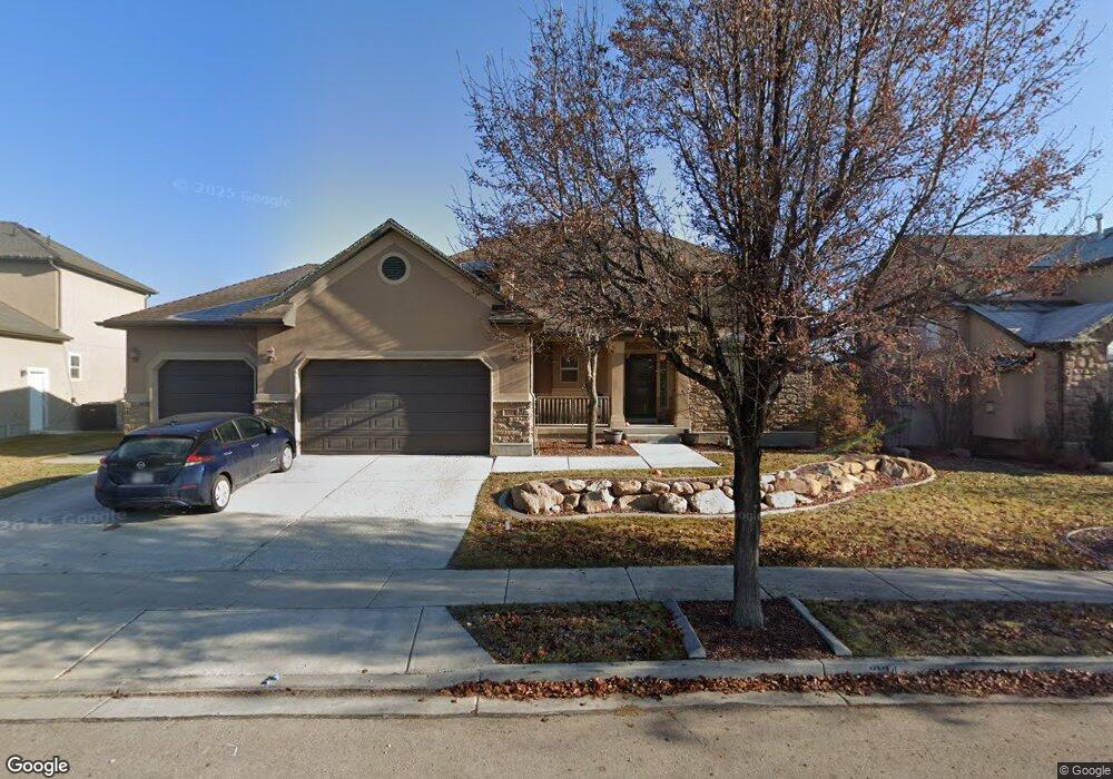
This home is located at 1904 W Colony Pointe Dr, Lehi, UT 84043 and is currently estimated at $910,053, approximately $328 per square foot. 1904 W Colony Pointe Dr is a home located in Utah County with nearby schools including North Point Elementary School, Willowcreek Middle School, and Lehi High School.
Ownership History
Date
Name
Owned For
Owner Type
Purchase Details
Closed on
Sep 14, 2016
Sold by
Tedrow John Eric and Tedrow Natalie L
Bought by
Tedrow John Eric and Tedrow Natalie L
Current Estimated Value
Home Financials for this Owner
Home Financials are based on the most recent Mortgage that was taken out on this home.
Original Mortgage
$314,600
Outstanding Balance
$251,290
Interest Rate
3.43%
Mortgage Type
New Conventional
Estimated Equity
$658,763
Purchase Details
Closed on
Dec 5, 2012
Sold by
Tedrow John Erid and Tedrow Natalie L
Bought by
Tedrow John Eric and Tedrow Natalie L
Home Financials for this Owner
Home Financials are based on the most recent Mortgage that was taken out on this home.
Original Mortgage
$312,200
Interest Rate
3.36%
Mortgage Type
New Conventional
Purchase Details
Closed on
Jan 30, 2009
Sold by
Tedrow John E and Tedrow Natalie L
Bought by
Tedrow John Eric and Tedrow Natalie L
Home Financials for this Owner
Home Financials are based on the most recent Mortgage that was taken out on this home.
Original Mortgage
$332,800
Interest Rate
5.01%
Mortgage Type
New Conventional
Purchase Details
Closed on
Feb 12, 2007
Sold by
Ivory Homes Ltd
Bought by
Tedrow John Eric and Tedrow Natalie L
Home Financials for this Owner
Home Financials are based on the most recent Mortgage that was taken out on this home.
Original Mortgage
$11,750
Interest Rate
6.21%
Mortgage Type
Stand Alone Second
Create a Home Valuation Report for This Property
The Home Valuation Report is an in-depth analysis detailing your home's value as well as a comparison with similar homes in the area
Home Values in the Area
Average Home Value in this Area
Purchase History
| Date | Buyer | Sale Price | Title Company |
|---|---|---|---|
| Tedrow John Eric | -- | None Available | |
| Tedrow John Eric | -- | Cottonwod Title Insurance | |
| Tedrow John Eric | -- | Cottonwood Title Insurance | |
| Tedrow John Eric | -- | First American Union Heig | |
| Tedrow John E | -- | First American Union Heig | |
| Tedrow John Eric | -- | Cottonwood Title Insurance | |
| Ivory Homes Ltd | -- | Cottonwood Title Insurance |
Source: Public Records
Mortgage History
| Date | Status | Borrower | Loan Amount |
|---|---|---|---|
| Open | Tedrow John Eric | $314,600 | |
| Closed | Tedrow John Eric | $312,200 | |
| Closed | Tedrow John E | $332,800 | |
| Closed | Ivory Homes Ltd | $11,750 | |
| Closed | Tedrow John Eric | $330,250 |
Source: Public Records
Tax History Compared to Growth
Tax History
| Year | Tax Paid | Tax Assessment Tax Assessment Total Assessment is a certain percentage of the fair market value that is determined by local assessors to be the total taxable value of land and additions on the property. | Land | Improvement |
|---|---|---|---|---|
| 2025 | $3,314 | $433,675 | $265,500 | $523,000 |
| 2024 | $3,314 | $387,805 | $0 | $0 |
| 2023 | $3,104 | $394,460 | $0 | $0 |
| 2022 | $3,401 | $418,990 | $0 | $0 |
| 2021 | $3,083 | $574,100 | $153,600 | $420,500 |
| 2020 | $2,907 | $535,200 | $142,200 | $393,000 |
| 2019 | $2,534 | $485,000 | $142,200 | $342,800 |
| 2018 | $2,383 | $431,200 | $121,900 | $309,300 |
| 2017 | $2,091 | $229,020 | $0 | $0 |
| 2016 | -- | $209,055 | $0 | $0 |
| 2015 | $2,351 | $199,155 | $0 | $0 |
| 2014 | $2,255 | $189,860 | $0 | $0 |
Source: Public Records
Map
Nearby Homes
- 1659 W Boxwood Dr Unit 109
- 1627 W Boxwood Dr Unit 110
- 1127 N 1500 W
- 1542 N 1900 W
- 1032 Titan Dr
- 1132 Titan Dr
- 1648 N 1900 W
- 1302 N 2450 W
- 1332 W 1500 N
- 1908 N 2230 W
- 1896 N 2230 W
- 1870 N 2230 W
- Accord Plan at Riverwalk
- Interlude Plan at Riverwalk
- Trio Plan at Riverwalk
- Fortissimo Plan at Riverwalk
- Ballad Plan at Riverwalk
- Tenor Plan at Riverwalk
- Madrigal Plan at Riverwalk
- Timpani Plan at Riverwalk
- 1894 W Colony Pointe Dr
- 1914 W Colony Pointe Dr
- 1924 W Colony Pointe Dr
- 1888 W Colony Pointe Dr
- 1901 W Colony Pointe Dr
- 1917 W Colony Pointe Dr
- 1893 W Colony Pointe Dr
- 1934 W Colony Pointe Dr
- 1884 W Colony Pointe Dr
- 1887 W Colony Pointe Dr
- 1937 W Colony Pointe Dr
- 1944 W Colony Pointe Dr
- 1874 W Colony Pointe Dr
- 1939 W 1150 N
- 1952 W 1150 N
- 1879 W Colony Pointe Dr
- 1959 W Colony Pointe Dr
- 1875 W 1260 N
- 1954 W Colony Pointe Dr
- 1855 W 1260 N