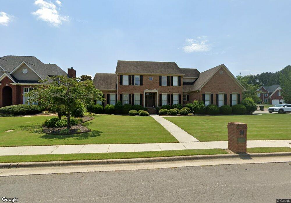
1905 Colony Way SW Decatur, AL 35603
Estimated Value: $422,000 - $526,000
--
Bed
1
Bath
3,473
Sq Ft
$134/Sq Ft
Est. Value
About This Home
This home is located at 1905 Colony Way SW, Decatur, AL 35603 and is currently estimated at $466,215, approximately $134 per square foot. 1905 Colony Way SW is a home located in Morgan County with nearby schools including Chestnut Grove Elementary School, Cedar Ridge Middle School, and Austin High School.
Ownership History
Date
Name
Owned For
Owner Type
Purchase Details
Closed on
Apr 20, 2007
Sold by
Leighty Chad E and Leighty Jennifer A
Bought by
Sims Jeffery S and Sims Ginger H
Current Estimated Value
Home Financials for this Owner
Home Financials are based on the most recent Mortgage that was taken out on this home.
Original Mortgage
$92,000
Outstanding Balance
$55,473
Interest Rate
6.1%
Mortgage Type
New Conventional
Estimated Equity
$410,742
Purchase Details
Closed on
Nov 15, 2005
Sold by
Landamerica Onestop Inc
Bought by
Leighty Chad E and Leighty Jennifer A
Home Financials for this Owner
Home Financials are based on the most recent Mortgage that was taken out on this home.
Original Mortgage
$23,000
Interest Rate
6.04%
Mortgage Type
Credit Line Revolving
Purchase Details
Closed on
Aug 16, 2005
Sold by
Loudermilk John A and Loudermilk Staci W
Bought by
Landamerica Onestop Inc
Create a Home Valuation Report for This Property
The Home Valuation Report is an in-depth analysis detailing your home's value as well as a comparison with similar homes in the area
Home Values in the Area
Average Home Value in this Area
Purchase History
| Date | Buyer | Sale Price | Title Company |
|---|---|---|---|
| Sims Jeffery S | -- | None Available | |
| Leighty Chad E | -- | None Available | |
| Landamerica Onestop Inc | -- | None Available |
Source: Public Records
Mortgage History
| Date | Status | Borrower | Loan Amount |
|---|---|---|---|
| Open | Sims Jeffery S | $92,000 | |
| Previous Owner | Leighty Chad E | $23,000 | |
| Previous Owner | Leighty Chad E | $212,000 |
Source: Public Records
Tax History Compared to Growth
Tax History
| Year | Tax Paid | Tax Assessment Tax Assessment Total Assessment is a certain percentage of the fair market value that is determined by local assessors to be the total taxable value of land and additions on the property. | Land | Improvement |
|---|---|---|---|---|
| 2024 | $1,630 | $37,020 | $3,710 | $33,310 |
| 2023 | $1,630 | $37,020 | $3,710 | $33,310 |
| 2022 | $1,630 | $37,020 | $3,710 | $33,310 |
| 2021 | $1,424 | $34,360 | $3,710 | $30,650 |
| 2020 | $1,424 | $61,210 | $3,710 | $57,500 |
| 2019 | $1,424 | $32,480 | $0 | $0 |
| 2015 | $1,282 | $29,340 | $0 | $0 |
| 2014 | $1,282 | $29,340 | $0 | $0 |
| 2013 | -- | $29,140 | $0 | $0 |
Source: Public Records
Map
Nearby Homes
- 2916 Glasgow Place SW
- 2101 Lancelot Dr SW
- 1701 Camden Cir SW
- 2004 Vestavia Dr SW
- 3325 Danville Rd SW
- 1512 Oak Lea Rd SW
- 1823 Vestavia Dr SW
- 2209 Galahad Dr SW
- 3401 Cedarhurst Dr
- 3412 Cedarhurst Dr
- 3410 Cedarhurst Dr
- 3406 Cedarhurst Dr
- 3402 Cedarhurst Dr
- 3305 Cedar Cove SW
- 2723 Longfellow Dr SW
- 3214 Darlington Dr SW
- 3318 Cedarhurst Dr SW
- 3312 Cedar Cove SW
- 2309 Selma St SW
- 1540 Berkley St SW
- 1903 Colony Way SW
- 3104 Knox Cir SW
- 1906 Colony Way SW
- 3106 Knox Cir SW
- 1908 Colony Way SW
- 3103 Knox Cir SW
- 3103 Constitution Dr SW
- 3101 Knox Cir SW
- 1904 Colony Way SW
- 3105 Constitution Dr SW
- 1910 Colony Way SW
- 3105 Knox Cir SW
- 3107 Knox Cir SW
- 3107 Constitution Dr SW
- 1902 Colony Way SW
- 1908 Chesapeake Trail SW
- 1906 Chesapeake Trail SW
- 1904 Chesapeake Trail SW
- 1912 Chesapeake Trail SW
- 3106 Constitution Dr SW