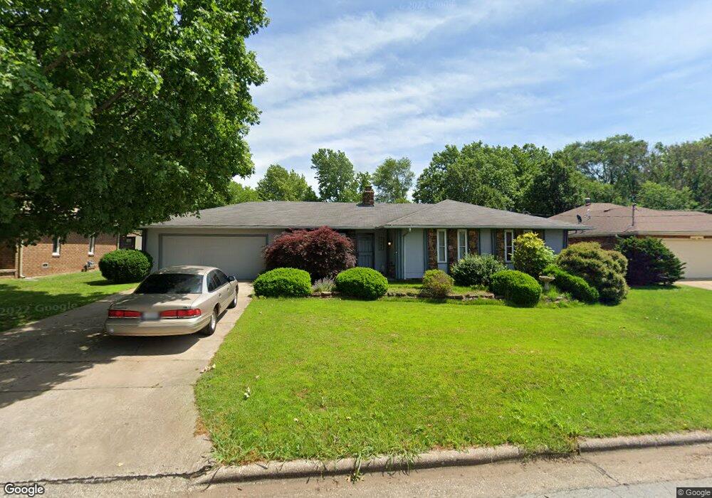
1905 E Stoneridge Dr Springfield, MO 65803
Estimated Value: $253,000 - $287,000
4
Beds
2
Baths
1,856
Sq Ft
$144/Sq Ft
Est. Value
About This Home
This home is located at 1905 E Stoneridge Dr, Springfield, MO 65803 and is currently estimated at $266,667, approximately $143 per square foot. 1905 E Stoneridge Dr is a home located in Greene County with nearby schools including Pleasant View K-8 School, Hillcrest High School, and Dayspring Christian School.
Ownership History
Date
Name
Owned For
Owner Type
Purchase Details
Closed on
Sep 19, 2025
Sold by
Cataldo Lawrence M
Bought by
Cataldo Lawrence M
Current Estimated Value
Home Financials for this Owner
Home Financials are based on the most recent Mortgage that was taken out on this home.
Original Mortgage
$390,000
Outstanding Balance
$382,358
Interest Rate
6.35%
Mortgage Type
Reverse Mortgage Home Equity Conversion Mortgage
Estimated Equity
-$115,691
Purchase Details
Closed on
Apr 26, 2022
Sold by
Cataldo Lawrence M and Cataldo Monica O
Bought by
Cataldo Lawrence M
Home Financials for this Owner
Home Financials are based on the most recent Mortgage that was taken out on this home.
Original Mortgage
$90,000
Interest Rate
2.99%
Mortgage Type
New Conventional
Create a Home Valuation Report for This Property
The Home Valuation Report is an in-depth analysis detailing your home's value as well as a comparison with similar homes in the area
Purchase History
| Date | Buyer | Sale Price | Title Company |
|---|---|---|---|
| Cataldo Lawrence M | -- | None Listed On Document | |
| Cataldo Lawrence M | -- | None Listed On Document |
Source: Public Records
Mortgage History
| Date | Status | Borrower | Loan Amount |
|---|---|---|---|
| Open | Cataldo Lawrence M | $390,000 | |
| Closed | Cataldo Lawrence M | $390,000 | |
| Previous Owner | Cataldo Lawrence M | $90,000 |
Source: Public Records
Tax History
| Year | Tax Paid | Tax Assessment Tax Assessment Total Assessment is a certain percentage of the fair market value that is determined by local assessors to be the total taxable value of land and additions on the property. | Land | Improvement |
|---|---|---|---|---|
| 2025 | $1,649 | $30,490 | $8,320 | $22,170 |
| 2024 | $1,502 | $25,950 | $4,180 | $21,770 |
| 2023 | $1,495 | $25,950 | $4,180 | $21,770 |
| 2022 | $1,402 | $23,860 | $4,180 | $19,680 |
| 2021 | $1,341 | $23,860 | $4,180 | $19,680 |
| 2020 | $1,290 | $21,790 | $4,180 | $17,610 |
| 2019 | $1,254 | $21,790 | $4,180 | $17,610 |
| 2018 | $1,045 | $18,070 | $3,230 | $14,840 |
| 2017 | $1,036 | $18,070 | $3,230 | $14,840 |
| 2016 | $1,034 | $18,070 | $3,230 | $14,840 |
| 2015 | $1,026 | $18,070 | $3,230 | $14,840 |
| 2014 | $1,025 | $18,070 | $3,230 | $14,840 |
Source: Public Records
Map
Nearby Homes
- 3839 N Stewart Ave
- 1923 E Valley Water Mill Rd
- 3975 N Stewart Ave
- 4260 N State Highway H
- 3424 N Darwin Ave
- 3749 N Pickwick Ave
- 3753 N Pickwick Ave
- 2393 E Valley Water Mill Rd
- 3983 N Courtney Cir
- 1349 E Stoneridge St
- 3333 N Delaware Ave
- 1270 E Ogorman Ct
- 3957 N Springlawn Ave
- 3969 N Springlawn Ave
- 1255 E Bonaire Dr
- 1414 E Smith St
- 1502 E McClernon St
- 4541b N Lanier Ln
- 4541 N Lanier Ln
- Tract C N Farm Road 173
- 1911 E Stoneridge Dr
- 1863 E Stoneridge Dr
- 1908 E Wheatridge Dr
- 1919 E Stoneridge Dr
- 1855 E Stoneridge Dr
- 1910 E Wheatridge Dr
- 1904 E Wheatridge Dr
- 1904 E Stoneridge Dr
- 1860 E Stoneridge Dr
- 1918 E Wheatridge Dr
- 1900 E Wheatridge Dr
- 1910 E Stoneridge Dr
- 1925 E Stoneridge Dr
- 1852 E Stoneridge Dr
- 1849 E Stoneridge Dr
- 1918 E Stoneridge Dr
- 1924 E Wheatridge Dr
- 1854 E Wheatridge Dr
- 1842 E Stoneridge Dr
- 1931 E Stoneridge Dr
Your Personal Tour Guide
Ask me questions while you tour the home.