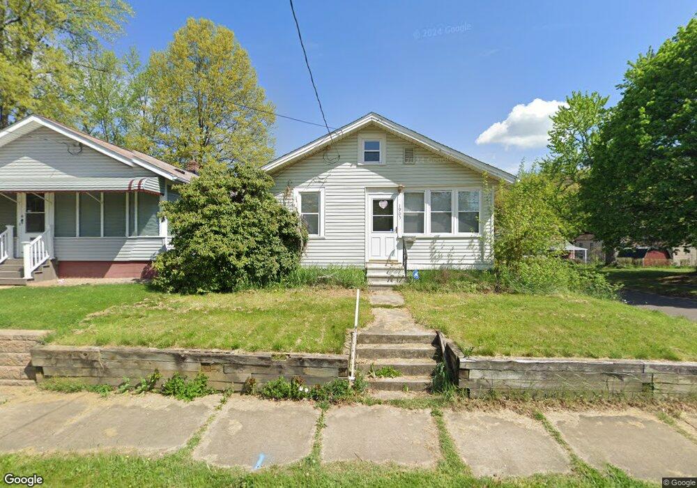
1905 Flint Ave Akron, OH 44305
Goodyear Heights NeighborhoodEstimated Value: $99,000 - $131,522
2
Beds
2
Baths
1,188
Sq Ft
$101/Sq Ft
Est. Value
About This Home
This home is located at 1905 Flint Ave, Akron, OH 44305 and is currently estimated at $119,631, approximately $100 per square foot. 1905 Flint Ave is a home located in Summit County with nearby schools including Seiberling Community Learning Center, Akron Preparatory school, and Middlebury Academy.
Ownership History
Date
Name
Owned For
Owner Type
Purchase Details
Closed on
Nov 16, 2020
Sold by
Smith Vicki L and Chaffin Vicki L
Bought by
Butler Sirena I and Forinash Devin B
Current Estimated Value
Home Financials for this Owner
Home Financials are based on the most recent Mortgage that was taken out on this home.
Original Mortgage
$75,605
Outstanding Balance
$67,278
Interest Rate
2.8%
Mortgage Type
FHA
Estimated Equity
$52,353
Purchase Details
Closed on
Dec 17, 2002
Sold by
Butler Vicki L and Butler Vicki L
Bought by
Chaffin Vicki L
Home Financials for this Owner
Home Financials are based on the most recent Mortgage that was taken out on this home.
Original Mortgage
$45,500
Interest Rate
6.23%
Create a Home Valuation Report for This Property
The Home Valuation Report is an in-depth analysis detailing your home's value as well as a comparison with similar homes in the area
Home Values in the Area
Average Home Value in this Area
Purchase History
| Date | Buyer | Sale Price | Title Company |
|---|---|---|---|
| Butler Sirena I | $77,000 | Accommodation | |
| Chaffin Vicki L | -- | -- |
Source: Public Records
Mortgage History
| Date | Status | Borrower | Loan Amount |
|---|---|---|---|
| Open | Butler Sirena I | $75,605 | |
| Previous Owner | Chaffin Vicki L | $45,500 |
Source: Public Records
Tax History Compared to Growth
Tax History
| Year | Tax Paid | Tax Assessment Tax Assessment Total Assessment is a certain percentage of the fair market value that is determined by local assessors to be the total taxable value of land and additions on the property. | Land | Improvement |
|---|---|---|---|---|
| 2025 | $1,777 | $32,089 | $6,759 | $25,330 |
| 2024 | $1,777 | $32,089 | $6,759 | $25,330 |
| 2023 | $1,777 | $32,089 | $6,759 | $25,330 |
| 2022 | $1,547 | $21,683 | $4,568 | $17,115 |
| 2021 | $1,563 | $21,904 | $4,568 | $17,336 |
| 2020 | $1,541 | $21,910 | $4,570 | $17,340 |
| 2019 | $1,455 | $18,690 | $4,760 | $13,930 |
| 2018 | $1,437 | $18,690 | $4,760 | $13,930 |
| 2017 | $1,458 | $18,690 | $4,760 | $13,930 |
| 2016 | $1,459 | $18,690 | $4,760 | $13,930 |
| 2015 | $1,458 | $18,690 | $4,760 | $13,930 |
| 2014 | $1,447 | $18,690 | $4,760 | $13,930 |
| 2013 | $1,495 | $19,800 | $4,760 | $15,040 |
Source: Public Records
Map
Nearby Homes
- 1874 Adelaide Blvd
- 1818 Flint Ave
- 1826 Ford Ave
- 1837 Marks Ave
- 1947 Preston Ave Unit 1949
- 1955 Preston Ave Unit 1957
- 1769 Flint Ave
- 1792 Malasia Rd
- 1892 Malasia Rd
- 1726 Shaw Ave
- 248 Malacca St
- 249 Malacca St
- 1551 Preston Ave
- 57 Carlton Dr
- 333 Cluster Ave
- 360 Cluster Ave
- 1796 Newton St
- 1508 Malasia Rd
- 1598 Pilgrim St
- 159 Dellenberger Ave
- 1901 Flint Ave
- 1897 Flint Ave
- 1915 Flint Ave
- 1900 Adelaide Blvd
- 1889 Flint Ave
- 1916 Adelaide Blvd
- 1906 Flint Ave
- 1902 Flint Ave
- 1894 Adelaide Blvd
- 1898 Flint Ave
- 71 Pilmore St
- 1922 Adelaide Blvd
- 1921 Flint Ave
- 1921 Flint Ave
- 1894 Flint Ave Unit 1896
- 1929 Flint Ave
- 1890 Flint Ave
- 1888 Adelaide Blvd
- 1922 Flint Ave
- 1930 Adelaide Blvd