
Seller's Agent in 2026
Darren Allen
Real Broker LLC
(224) 707-2500
1 in this area
264 Total Sales
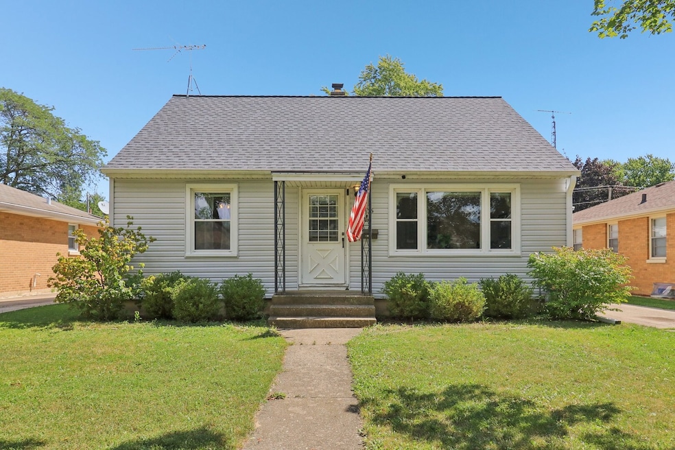
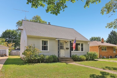
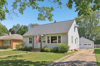
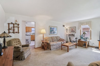
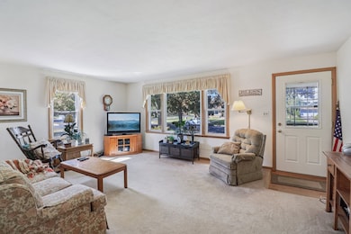
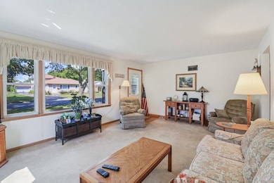
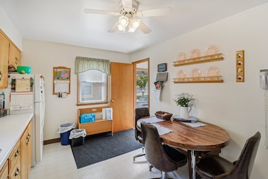
Welcome to this well maintained home located in quiet North Waukegan. Sitting on a gorgeous tree-lined street, this 3 bedroom 2 bathroom house is close to shopping, restaurants, Lake Michigan, and highway access. Long term owner has maintained the property with care! New Roof, Siding and Downspouts in 2025. Furnace 2018. Newer windows! Enjoy the oversized 3 car Heated garage, excellent for extra storage and additional workspace. Untouched hardwood floors under the carpet in the living room! The fully finished attic and basement add extra space to spread out. Deep freezer included. Garage wired for 30amp 220amp connections. Come check it out Today!
Last Agent to Sell the Property
Real Broker LLC Brokerage Phone: (224) 707-2500 License #475180908 Listed on: 11/03/2025
| Date | Type | Sale Price | Title Company |
|---|---|---|---|
| Deed | -- | None Listed On Document | |
| Interfamily Deed Transfer | -- | None Available | |
| Interfamily Deed Transfer | -- | -- |
| Date | Event | Price | List to Sale | Price per Sq Ft |
|---|---|---|---|---|
| 02/10/2026 02/10/26 | Sold | $277,000 | -4.4% | $159 / Sq Ft |
| 12/10/2025 12/10/25 | Pending | -- | -- | -- |
| 11/11/2025 11/11/25 | Price Changed | $289,900 | -3.4% | $166 / Sq Ft |
| 11/03/2025 11/03/25 | For Sale | $300,000 | -- | $172 / Sq Ft |
| Year | Tax Paid | Tax Assessment Tax Assessment Total Assessment is a certain percentage of the fair market value that is determined by local assessors to be the total taxable value of land and additions on the property. | Land | Improvement |
|---|---|---|---|---|
| 2024 | $4,735 | $63,842 | $10,278 | $53,564 |
| 2023 | $4,867 | $58,216 | $9,372 | $48,844 |
| 2022 | $4,867 | $55,781 | $8,666 | $47,115 |
| 2021 | $4,591 | $50,035 | $7,730 | $42,305 |
| 2020 | $4,037 | $46,613 | $7,201 | $39,412 |
| 2019 | $3,966 | $42,714 | $6,599 | $36,115 |
| 2018 | $2,946 | $34,482 | $8,490 | $25,992 |
| 2017 | $2,796 | $30,507 | $7,511 | $22,996 |
| 2016 | $2,397 | $26,510 | $6,527 | $19,983 |
| 2015 | $2,150 | $23,727 | $5,842 | $17,885 |
| 2014 | $2,345 | $24,014 | $6,069 | $17,945 |
| 2012 | $3,467 | $26,019 | $6,576 | $19,443 |
Seller's Agent in 2026
Darren Allen
Real Broker LLC
(224) 707-2500
1 in this area
264 Total Sales
Buyer's Agent in 2026
Terie Garza
Fulton Grace Realty
(224) 280-8288
2 in this area
61 Total Sales
Source: Midwest Real Estate Data (MRED)
MLS Number: 12509506
APN: 08-09-314-011
Disclaimer: Certain information contained herein is derived from information provided by parties other than Homes.com. All information provided is deemed reliable, but is not guaranteed to be accurate and should be independently verified.
![]() Based on information submitted to the MLS GRID. All data is obtained from various sources and may not have been verified by broker or MLS GRID. Supplied Open House Information is subject to change without notice. All information should be independently reviewed and verified for accuracy. Properties may or may not be listed by the office/agent presenting the information. Some IDX listings have been excluded from this website.
Based on information submitted to the MLS GRID. All data is obtained from various sources and may not have been verified by broker or MLS GRID. Supplied Open House Information is subject to change without notice. All information should be independently reviewed and verified for accuracy. Properties may or may not be listed by the office/agent presenting the information. Some IDX listings have been excluded from this website.
Based on information submitted to the MLS GRID
Ask me questions while you tour the home.