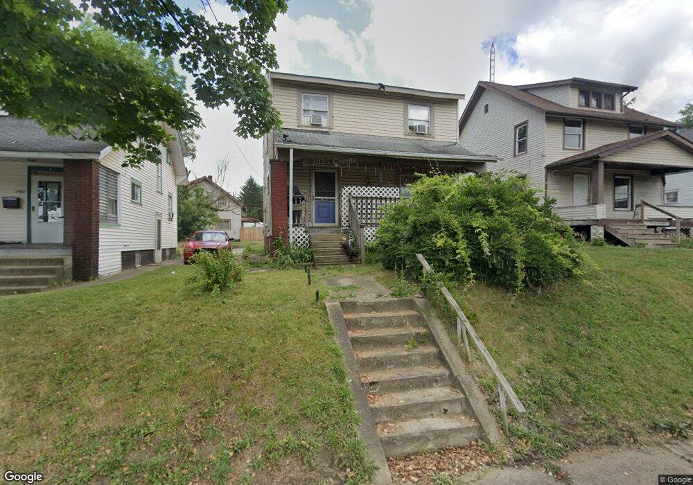
1905 Maple Ave NE Canton, OH 44714
Colonial Heights NeighborhoodEstimated Value: $87,790 - $116,000
3
Beds
1
Bath
1,248
Sq Ft
$79/Sq Ft
Est. Value
About This Home
This home is located at 1905 Maple Ave NE, Canton, OH 44714 and is currently estimated at $98,948, approximately $79 per square foot. 1905 Maple Ave NE is a home located in Stark County with nearby schools including Belle Stone Elementary School, Early Learning Center @ Schreiber, and Youtz Intermediate School.
Ownership History
Date
Name
Owned For
Owner Type
Purchase Details
Closed on
Jul 30, 2021
Sold by
Coram Michael L
Bought by
Shelton Wes E and Shelton Danielle
Current Estimated Value
Purchase Details
Closed on
Jul 2, 2009
Sold by
Coram Michael L
Bought by
Shelton Wes E and Shelton Danielle
Home Financials for this Owner
Home Financials are based on the most recent Mortgage that was taken out on this home.
Original Mortgage
$84,530
Interest Rate
5.49%
Mortgage Type
Seller Take Back
Purchase Details
Closed on
Jan 14, 1998
Sold by
Oswald Robert W
Bought by
Coram Michael L
Home Financials for this Owner
Home Financials are based on the most recent Mortgage that was taken out on this home.
Original Mortgage
$28,900
Interest Rate
7.24%
Mortgage Type
New Conventional
Create a Home Valuation Report for This Property
The Home Valuation Report is an in-depth analysis detailing your home's value as well as a comparison with similar homes in the area
Home Values in the Area
Average Home Value in this Area
Purchase History
| Date | Buyer | Sale Price | Title Company |
|---|---|---|---|
| Shelton Wes E | $84,600 | None Available | |
| Shelton Wes E | $84,530 | Attorney | |
| Coram Michael L | $23,800 | -- |
Source: Public Records
Mortgage History
| Date | Status | Borrower | Loan Amount |
|---|---|---|---|
| Previous Owner | Shelton Wes E | $84,530 | |
| Previous Owner | Coram Michael L | $28,900 |
Source: Public Records
Tax History Compared to Growth
Tax History
| Year | Tax Paid | Tax Assessment Tax Assessment Total Assessment is a certain percentage of the fair market value that is determined by local assessors to be the total taxable value of land and additions on the property. | Land | Improvement |
|---|---|---|---|---|
| 2025 | -- | $24,470 | $6,580 | $17,890 |
| 2024 | $687 | $24,470 | $6,580 | $17,890 |
| 2023 | $1,222 | $18,490 | $4,240 | $14,250 |
| 2022 | $1,076 | $18,490 | $4,240 | $14,250 |
| 2021 | $1,111 | $18,490 | $4,240 | $14,250 |
| 2020 | $969 | $14,430 | $3,400 | $11,030 |
| 2019 | $843 | $14,430 | $3,400 | $11,030 |
| 2018 | $854 | $14,430 | $3,400 | $11,030 |
| 2017 | $838 | $12,880 | $3,220 | $9,660 |
| 2016 | $841 | $12,880 | $3,220 | $9,660 |
| 2015 | $846 | $12,880 | $3,220 | $9,660 |
| 2014 | $933 | $13,720 | $3,430 | $10,290 |
| 2013 | $450 | $13,720 | $3,430 | $10,290 |
Source: Public Records
Map
Nearby Homes
- 1607 18th St NE
- 1607 20th St NE
- 1602 18th St NE
- 2100 Maple Ave NE
- 0 Dover Ave NE
- 2028 Saint Elmo Ave NE
- 1513 22nd St NE
- 1630 Bonnot Place NE
- 2315 Maple Ave NE
- 2310 Maple Ave NE
- 1815 Virginia Place NE
- 1517 16th St NE
- 2005 17th St NE
- 1734 Rowland Ave NE
- 0 Rowland Ave NE Unit 5089960
- 1643 Olive Place NE
- 1631 Shriver Ave NE
- 1219 17th St NE
- 2510 Gross Ave NE
- 1210 17th St NE
- 1901 Maple Ave NE
- 1641 19th St NE
- 1919 Maple Ave NE
- 1906 Maple Ave NE
- 1909 Widmer Ct NE
- 1857 Maple Ave NE
- 1902 Maple Ave NE
- 1915 Widmer Ct NE
- 1642 19th St NE
- 1919 Widmer Ct NE
- 1910 Maple Ave NE
- 1633 19th St NE
- 1923 Maple Ave NE
- 1851 Maple Ave NE
- 1713 19th St NE
- 1625 19th St NE
- 0 Maple Ave NE Unit 3350330
- 0 Maple Ave NE Unit 3350329
- 0 Maple Ave NE Unit 4283475
- 1920 Maple Ave NE