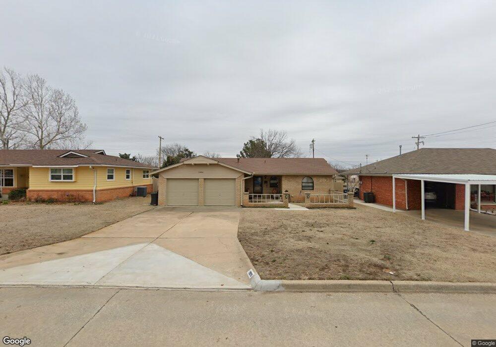
1905 N Oklahoma Ave Shawnee, OK 74804
Estimated Value: $107,000 - $153,903
3
Beds
2
Baths
1,137
Sq Ft
$121/Sq Ft
Est. Value
About This Home
This home is located at 1905 N Oklahoma Ave, Shawnee, OK 74804 and is currently estimated at $137,726, approximately $121 per square foot. 1905 N Oklahoma Ave is a home located in Pottawatomie County with nearby schools including Will Rogers Elementary School, Shawnee Middle School, and Shawnee High School.
Ownership History
Date
Name
Owned For
Owner Type
Purchase Details
Closed on
Apr 28, 2022
Sold by
Gilles Joanne Marie
Bought by
Gilles Joanne Marie and Holter Marcy Ann
Current Estimated Value
Purchase Details
Closed on
Mar 22, 2016
Sold by
Brown Sherman and Brown Patricia
Bought by
Gilles Joanne
Purchase Details
Closed on
Aug 1, 2006
Sold by
Housing Authority Of Sac & Fox Nation
Bought by
Brown Sherman and Brown Patricia
Create a Home Valuation Report for This Property
The Home Valuation Report is an in-depth analysis detailing your home's value as well as a comparison with similar homes in the area
Home Values in the Area
Average Home Value in this Area
Purchase History
| Date | Buyer | Sale Price | Title Company |
|---|---|---|---|
| Gilles Joanne Marie | -- | None Listed On Document | |
| Gilles Joanne | $72,500 | First American Title | |
| Brown Sherman | -- | None Available |
Source: Public Records
Tax History Compared to Growth
Tax History
| Year | Tax Paid | Tax Assessment Tax Assessment Total Assessment is a certain percentage of the fair market value that is determined by local assessors to be the total taxable value of land and additions on the property. | Land | Improvement |
|---|---|---|---|---|
| 2024 | $734 | $8,269 | $900 | $7,369 |
| 2023 | $734 | $8,029 | $1,050 | $6,979 |
| 2022 | $721 | $8,029 | $1,050 | $6,979 |
| 2021 | $708 | $8,029 | $1,050 | $6,979 |
| 2020 | $725 | $8,180 | $1,050 | $7,130 |
| 2019 | $766 | $8,332 | $1,050 | $7,282 |
| 2018 | $761 | $8,437 | $1,050 | $7,387 |
| 2017 | $777 | $8,700 | $900 | $7,800 |
| 2016 | $933 | $10,147 | $811 | $9,336 |
| 2015 | $886 | $9,863 | $719 | $9,144 |
| 2014 | $858 | $9,576 | $875 | $8,701 |
Source: Public Records
Map
Nearby Homes
- 401 E Federal St
- 1822 N Phil Ave
- 1712 N Pennsylvania Ave
- 1901 N Bell Ave
- 2001 N Mckinley Ave
- 1817 N Bell Ave
- 1816 N Bell Ave
- 806 E Midland St
- 2021 N Broadway Ave
- 1510 N Union Ave
- 2415 N Minnesota Cir
- 0 Independence and Minnesota St
- 1602 N Bdwy
- 10 W Midland St
- 1607 N Beard Ave
- 1925 N Park Ave
- 202 W Franklin St
- 27 N Rice Ave
- 1710 N Park Ave
- 3306 N Oklahoma Ave
- 1913 N Oklahoma Ave
- 1901 N Minnesota Ave
- 1916 N Minnesota Ave
- 1902 N Minnesota Ave
- 1934 N Minnesota Ave
- 1906 N Minnesota Ave
- 1936 N Minnesota Ave
- 1904 N Oklahoma Ave
- 1906 N Oklahoma Ave
- 1930 N Oklahoma Ave
- 1908 N Oklahoma Ave
- 1835 N Oklahoma Ave
- 1922 N Minnesota Ave
- 427 E Emmett St
- 1919 N Oklahoma Ave
- 1928 N Minnesota Ave
- 1911 N Phil Ave
- 1840 N Minnesota Ave
- 1927 N Minnesota Ave
- 1905 N Phil Ave