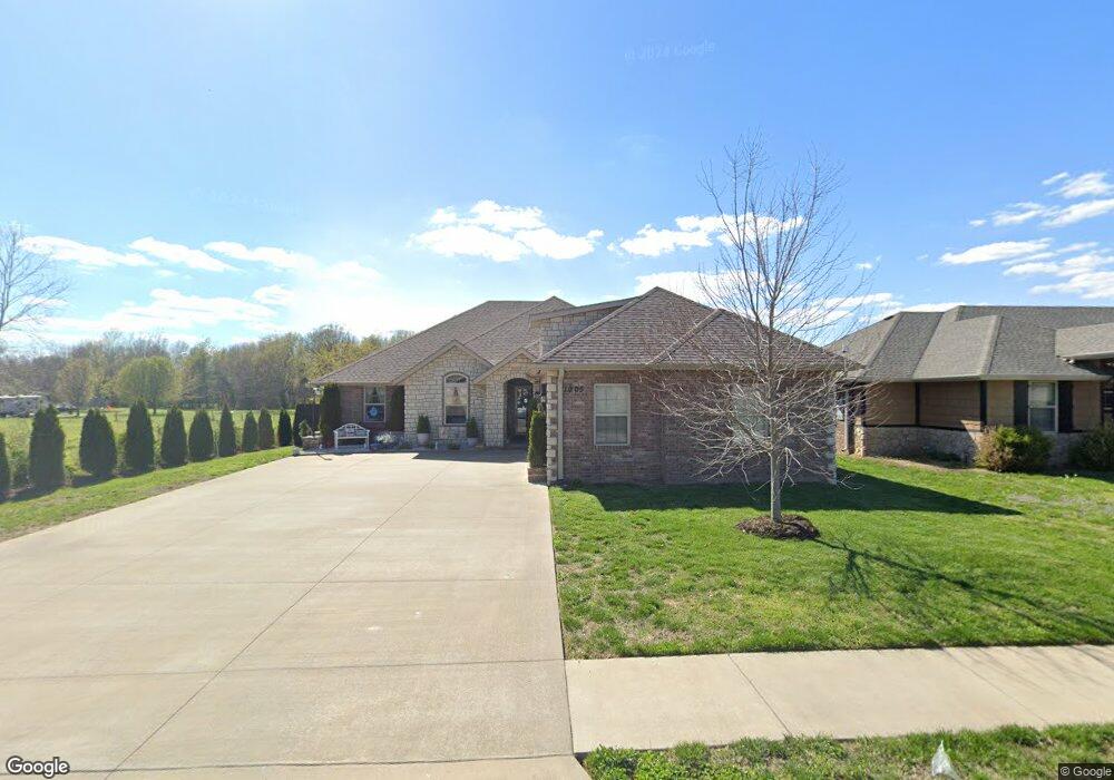
1905 N Trellis Rd Strafford, MO 65757
Southeast Springfield NeighborhoodEstimated Value: $395,435 - $450,000
4
Beds
2
Baths
2,235
Sq Ft
$187/Sq Ft
Est. Value
About This Home
This home is located at 1905 N Trellis Rd, Strafford, MO 65757 and is currently estimated at $417,609, approximately $186 per square foot. 1905 N Trellis Rd is a home with nearby schools including Strafford Elementary School, Strafford Middle School, and Strafford High School.
Ownership History
Date
Name
Owned For
Owner Type
Purchase Details
Closed on
Jan 23, 2017
Sold by
Richland Homes Inc
Bought by
Meeks Tom and Meeks Tiffany
Current Estimated Value
Home Financials for this Owner
Home Financials are based on the most recent Mortgage that was taken out on this home.
Original Mortgage
$206,094
Outstanding Balance
$169,889
Interest Rate
4.13%
Mortgage Type
New Conventional
Estimated Equity
$247,720
Purchase Details
Closed on
Jul 6, 2016
Sold by
Craftmaster Properties Llc
Bought by
Richand Homes Inc
Create a Home Valuation Report for This Property
The Home Valuation Report is an in-depth analysis detailing your home's value as well as a comparison with similar homes in the area
Home Values in the Area
Average Home Value in this Area
Purchase History
| Date | Buyer | Sale Price | Title Company |
|---|---|---|---|
| Meeks Tom | -- | None Available | |
| Richand Homes Inc | -- | Choice Escrow & Land Title L |
Source: Public Records
Mortgage History
| Date | Status | Borrower | Loan Amount |
|---|---|---|---|
| Open | Meeks Tom | $206,094 |
Source: Public Records
Tax History
| Year | Tax Paid | Tax Assessment Tax Assessment Total Assessment is a certain percentage of the fair market value that is determined by local assessors to be the total taxable value of land and additions on the property. | Land | Improvement |
|---|---|---|---|---|
| 2025 | $3,295 | $62,530 | $10,450 | $52,080 |
| 2024 | $3,028 | $55,460 | $6,420 | $49,040 |
| 2023 | $3,048 | $55,460 | $6,420 | $49,040 |
| 2022 | $2,557 | $49,090 | $6,420 | $42,670 |
| 2021 | $2,406 | $49,090 | $6,420 | $42,670 |
| 2020 | $2,251 | $45,180 | $6,420 | $38,760 |
| 2019 | $2,243 | $45,180 | $6,420 | $38,760 |
| 2018 | $2,162 | $43,240 | $5,700 | $37,540 |
| 2017 | $2,144 | $5,700 | $5,700 | $0 |
| 2016 | $282 | $0 | $0 | $0 |
| 2015 | -- | $0 | $0 | $0 |
Source: Public Records
Map
Nearby Homes
- 5677 E Pearson Pkwy
- 2032 N Unbridled Ct
- 2044 N Unbridled Ct
- 5566 E Cavalcade Ln
- 5558 E Cavalcade Ln
- 1999 N Alysheba Ct
- 2086 N Riva Ridge Ct
- 1999 N Riva Ridge Ct
- 5447 E Wild Horse Dr
- Lot 16 E Wildhorse Dr
- 2027 N Cannonade Ct
- 2360 N Citation Ave
- Lot 40 Beland Blvd
- Lot 60 Morningwood
- Lot 55 Summertime St
- Lot 25 Wonderview Ln
- Lot 47 Morningwood
- Lot 24 Wonderview Ln
- Lot 45 Morningwood
- Lot 36 Summertime St
- 1913 N Trellis Rd
- 1921 N Trellis Rd
- 1904 N Trellis Rd
- 1912 N Trellis Rd
- 1920 N Trellis Rd
- 1930 N Pavilion Place
- 1929 N Trellis Rd
- 1938 N Pavilion Place
- 1928 N Trellis Rd
- 1937 N Trellis Rd
- 1938 Pavilion Place
- 1903 N Vineyard Place
- 1915 N Vineyard Place
- 1946 N Pavilion Place
- 1936 N Trellis Rd
- 1945 N Trellis Rd
- Lot 16 Phase 5 Pearson Park Ave
- 1944 N Trellis Rd
- 1954 N Pavilion Place
- 1935 N Pavilion Place
Your Personal Tour Guide
Ask me questions while you tour the home.