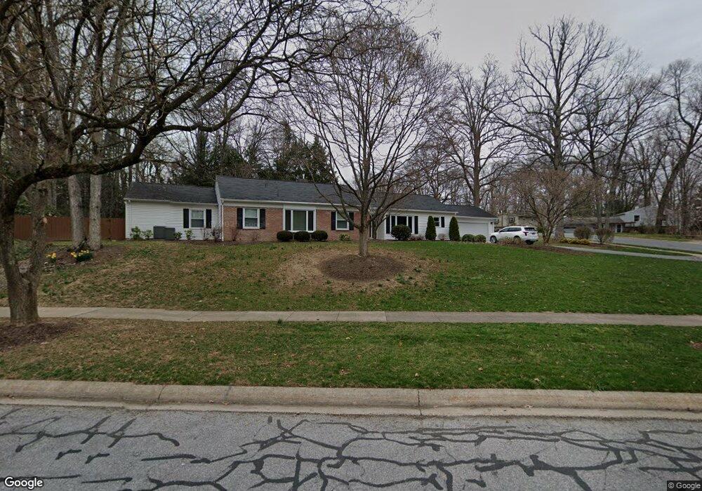
1905 Park Forest Ave State College, PA 16803
Patton NeighborhoodEstimated Value: $343,000 - $549,000
3
Beds
3
Baths
2,391
Sq Ft
$200/Sq Ft
Est. Value
About This Home
This home is located at 1905 Park Forest Ave, State College, PA 16803 and is currently estimated at $478,581, approximately $200 per square foot. 1905 Park Forest Ave is a home located in Centre County with nearby schools including Park Forest Elementary School, Park Forest Middle School, and State College Area High School.
Ownership History
Date
Name
Owned For
Owner Type
Purchase Details
Closed on
Feb 22, 2010
Sold by
Vratarich Gary F and Vratarich Tammy L
Bought by
Vratarich Gary F and Vratarich Tammy L
Current Estimated Value
Home Financials for this Owner
Home Financials are based on the most recent Mortgage that was taken out on this home.
Original Mortgage
$203,000
Interest Rate
5.11%
Mortgage Type
New Conventional
Create a Home Valuation Report for This Property
The Home Valuation Report is an in-depth analysis detailing your home's value as well as a comparison with similar homes in the area
Home Values in the Area
Average Home Value in this Area
Purchase History
| Date | Buyer | Sale Price | Title Company |
|---|---|---|---|
| Vratarich Gary F | -- | None Available |
Source: Public Records
Mortgage History
| Date | Status | Borrower | Loan Amount |
|---|---|---|---|
| Closed | Vratarich Gary F | $203,000 |
Source: Public Records
Tax History Compared to Growth
Tax History
| Year | Tax Paid | Tax Assessment Tax Assessment Total Assessment is a certain percentage of the fair market value that is determined by local assessors to be the total taxable value of land and additions on the property. | Land | Improvement |
|---|---|---|---|---|
| 2025 | $7,016 | $100,715 | $28,645 | $72,070 |
| 2024 | $6,545 | $100,715 | $28,645 | $72,070 |
| 2023 | $6,545 | $100,715 | $28,645 | $72,070 |
| 2022 | $6,388 | $100,715 | $28,645 | $72,070 |
| 2021 | $6,388 | $100,715 | $28,645 | $72,070 |
| 2020 | $6,388 | $100,715 | $28,645 | $72,070 |
| 2019 | $4,533 | $100,715 | $28,645 | $72,070 |
| 2018 | $6,193 | $100,715 | $28,645 | $72,070 |
| 2017 | $6,125 | $100,715 | $28,645 | $72,070 |
| 2016 | -- | $100,715 | $28,645 | $72,070 |
| 2015 | -- | $100,715 | $28,645 | $72,070 |
| 2014 | -- | $93,030 | $28,645 | $64,385 |
Source: Public Records
Map
Nearby Homes
- 1952 Highland Dr
- 613 Wiltshire Dr
- 656 Severn Dr
- 690 Wiltshire Dr
- 291 Oakley Dr
- 2074 Mary Ellen Ln
- 1635 Princeton Dr
- 1918 Weaver St Unit 1
- 1832 Waddle Rd
- 144 Kenley Ct Unit 144
- 169 Sandy Ridge Rd
- 159 Bolton Ave
- 2292 Oak Leaf Dr
- 257 Oakwood Ave
- 658 -A Oakwood Ave
- 652 B Oakwood Ave
- 861 Willard St
- 936 Taylor St
- 505 Hillcrest Ave
- 465 Hillcrest Ave
- 1917 Park Forest Ave
- 1899 Park Forest Ave
- 1912 Park Forest Ave
- 1906 Park Forest Ave
- 1903 Norwood Ln
- 1918 Park Forest Ave
- 1926 Norwood Ln
- 1923 Park Forest Ave
- 1909 Norwood Ln
- 1893 Park Forest Ave
- 1932 Norwood Ln
- 1924 Park Forest Ave
- 1915 Norwood Ln
- 1938 Norwood Ln
- 1930 Park Forest Ave
- 362 Laurel Ln
- 1887 Park Forest Ave
- 1927 Norwood Ln