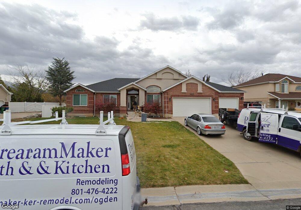
1905 Phillips St Kaysville, UT 84037
West Kaysville NeighborhoodEstimated Value: $792,000 - $858,000
6
Beds
3
Baths
3,787
Sq Ft
$218/Sq Ft
Est. Value
About This Home
This home is located at 1905 Phillips St, Kaysville, UT 84037 and is currently estimated at $825,321, approximately $217 per square foot. 1905 Phillips St is a home located in Davis County with nearby schools including Kay's Creek Elementary School, Shoreline Junior High School, and Davis High School.
Ownership History
Date
Name
Owned For
Owner Type
Purchase Details
Closed on
Aug 23, 2021
Sold by
Crimin Bryan D and Crimin Tracy J
Bought by
Karp Gary Edward and Karp Diane Marie
Current Estimated Value
Home Financials for this Owner
Home Financials are based on the most recent Mortgage that was taken out on this home.
Original Mortgage
$547,200
Outstanding Balance
$496,067
Interest Rate
2.7%
Mortgage Type
New Conventional
Estimated Equity
$329,254
Purchase Details
Closed on
Jul 8, 1997
Sold by
Legacy Design Homes Inc
Bought by
Crimin Bryan D and Crimin Tracy J
Home Financials for this Owner
Home Financials are based on the most recent Mortgage that was taken out on this home.
Original Mortgage
$214,600
Interest Rate
7.93%
Create a Home Valuation Report for This Property
The Home Valuation Report is an in-depth analysis detailing your home's value as well as a comparison with similar homes in the area
Home Values in the Area
Average Home Value in this Area
Purchase History
| Date | Buyer | Sale Price | Title Company |
|---|---|---|---|
| Karp Gary Edward | -- | Real Advantage Title | |
| Crimin Bryan D | -- | Mountain View Title & Escrow |
Source: Public Records
Mortgage History
| Date | Status | Borrower | Loan Amount |
|---|---|---|---|
| Open | Karp Gary Edward | $547,200 | |
| Previous Owner | Crimin Bryan D | $214,600 |
Source: Public Records
Tax History Compared to Growth
Tax History
| Year | Tax Paid | Tax Assessment Tax Assessment Total Assessment is a certain percentage of the fair market value that is determined by local assessors to be the total taxable value of land and additions on the property. | Land | Improvement |
|---|---|---|---|---|
| 2025 | $3,734 | $416,900 | $221,406 | $195,494 |
| 2024 | $3,734 | $393,800 | $210,285 | $183,515 |
| 2023 | $3,626 | $677,000 | $370,923 | $306,077 |
| 2022 | $3,838 | $402,050 | $202,364 | $199,686 |
| 2021 | $3,388 | $532,000 | $242,155 | $289,845 |
| 2020 | $3,061 | $468,000 | $207,363 | $260,637 |
| 2019 | $2,937 | $441,000 | $206,127 | $234,873 |
| 2018 | $2,739 | $410,000 | $174,334 | $235,666 |
| 2016 | $2,700 | $212,465 | $81,231 | $131,234 |
| 2015 | $2,658 | $198,605 | $81,231 | $117,374 |
| 2014 | $2,455 | $186,718 | $65,545 | $121,173 |
| 2013 | -- | $175,399 | $53,022 | $122,377 |
Source: Public Records
Map
Nearby Homes
- 2056 W Phillips St
- 774 W Farming Way
- 1071 Shoreline Dr
- 1042 W Shoreline Dr
- 256 Seemore Dr
- 2095 W 200 N
- 71 S Harvs Ln
- 562 S 850 W
- 34 S Preston St
- Brinton Signature Plan at Pintail Estates
- 1845 W Sherri Ln
- 37 S Preston St Unit 10
- 1429 W Lincoln Way
- 1873 W 75 S
- 129 N Mountain Vistas Rd
- 557 S Angel St
- 1910 W Bonneville Ln
- 1441 Bridgeview Dr
- 2234 Burkhill Place Unit 425
- 1566 Pheasant Meadow Dr
- 1905 W Phillips St
- 1887 Phillips St
- 1921 Phillips St
- 2009 Hill St
- 1869 Phillips St
- 1869 W Phillips St
- 507 Anita Dr
- 2012 Hill St
- 519 Anita Dr
- 1913 W Walker Farm Dr
- 2027 Hill St
- 525 Anita Dr
- 1855 Phillips St
- 2013 Hill St
- 2020 Hill St
- 2011 Hill St
- 1929 W Walker Farm Dr
- 1951 Phillips St
- 531 Anita Dr
- 1992 Hill St