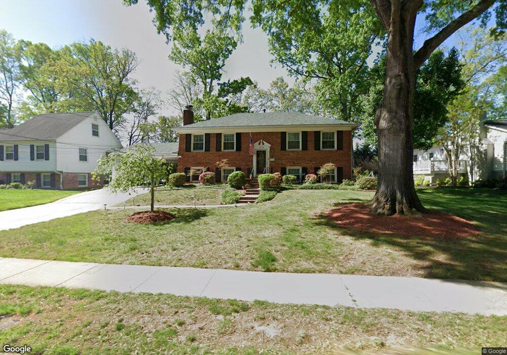
1905 Rampart Dr Alexandria, VA 22308
Fort Hunt NeighborhoodEstimated Value: $800,520 - $871,000
4
Beds
2
Baths
1,092
Sq Ft
$768/Sq Ft
Est. Value
About This Home
This home is located at 1905 Rampart Dr, Alexandria, VA 22308 and is currently estimated at $838,880, approximately $768 per square foot. 1905 Rampart Dr is a home located in Fairfax County with nearby schools including Stratford Landing Elementary School, Sandburg Middle, and West Potomac High School.
Ownership History
Date
Name
Owned For
Owner Type
Purchase Details
Closed on
Dec 22, 2021
Sold by
Terio Anne L
Bought by
Anne L Terio Revocable Trust and Terio
Current Estimated Value
Purchase Details
Closed on
Apr 11, 2000
Sold by
Downie Michael H
Bought by
Terio Charles
Home Financials for this Owner
Home Financials are based on the most recent Mortgage that was taken out on this home.
Original Mortgage
$209,600
Interest Rate
8.23%
Purchase Details
Closed on
Dec 15, 1999
Sold by
Thompson John G
Bought by
Downie Michael H
Home Financials for this Owner
Home Financials are based on the most recent Mortgage that was taken out on this home.
Original Mortgage
$156,800
Interest Rate
7.81%
Create a Home Valuation Report for This Property
The Home Valuation Report is an in-depth analysis detailing your home's value as well as a comparison with similar homes in the area
Home Values in the Area
Average Home Value in this Area
Purchase History
| Date | Buyer | Sale Price | Title Company |
|---|---|---|---|
| Anne L Terio Revocable Trust | -- | None Listed On Document | |
| Terio Anne L | -- | None Available | |
| Terio Charles | $262,000 | -- | |
| Downie Michael H | $196,000 | -- |
Source: Public Records
Mortgage History
| Date | Status | Borrower | Loan Amount |
|---|---|---|---|
| Previous Owner | Terio Charles | $209,600 | |
| Previous Owner | Downie Michael H | $156,800 |
Source: Public Records
Tax History Compared to Growth
Tax History
| Year | Tax Paid | Tax Assessment Tax Assessment Total Assessment is a certain percentage of the fair market value that is determined by local assessors to be the total taxable value of land and additions on the property. | Land | Improvement |
|---|---|---|---|---|
| 2025 | $574 | $734,430 | $376,000 | $358,430 |
| 2024 | $574 | $669,360 | $331,000 | $338,360 |
| 2023 | $509 | $699,130 | $331,000 | $368,130 |
| 2022 | $494 | $655,630 | $306,000 | $349,630 |
| 2021 | $419 | $615,450 | $276,000 | $339,450 |
| 2020 | $390 | $571,080 | $258,000 | $313,080 |
| 2019 | $405 | $556,940 | $250,000 | $306,940 |
| 2018 | $6,255 | $543,920 | $243,000 | $300,920 |
| 2017 | $364 | $1,660 | $0 | $1,660 |
| 2016 | $364 | $1,660 | $0 | $1,660 |
| 2015 | $345 | $531,020 | $236,000 | $295,020 |
| 2014 | $345 | $506,090 | $221,000 | $285,090 |
Source: Public Records
Map
Nearby Homes
- Hampton II Plan at Collingwood Chase
- 8260 Colling Manor Ct
- 1700 Collingwood Rd
- 8127 Stacey Rd
- 8281 Colling Manor Ct
- 8280 Colling Manor Ct
- 8276 Colling Manor Ct
- 8123 Stacey Rd
- 8264 Colling Manor Ct
- 8119 Stacey Rd
- 8126 Stacey Rd
- 8118 Stacey Rd
- 8305 Fort Hunt Rd
- 8601 Buckboard Dr
- 8518 Riverside Rd
- 8047 Fairfax Rd
- 2408 William And Mary Dr
- 1600 Lafayette Dr
- 8628 Plymouth Rd
- 8602 Cushman Place
- 1907 Rampart Dr
- 1903 Rampart Dr
- 1901 Rampart Dr
- 1909 Rampart Dr
- 1904 Rampart Dr
- 1902 Rampart Dr
- 1906 Rampart Dr
- 1807 Rampart Dr
- 1908 Rampart Dr
- 1911 Rampart Dr
- 1900 Rampart Dr
- 1910 Rampart Dr
- 1806 Rampart Dr
- 1805 Rampart Dr
- 1913 Rampart Dr
- 8319 Midwood St
- 8326 Fleetwood Ct
- 8324 Fleetwood Ct
- 1804 Rampart Dr
- 1803 Rampart Dr