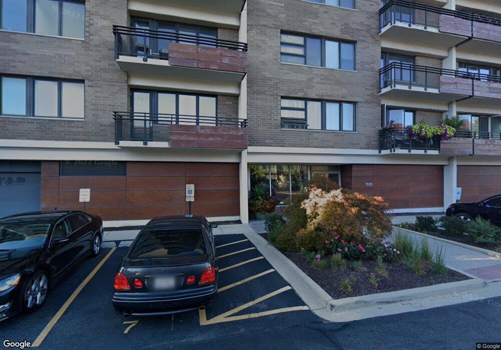
1905 S Wolf Rd Unit G6 Hillside, IL 60162
Estimated Value: $176,000 - $243,088
--
Bed
--
Bath
86,100
Sq Ft
$2/Sq Ft
Est. Value
About This Home
This home is located at 1905 S Wolf Rd Unit G6, Hillside, IL 60162 and is currently estimated at $206,022, approximately $2 per square foot. 1905 S Wolf Rd Unit G6 is a home located in Cook County with nearby schools including Hillside Elementary School, Proviso West High School, and Immanuel Christian Academy.
Ownership History
Date
Name
Owned For
Owner Type
Purchase Details
Closed on
Sep 30, 2024
Sold by
Angelo Annoreno And Maria B Annoreno Tru and Annoreno Angelo
Bought by
Porter Danny J and Porter Van Winkle
Current Estimated Value
Purchase Details
Closed on
Nov 9, 2018
Sold by
Annoreno Stephen A and Annoreno Angelo F
Bought by
The Angelo Annoreno And Mario B Annoreno
Purchase Details
Closed on
Oct 20, 2015
Sold by
Annoreno Steve
Bought by
Annoreno Steve and Annoreno Family Living Trust
Create a Home Valuation Report for This Property
The Home Valuation Report is an in-depth analysis detailing your home's value as well as a comparison with similar homes in the area
Home Values in the Area
Average Home Value in this Area
Purchase History
| Date | Buyer | Sale Price | Title Company |
|---|---|---|---|
| Porter Danny J | $226,500 | None Listed On Document | |
| The Angelo Annoreno And Mario B Annoreno | -- | None Available | |
| Annoreno Steve | -- | Git |
Source: Public Records
Tax History Compared to Growth
Tax History
| Year | Tax Paid | Tax Assessment Tax Assessment Total Assessment is a certain percentage of the fair market value that is determined by local assessors to be the total taxable value of land and additions on the property. | Land | Improvement |
|---|---|---|---|---|
| 2024 | $257 | $753 | $25 | $728 |
| 2023 | $274 | $753 | $25 | $728 |
| 2022 | $274 | $731 | $24 | $707 |
| 2021 | $268 | $730 | $23 | $707 |
| 2020 | $358 | $1,000 | $23 | $977 |
| 2019 | $204 | $534 | $21 | $513 |
| 2018 | $235 | $635 | $21 | $614 |
| 2017 | $226 | $635 | $21 | $614 |
| 2016 | $232 | $637 | $19 | $618 |
| 2015 | $224 | $637 | $19 | $618 |
| 2014 | $218 | $637 | $19 | $618 |
| 2013 | $219 | $700 | $19 | $681 |
Source: Public Records
Map
Nearby Homes
- 1905 S Wolf Rd Unit 302
- 11157 Shaw St
- 1847 Boeger Ave
- 2130 Mandel Ave
- 1948 Boeger Ave
- 2300 Boeger Ave
- 11140 Windsor Dr
- 1413 Highridge Pkwy
- 2205 Mayfair Ave
- 1327 S Wolf Rd
- 1326 Heidorn Ave
- 1811 Downing Ave
- 11449 Prescott Ln
- 1860 Buckingham Ave
- 1242 Heidorn Ave
- 10630 W Cermak Rd Unit 2E
- 2401 Mayfair Ave
- 11107 Kingston St
- 2337 Kensington Ave
- 10916 Kingston St
- 1905 S Wolf Rd Unit P56
- 1905 S Wolf Rd Unit P55
- 1905 S Wolf Rd Unit P54
- 1905 S Wolf Rd Unit G21
- 1905 S Wolf Rd Unit G19
- 1905 S Wolf Rd Unit G17
- 1905 S Wolf Rd Unit G15
- 1905 S Wolf Rd Unit G13
- 1905 S Wolf Rd Unit G11
- 1905 S Wolf Rd Unit G9
- 1905 S Wolf Rd Unit G4
- 1905 S Wolf Rd Unit G2
- 1905 S Wolf Rd Unit 608
- 1905 S Wolf Rd Unit 607
- 1905 S Wolf Rd Unit 606
- 1905 S Wolf Rd Unit 605
- 1905 S Wolf Rd Unit 604
- 1905 S Wolf Rd Unit 603
- 1905 S Wolf Rd Unit 602
- 1905 S Wolf Rd Unit 601