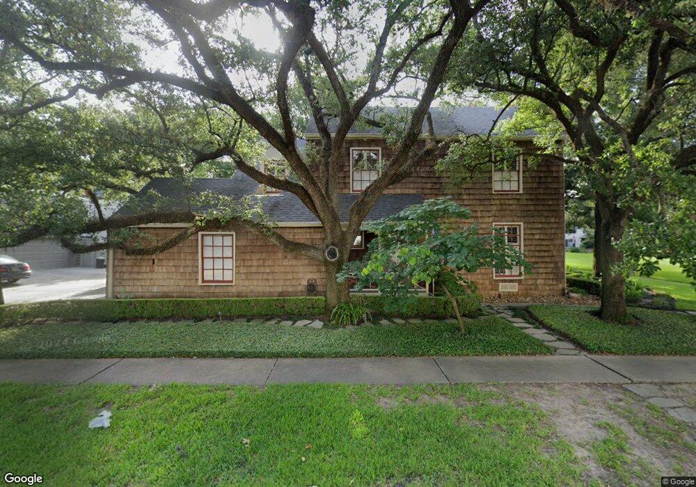
1905 Sharp Place Houston, TX 77019
River Oaks NeighborhoodEstimated Value: $1,680,955 - $2,312,000
4
Beds
5
Baths
3,715
Sq Ft
$547/Sq Ft
Est. Value
About This Home
This home is located at 1905 Sharp Place, Houston, TX 77019 and is currently estimated at $2,032,239, approximately $547 per square foot. 1905 Sharp Place is a home located in Harris County with nearby schools including River Oaks Elementary School, Lanier Middle School, and Lamar High School.
Ownership History
Date
Name
Owned For
Owner Type
Purchase Details
Closed on
Oct 28, 2005
Sold by
Susman Harry P and Susman Karen T
Bought by
Morris Matthew William and Morris Melissa Grace
Current Estimated Value
Home Financials for this Owner
Home Financials are based on the most recent Mortgage that was taken out on this home.
Original Mortgage
$400,000
Outstanding Balance
$215,266
Interest Rate
5.75%
Mortgage Type
Fannie Mae Freddie Mac
Estimated Equity
$1,816,973
Purchase Details
Closed on
Nov 10, 2000
Sold by
Matrix Bancorp Inc
Bought by
Susman Harry P and Susman Karen T
Purchase Details
Closed on
Aug 7, 2000
Sold by
Bender George R and Bender Victoria
Bought by
Matrix Bancorp Inc
Create a Home Valuation Report for This Property
The Home Valuation Report is an in-depth analysis detailing your home's value as well as a comparison with similar homes in the area
Home Values in the Area
Average Home Value in this Area
Purchase History
| Date | Buyer | Sale Price | Title Company |
|---|---|---|---|
| Morris Matthew William | -- | Stewart Title Company | |
| Susman Harry P | -- | -- | |
| Matrix Bancorp Inc | -- | -- |
Source: Public Records
Mortgage History
| Date | Status | Borrower | Loan Amount |
|---|---|---|---|
| Open | Morris Matthew William | $400,000 |
Source: Public Records
Tax History Compared to Growth
Tax History
| Year | Tax Paid | Tax Assessment Tax Assessment Total Assessment is a certain percentage of the fair market value that is determined by local assessors to be the total taxable value of land and additions on the property. | Land | Improvement |
|---|---|---|---|---|
| 2025 | $22,271 | $1,600,000 | $1,009,800 | $590,200 |
| 2024 | $22,271 | $1,380,000 | $948,600 | $431,400 |
| 2023 | $22,271 | $1,465,300 | $918,000 | $547,300 |
| 2022 | $30,791 | $1,420,043 | $887,400 | $532,643 |
| 2021 | $29,629 | $1,271,253 | $826,200 | $445,053 |
| 2020 | $30,475 | $1,258,485 | $826,200 | $432,285 |
| 2019 | $31,304 | $1,237,086 | $826,200 | $410,886 |
| 2018 | $24,243 | $1,206,486 | $795,600 | $410,886 |
| 2017 | $29,185 | $1,206,486 | $795,600 | $410,886 |
| 2016 | $26,532 | $1,187,793 | $771,120 | $416,673 |
| 2015 | $17,747 | $1,160,253 | $743,580 | $416,673 |
| 2014 | $17,747 | $1,032,174 | $633,420 | $398,754 |
Source: Public Records
Map
Nearby Homes
- 1711 Huldy St Unit A
- 2100 Welch St Unit C113
- 2100 Welch St Unit C101
- 1910 Huldy St Unit A
- 2105 Del Monte Dr
- 2217 Pelham Dr
- 1601 S Shepherd Dr Unit 20
- 1601 S Shepherd Dr Unit 29
- 1601 S Shepherd Dr Unit 138
- 2026 Welch St
- 1915 Spann St
- 2111 Welch St Unit A321
- 2111 Welch St Unit A232
- 2111 Welch St Unit A107
- 1712 Mcduffie St
- 1909 Brun St Unit 17
- 1909 Brun St Unit 16
- 2233 Pelham Dr
- 2027 Huldy St
- 2249 Pelham Dr
- 1901 Sharp Place
- 1909 Sharp Place
- 1829 Sharp Place
- 1825 Sharp Place
- 1833 Sharp Place
- 1913 Sharp Place
- 1821 Sharp Place
- 1929 Sharp Place
- 1917 Sharp Place
- 1933 Sharp Place
- 1925 Sharp Place
- 2139 Stanmore Dr
- 1921 Sharp Place
- 2137 Stanmore Dr
- 2141 Stanmore Dr
- 1817 Sharp Place
- 2143 Stanmore Dr
- 1805 Sharp Place
- 2130 Stanmore Dr
- 1801 Sharp Place