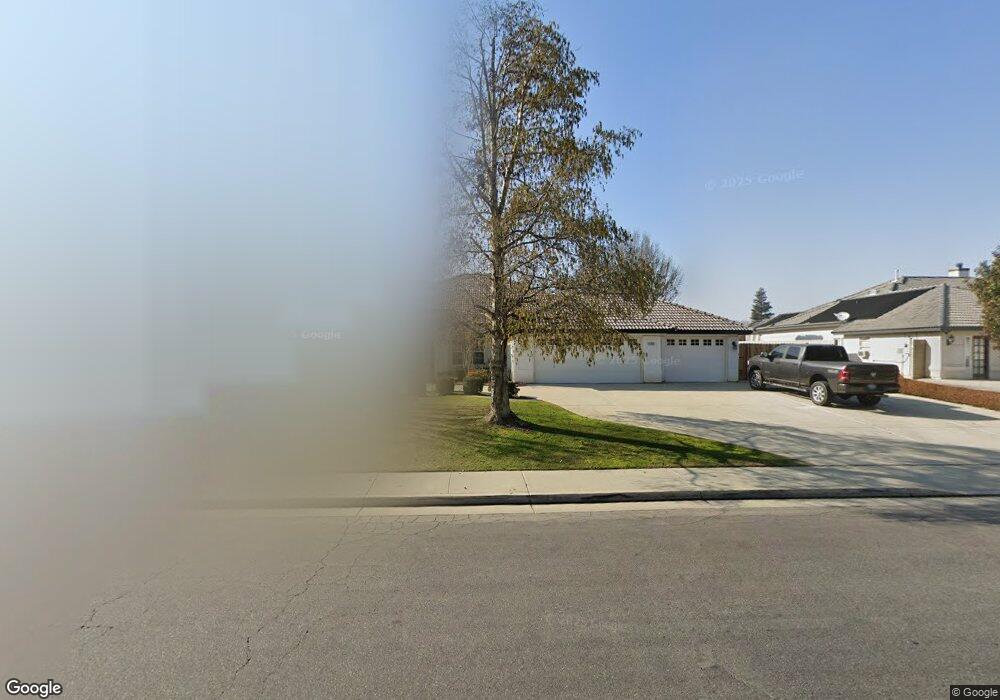
1905 Spanke St Bakersfield, CA 93312
Greenacres NeighborhoodEstimated Value: $642,562 - $751,000
4
Beds
3
Baths
2,587
Sq Ft
$268/Sq Ft
Est. Value
About This Home
This home is located at 1905 Spanke St, Bakersfield, CA 93312 and is currently estimated at $692,141, approximately $267 per square foot. 1905 Spanke St is a home located in Kern County with nearby schools including American Elementary School, Rosedale Middle School, and Liberty High School.
Ownership History
Date
Name
Owned For
Owner Type
Purchase Details
Closed on
Feb 10, 2011
Sold by
Potter Steve and Potter Becky
Bought by
Potter Steven Lynn and Potter Rebecca Sue
Current Estimated Value
Purchase Details
Closed on
Feb 27, 2000
Sold by
Carriage Homes
Bought by
Gsjb Development Inc
Home Financials for this Owner
Home Financials are based on the most recent Mortgage that was taken out on this home.
Original Mortgage
$188,000
Interest Rate
8.38%
Mortgage Type
Construction
Purchase Details
Closed on
Feb 18, 2000
Sold by
Gsjb Development Inc
Bought by
Potter Steve and Potter Becky
Home Financials for this Owner
Home Financials are based on the most recent Mortgage that was taken out on this home.
Original Mortgage
$188,000
Interest Rate
8.38%
Mortgage Type
Construction
Create a Home Valuation Report for This Property
The Home Valuation Report is an in-depth analysis detailing your home's value as well as a comparison with similar homes in the area
Home Values in the Area
Average Home Value in this Area
Purchase History
We collect this data history from publicly available records. To have your information removed, we recommend requesting removal directly through your county’s website.
| Date | Buyer | Sale Price | Title Company |
|---|---|---|---|
| Potter Steven Lynn | -- | None Available | |
| Gsjb Development Inc | $45,500 | First American Title Co | |
| Potter Steve | $236,000 | Commonwealth Land Title Co |
Source: Public Records
Mortgage History
We collect this data history from publicly available records. To have your information removed, we recommend requesting removal directly through your county’s website.
| Date | Status | Borrower | Loan Amount |
|---|---|---|---|
| Previous Owner | Gsjb Development Inc | $188,000 | |
| Previous Owner | Potter Steve | $188,500 |
Source: Public Records
Tax History
| Year | Tax Paid | Tax Assessment Tax Assessment Total Assessment is a certain percentage of the fair market value that is determined by local assessors to be the total taxable value of land and additions on the property. | Land | Improvement |
|---|---|---|---|---|
| 2025 | $4,861 | $377,827 | $68,547 | $309,280 |
| 2024 | $4,678 | $370,420 | $67,203 | $303,217 |
| 2023 | $4,678 | $363,158 | $65,886 | $297,272 |
| 2022 | $4,596 | $356,039 | $64,595 | $291,444 |
| 2021 | $4,454 | $349,059 | $63,329 | $285,730 |
| 2020 | $4,384 | $345,481 | $62,680 | $282,801 |
| 2019 | $4,307 | $345,481 | $62,680 | $282,801 |
| 2018 | $4,205 | $332,069 | $60,247 | $271,822 |
| 2017 | $4,140 | $325,560 | $59,066 | $266,494 |
| 2016 | $3,888 | $319,177 | $57,908 | $261,269 |
| 2015 | $3,825 | $314,385 | $57,039 | $257,346 |
| 2014 | $3,741 | $308,228 | $55,922 | $252,306 |
Source: Public Records
Map
Nearby Homes
- 1913 Kathryn Ct
- 10931 Shellabarger Rd
- 11520 Pinehaven Ave
- 2500 Jewetta Ave Unit 85
- 10429 Enger St
- 10421 Enger St
- 10332 Shellabarger Rd
- 10328 Shellabarger Rd Unit CA
- 11001 Four Bears Dr
- 1101 Sayword Ct
- 11001 Aimee Way
- 10419 Crandon Park Dr Unit 3
- 2113 Old Farm Rd
- 10717 Rising Sun Dr
- 10722 Iron Creek Ave
- 10906 Dee Ave
- 10723 Iron Creek Ave
- 11600 Whippoorwill Ln
- 10512 Dee Ave
- 10106 Boone Valley Dr
- 1909 Spanke St
- 1901 Spanke St
- 10715 Palm Ave
- 1807 Spanke St
- 10912 Melocoton Ct
- 10709 Palm Ave
- 10728 Palm Ave
- 1803 Spanke St
- 10720 Palm Ave
- 10908 Melocoton Ct
- 10716 Palm Ave
- 2001 Jason St
- 10724 Palm Ave
- 10712 Palm Ave
- 10705 Palm Ave
- 10913 Melocoton Ct
- 10904 Melocoton Ct
- 1705 Spanke St
- 2005 Jason St
- 10708 Palm Ave
Your Personal Tour Guide
Ask me questions while you tour the home.