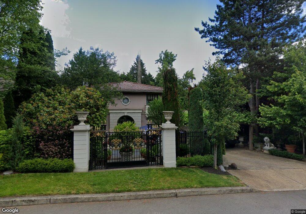
1905 SW Broadleaf Dr Portland, OR 97219
Marshall Park NeighborhoodEstimated Value: $718,000 - $813,000
3
Beds
3
Baths
2,554
Sq Ft
$307/Sq Ft
Est. Value
About This Home
This home is located at 1905 SW Broadleaf Dr, Portland, OR 97219 and is currently estimated at $784,474, approximately $307 per square foot. 1905 SW Broadleaf Dr is a home located in Multnomah County with nearby schools including Stephenson Elementary School, Jackson Middle School, and Ida B. Wells-Barnett High School.
Ownership History
Date
Name
Owned For
Owner Type
Purchase Details
Closed on
Sep 20, 2016
Sold by
Scattarella Donalad J
Bought by
Rueter Derek Charles
Current Estimated Value
Home Financials for this Owner
Home Financials are based on the most recent Mortgage that was taken out on this home.
Original Mortgage
$382,415
Outstanding Balance
$304,827
Interest Rate
3.45%
Mortgage Type
New Conventional
Estimated Equity
$479,647
Create a Home Valuation Report for This Property
The Home Valuation Report is an in-depth analysis detailing your home's value as well as a comparison with similar homes in the area
Home Values in the Area
Average Home Value in this Area
Purchase History
| Date | Buyer | Sale Price | Title Company |
|---|---|---|---|
| Rueter Derek Charles | $449,900 | Fidelity Natl Title Of Or |
Source: Public Records
Mortgage History
| Date | Status | Borrower | Loan Amount |
|---|---|---|---|
| Open | Rueter Derek Charles | $382,415 |
Source: Public Records
Tax History Compared to Growth
Tax History
| Year | Tax Paid | Tax Assessment Tax Assessment Total Assessment is a certain percentage of the fair market value that is determined by local assessors to be the total taxable value of land and additions on the property. | Land | Improvement |
|---|---|---|---|---|
| 2025 | $14,561 | $572,860 | -- | -- |
| 2024 | $13,890 | $556,180 | -- | -- |
| 2023 | $14,051 | $539,990 | $0 | $0 |
| 2022 | $13,627 | $524,270 | $0 | $0 |
| 2021 | $12,380 | $509,000 | $0 | $0 |
| 2020 | $10,451 | $494,180 | $0 | $0 |
| 2019 | $10,482 | $479,790 | $0 | $0 |
| 2018 | $10,289 | $465,820 | $0 | $0 |
| 2017 | $10,132 | $452,260 | $0 | $0 |
| 2016 | $8,573 | $439,090 | $0 | $0 |
| 2015 | $8,075 | $426,310 | $0 | $0 |
| 2014 | $7,371 | $413,900 | $0 | $0 |
Source: Public Records
Map
Nearby Homes
- 9855 SW 25th Ave
- 1845 SW Taylors Ferry Rd
- 2249 SW Taylors Ferry Rd
- 9224 SW 26th Ave
- 0 SW Lancaster Rd Unit 722439051
- 0 SW Lancaster Rd Unit 540028719
- 0 SW Taylors Ferry Ct Unit 171663449
- 1345 SW Taylors Ferry Ct
- 9375 SW 8th Ave
- 10850 SW Creightonwood Place
- 9341 SW 8th Ave
- 2731 SW 28th Dr
- 9818 SW 34th Place
- 9822 SW 34th Place
- 9824 SW 34th Place
- 2531 SW Spring Garden St
- 8921 SW 7th Ave
- 1515 SW Carson St
- 9320 SW Boones Ferry Rd
- 2644 SW Hume Ct
- 1853 SW Broadleaf Dr
- 1911 SW Broadleaf Dr
- 1845 SW Broadleaf Dr
- 1902 SW Broadleaf Dr
- 1831 SW Broadleaf Dr
- 1850 SW Broadleaf Dr
- 1920 SW Broadleaf Dr
- 1933 SW Broadleaf Dr
- 1840 SW Broadleaf Dr
- 1932 SW Broadleaf Dr
- 1821 SW Broadleaf Dr
- 1834 SW Broadleaf Dr
- 1937 SW Broadleaf Dr
- 10018 SW Balmer Cir
- 1940 SW Broadleaf Dr
- 10022 SW Balmer Cir
- 10014 SW Balmer Cir
- 1820 SW Broadleaf Dr
- 1809 SW Broadleaf Dr
- 10010 SW