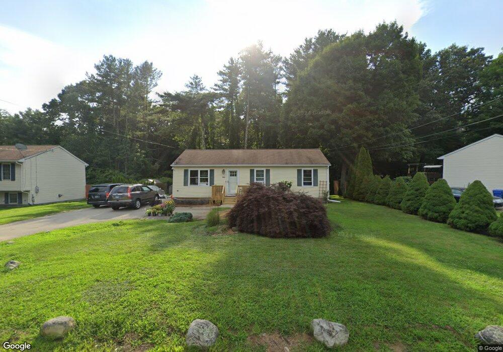
1905 Upper Maple St Dayville, CT 06241
Estimated Value: $207,000 - $383,000
3
Beds
1
Bath
1,008
Sq Ft
$300/Sq Ft
Est. Value
About This Home
This home is located at 1905 Upper Maple St, Dayville, CT 06241 and is currently estimated at $302,414, approximately $300 per square foot. 1905 Upper Maple St is a home located in Windham County with nearby schools including Killingly Central School, Killingly Memorial School, and Killingly Intermediate School.
Ownership History
Date
Name
Owned For
Owner Type
Purchase Details
Closed on
May 8, 2023
Sold by
Witkowski Johann A
Bought by
Kipp Benjamin R and Kipp Christine L
Current Estimated Value
Home Financials for this Owner
Home Financials are based on the most recent Mortgage that was taken out on this home.
Original Mortgage
$153,000
Outstanding Balance
$147,853
Interest Rate
6.32%
Mortgage Type
Purchase Money Mortgage
Estimated Equity
$154,561
Purchase Details
Closed on
Aug 27, 2001
Sold by
On Trac Bldrs Llc
Bought by
Witkowski Johann A and Witkowski Martha M
Create a Home Valuation Report for This Property
The Home Valuation Report is an in-depth analysis detailing your home's value as well as a comparison with similar homes in the area
Home Values in the Area
Average Home Value in this Area
Purchase History
| Date | Buyer | Sale Price | Title Company |
|---|---|---|---|
| Kipp Benjamin R | $170,000 | None Available | |
| Kipp Benjamin R | $170,000 | None Available | |
| Witkowski Johann A | $111,900 | -- | |
| Witkowski Johann A | $111,900 | -- |
Source: Public Records
Mortgage History
| Date | Status | Borrower | Loan Amount |
|---|---|---|---|
| Open | Kipp Benjamin R | $153,000 | |
| Closed | Kipp Benjamin R | $153,000 | |
| Previous Owner | Witkowski Johann A | $17,000 | |
| Previous Owner | Witkowski Johann A | $225,000 | |
| Previous Owner | Witkowski Johann A | $40,000 |
Source: Public Records
Tax History
| Year | Tax Paid | Tax Assessment Tax Assessment Total Assessment is a certain percentage of the fair market value that is determined by local assessors to be the total taxable value of land and additions on the property. | Land | Improvement |
|---|---|---|---|---|
| 2025 | $3,839 | $163,730 | $35,280 | $128,450 |
| 2024 | $3,610 | $163,580 | $35,280 | $128,300 |
| 2023 | $3,269 | $114,100 | $29,120 | $84,980 |
| 2022 | $3,070 | $114,100 | $29,120 | $84,980 |
| 2021 | $3,070 | $114,100 | $29,120 | $84,980 |
| 2020 | $3,005 | $114,100 | $29,120 | $84,980 |
| 2019 | $3,065 | $114,100 | $29,120 | $84,980 |
| 2017 | $2,687 | $91,980 | $23,310 | $68,670 |
| 2016 | $2,678 | $91,980 | $23,310 | $68,670 |
| 2015 | $2,696 | $91,980 | $23,310 | $68,670 |
| 2014 | $2,622 | $91,980 | $23,310 | $68,670 |
Source: Public Records
Map
Nearby Homes
- 30 Huntley Rd
- 385 Putnam Pike
- 36 Church St
- 38-82 Ballouville Rd
- 279 Putnam Pike
- 55 Island Rd
- 152 Country Club Rd
- 93 Pleasant View Dr
- 85 Soap St
- 1567 Upper Maple St
- 350 Hartford Pike
- 438 Hartford Pike
- 58 Hartford Pike
- 251 Park Rd
- 104 Jessica Ln Unit 104
- 4 Bluebird Ln
- 228 River Rd
- 241 Killingly Ave
- 117 State Ave
- 941 Upper Maple St
- 1901 Upper Maple St
- 1909 Upper Maple St
- 1893 Upper Maple St
- 1889 Upper Maple St
- 1885 Upper Maple St
- 417 Lake Rd
- 8 Tracy Rd
- 107 Attawaugan Crossing Rd
- 1871 Upper Maple St
- 390 Lake Rd
- 1883 Upper Maple St
- 27 Old Trolley Rd
- 280 Laurel Point Rd
- 1853 Upper Maple St
- 30 Tracy Rd
- 108 Attawaugan Crossing Rd
- 182 Laurel Point Rd
- 183 Laurel Point Rd
- 184 Laurel Point Rd
- 181 Laurel Point Rd
Your Personal Tour Guide
Ask me questions while you tour the home.