Estimated Value: $203,000 - $259,232
2
Beds
2
Baths
1,060
Sq Ft
$218/Sq Ft
Est. Value
About This Home
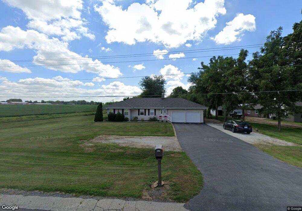
This home is located at 19055 State Route 9, Pekin, IL 61554 and is currently estimated at $231,308, approximately $218 per square foot. 19055 State Route 9 is a home located in Tazewell County with nearby schools including Scott Altman Primary School, Wilson Intermediate School, and Broadmoor Junior High School.
Ownership History
Date
Name
Owned For
Owner Type
Purchase Details
Closed on
Jul 26, 2011
Sold by
Gilmer Melissa Ann
Bought by
Hackman Terry E
Current Estimated Value
Home Financials for this Owner
Home Financials are based on the most recent Mortgage that was taken out on this home.
Original Mortgage
$153,212
Outstanding Balance
$105,835
Interest Rate
4.52%
Mortgage Type
New Conventional
Estimated Equity
$125,473
Purchase Details
Closed on
Apr 27, 2007
Sold by
Lindsay Mark A
Bought by
Gilmer Melissa Ann
Home Financials for this Owner
Home Financials are based on the most recent Mortgage that was taken out on this home.
Original Mortgage
$133,050
Interest Rate
6.18%
Mortgage Type
VA
Purchase Details
Closed on
Nov 20, 2006
Sold by
Jackson Tammy R
Bought by
Lindsay Mark A
Create a Home Valuation Report for This Property
The Home Valuation Report is an in-depth analysis detailing your home's value as well as a comparison with similar homes in the area
Home Values in the Area
Average Home Value in this Area
Purchase History
| Date | Buyer | Sale Price | Title Company |
|---|---|---|---|
| Hackman Terry E | $148,000 | None Available | |
| Gilmer Melissa Ann | $133,500 | First Community Title Svcs | |
| Lindsay Mark A | -- | None Available |
Source: Public Records
Mortgage History
| Date | Status | Borrower | Loan Amount |
|---|---|---|---|
| Open | Hackman Terry E | $153,212 | |
| Previous Owner | Gilmer Melissa Ann | $133,050 |
Source: Public Records
Tax History Compared to Growth
Tax History
| Year | Tax Paid | Tax Assessment Tax Assessment Total Assessment is a certain percentage of the fair market value that is determined by local assessors to be the total taxable value of land and additions on the property. | Land | Improvement |
|---|---|---|---|---|
| 2024 | $2,966 | $64,660 | $11,370 | $53,290 |
| 2023 | $2,966 | $59,370 | $10,440 | $48,930 |
| 2022 | $2,825 | $55,270 | $9,720 | $45,550 |
| 2021 | $2,766 | $48,200 | $9,350 | $38,850 |
| 2020 | $3,094 | $47,260 | $9,170 | $38,090 |
| 2019 | $3,096 | $47,260 | $9,170 | $38,090 |
| 2018 | $3,043 | $47,260 | $9,170 | $38,090 |
| 2017 | $2,991 | $46,790 | $9,080 | $37,710 |
| 2016 | $2,778 | $44,010 | $9,080 | $34,930 |
| 2015 | $2,703 | $0 | $0 | $0 |
| 2013 | $2,667 | $44,010 | $9,080 | $34,930 |
Source: Public Records
Map
Nearby Homes
- 107 Lost Creek Ct
- 116 Lost Creek Ct
- 105 Royal Point Ct
- 1960-1962 Mayflower Dr
- 1920-1922 Mayflower Dr
- 3858 Sunset Dr
- 303 Powers Ave
- 1471 Valle Vista Blvd Unit 6
- 1471 Valle Vista Blvd Unit 16
- 17902 Red Shale Hill Rd
- 1700 Deppert Dr
- 16810 Springfield Rd
- 1621 Valle Vista Blvd
- 16 Point Ct E
- 1515 Norwood Ave
- 1900 Saint Clair Dr
- 1824 Valencia Place
- 7 Country Club Ct
- 339 Country Club Dr
- 2104 Sierra Dr
- 19055 State Route 9
- 19019 State Route 9
- 18977 State Route 9
- 18977 Illinois 9
- 18923 State Route 9
- 18875 State Route 9
- 18875 State Route 9
- 18837 State Route 9
- 1925 Mayflower Dr
- 1919 Mayflower Dr
- 1933 Mayflower Dr
- 19400 Illinois 9
- 1927 Mayflower Dr
- 1935 Mayflower Dr
- 1939 Mayflower Dr
- 1941 Mayflower Dr
- 1951 Mayflower Dr
- 1930 Mayflower Dr
- 1936 Mayflower Dr
- 1920 Mayflower Dr