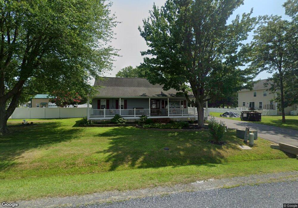
1906 Anchorage Dr Chester, MD 21619
Estimated Value: $423,000 - $465,000
Studio
2
Baths
1,780
Sq Ft
$250/Sq Ft
Est. Value
About This Home
This home is located at 1906 Anchorage Dr, Chester, MD 21619 and is currently estimated at $445,535, approximately $250 per square foot. 1906 Anchorage Dr is a home located in Queen Anne's County with nearby schools including Kent Island Elementary School, Bayside Elementary School, and Matapeake Middle School.
Ownership History
Date
Name
Owned For
Owner Type
Purchase Details
Closed on
Dec 16, 1998
Sold by
Humphrey Timothy H and Humphrey Brenda L
Bought by
Riddle James P
Current Estimated Value
Purchase Details
Closed on
Jan 17, 1996
Sold by
Eliadis Peter M
Bought by
Humphrey Timothy H and Humphrey Brenda L
Purchase Details
Closed on
Jun 25, 1991
Sold by
Hodges John T and Hodges Janet J
Bought by
Eliadis Peter M
Home Financials for this Owner
Home Financials are based on the most recent Mortgage that was taken out on this home.
Original Mortgage
$109,000
Interest Rate
9.65%
Create a Home Valuation Report for This Property
The Home Valuation Report is an in-depth analysis detailing your home's value as well as a comparison with similar homes in the area
Home Values in the Area
Average Home Value in this Area
Purchase History
| Date | Buyer | Sale Price | Title Company |
|---|---|---|---|
| Riddle James P | $99,000 | -- | |
| Humphrey Timothy H | $127,500 | -- | |
| Eliadis Peter M | $107,500 | -- |
Source: Public Records
Mortgage History
| Date | Status | Borrower | Loan Amount |
|---|---|---|---|
| Previous Owner | Eliadis Peter M | $109,000 | |
| Closed | Humphrey Timothy H | -- |
Source: Public Records
Tax History
| Year | Tax Paid | Tax Assessment Tax Assessment Total Assessment is a certain percentage of the fair market value that is determined by local assessors to be the total taxable value of land and additions on the property. | Land | Improvement |
|---|---|---|---|---|
| 2025 | $3,259 | $374,533 | $0 | $0 |
| 2024 | $3,093 | $346,767 | $0 | $0 |
| 2023 | $2,933 | $319,000 | $152,500 | $166,500 |
| 2022 | $2,802 | $311,133 | $0 | $0 |
| 2021 | $2,724 | $303,267 | $0 | $0 |
| 2020 | $2,602 | $295,400 | $142,500 | $152,900 |
| 2019 | $2,629 | $274,133 | $0 | $0 |
| 2018 | $2,419 | $252,267 | $0 | $0 |
| 2017 | $2,216 | $231,000 | $0 | $0 |
| 2016 | -- | $231,000 | $0 | $0 |
| 2015 | $2,401 | $231,000 | $0 | $0 |
| 2014 | $2,401 | $232,700 | $0 | $0 |
Source: Public Records
Map
Nearby Homes
- 1906 Harbor Dr
- 1872 Harbor Dr
- 1838 Sherman Dr
- 1916 Stevens Dr
- 0 Harbor Dr
- 7009 Bridgepointe Dr
- 2613 Cecil Dr
- 1757 Harbor Dr
- 1868 Roberta Dr
- 129 Sailcloth Way
- 135 Nauset Ln
- 1000 Herons Nest Way Unit 32
- 1000 Herons Nest Way Unit 23
- 205 Anchor Ln
- 2000 Herons Nest Way Unit 401
- 3000 Herons Nest Way Unit 11
- 4000 Herons Nest Way Unit 22
- 1 UNIT 2 Compass Cir
- 219 Broadwater Dr
- 54H Queen Caroline Ct
- 1910 Anchorage Dr
- 2716 Ellicott Dr
- 1912 Anchorage Dr
- 1905 Harbor Dr
- 1903 Harbor Dr
- 1907 Harbor Dr
- 1901 Harbor Dr
- 1911 Harbor Dr
- 1914 Anchorage Dr
- 1911 Anchorage Dr
- 1913 Harbor Dr
- 1915 Harbor Dr
- 1913 Anchorage Dr
- 1918 Anchorage Dr
- 1915 Anchorage Dr
- 1917 Harbor Dr
- 1871 Harbor Dr
- 1917 Anchorage Dr
- 1908 Harbor Dr
- 1904 Harbor Dr
Your Personal Tour Guide
Ask me questions while you tour the home.