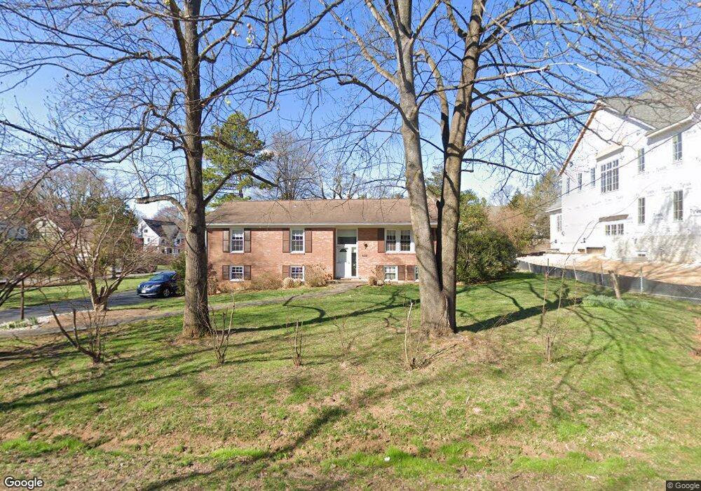
1906 Bargo Ct McLean, VA 22101
Estimated Value: $1,293,000 - $1,586,000
--
Bed
3
Baths
1,460
Sq Ft
$995/Sq Ft
Est. Value
About This Home
This home is located at 1906 Bargo Ct, McLean, VA 22101 and is currently estimated at $1,452,699, approximately $994 per square foot. 1906 Bargo Ct is a home located in Fairfax County with nearby schools including Chesterbrook Elementary School, Longfellow Middle School, and Montessori School Of Mclean.
Ownership History
Date
Name
Owned For
Owner Type
Purchase Details
Closed on
Feb 15, 2022
Sold by
Piontkowski Charles F and Piontkowski Barbara M
Bought by
Charles Francis Piontkowski Revocable Trust and Barbara Francis Piontkowski Revocable Trust
Current Estimated Value
Purchase Details
Closed on
Feb 28, 1978
Bought by
Piontkowski Charles F and And Barbara M
Create a Home Valuation Report for This Property
The Home Valuation Report is an in-depth analysis detailing your home's value as well as a comparison with similar homes in the area
Home Values in the Area
Average Home Value in this Area
Purchase History
| Date | Buyer | Sale Price | Title Company |
|---|---|---|---|
| Charles Francis Piontkowski Revocable Trust | -- | None Listed On Document | |
| Charles Francis Piontkowski Revocable Trust | -- | Zell Law Pllc | |
| Piontkowski Charles F | $100,000 | -- |
Source: Public Records
Tax History Compared to Growth
Tax History
| Year | Tax Paid | Tax Assessment Tax Assessment Total Assessment is a certain percentage of the fair market value that is determined by local assessors to be the total taxable value of land and additions on the property. | Land | Improvement |
|---|---|---|---|---|
| 2025 | $14,625 | $1,198,130 | $633,000 | $565,130 |
| 2024 | $14,625 | $1,190,860 | $633,000 | $557,860 |
| 2023 | $13,926 | $1,166,860 | $609,000 | $557,860 |
| 2022 | $13,121 | $1,084,140 | $569,000 | $515,140 |
| 2021 | $13,140 | $1,064,790 | $564,000 | $500,790 |
| 2020 | $12,998 | $1,046,700 | $564,000 | $482,700 |
| 2019 | $11,138 | $891,280 | $470,000 | $421,280 |
| 2018 | $10,109 | $879,010 | $470,000 | $409,010 |
| 2017 | $10,752 | $879,010 | $470,000 | $409,010 |
| 2016 | $10,636 | $870,990 | $470,000 | $400,990 |
| 2015 | $9,973 | $845,310 | $456,000 | $389,310 |
| 2014 | $9,563 | $811,070 | $443,000 | $368,070 |
Source: Public Records
Map
Nearby Homes
- 6511 Ivy Hill Dr
- 6434 Noble Dr
- 1904 Lamson Place
- 6514 Byrnes Dr
- 2005 Highboro Way
- 6424 Divine St
- 2107 Elliott Ave
- 1730 Barbee St
- 2115 Natahoa Ct
- 6449 Orland St
- 1843 Rhode Island Ave
- 2123 Natahoa Ct
- 6607 Midhill Place
- 3623 N Rockingham St
- 6603 Byrnes Dr
- 6529 Fairlawn Dr
- 2136 Powhatan St
- 1830 Massachusetts Ave
- 2125 Hilltop Place
- 6609 Rockmont Ct
- 1916 Macarthur Dr
- 1902 Bargo Ct
- 1928 Macarthur Dr
- 1917 Macarthur Dr
- 1913 Macarthur Dr
- 1909 Macarthur Dr
- 1932 Macarthur Dr
- 1900 Bargo Ct
- 1903 Bargo Ct
- 1921 Macarthur Dr
- 1901 Bargo Ct
- 0 Macarthur Dr Unit 1008377874
- 1936 Macarthur Dr
- 1914 Kenbar Ct
- 1900 Macarthur Dr
- 1925 Macarthur Dr
- 1806 Franklin Ave
- 1944 Macarthur Dr
- 1903 Macarthur Dr
- 1905 Macarthur Dr