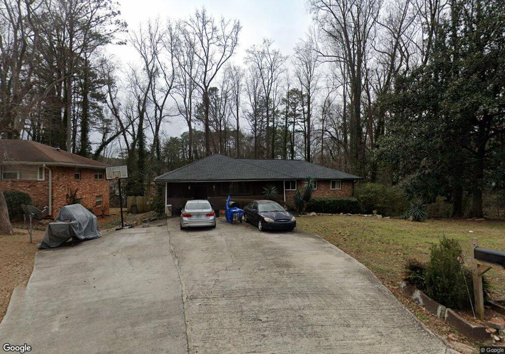
1906 Delphine Dr Decatur, GA 30032
East Lake NeighborhoodEstimated Value: $320,000 - $386,000
2
Beds
2
Baths
1,635
Sq Ft
$214/Sq Ft
Est. Value
About This Home
This home is located at 1906 Delphine Dr, Decatur, GA 30032 and is currently estimated at $349,148, approximately $213 per square foot. 1906 Delphine Dr is a home located in DeKalb County with nearby schools including McNair Middle School, McNair High School, and Charles Drew Charter School.
Ownership History
Date
Name
Owned For
Owner Type
Purchase Details
Closed on
May 30, 2007
Sold by
Hoseas Bonding
Bought by
Peterson Annie M
Current Estimated Value
Home Financials for this Owner
Home Financials are based on the most recent Mortgage that was taken out on this home.
Original Mortgage
$115,000
Interest Rate
6.52%
Mortgage Type
New Conventional
Create a Home Valuation Report for This Property
The Home Valuation Report is an in-depth analysis detailing your home's value as well as a comparison with similar homes in the area
Home Values in the Area
Average Home Value in this Area
Purchase History
| Date | Buyer | Sale Price | Title Company |
|---|---|---|---|
| Peterson Annie M | -- | -- |
Source: Public Records
Mortgage History
| Date | Status | Borrower | Loan Amount |
|---|---|---|---|
| Previous Owner | Peterson Annie M | $115,000 |
Source: Public Records
Tax History Compared to Growth
Tax History
| Year | Tax Paid | Tax Assessment Tax Assessment Total Assessment is a certain percentage of the fair market value that is determined by local assessors to be the total taxable value of land and additions on the property. | Land | Improvement |
|---|---|---|---|---|
| 2025 | $3,586 | $136,960 | $42,560 | $94,400 |
| 2024 | $3,586 | $135,160 | $42,560 | $92,600 |
| 2023 | $3,586 | $127,040 | $42,560 | $84,480 |
| 2022 | $3,064 | $115,680 | $34,600 | $81,080 |
| 2021 | $2,707 | $100,200 | $33,600 | $66,600 |
| 2020 | $2,272 | $81,160 | $33,600 | $47,560 |
| 2019 | $2,088 | $73,640 | $6,640 | $67,000 |
| 2018 | $1,409 | $59,800 | $6,640 | $53,160 |
| 2017 | $1,572 | $49,760 | $6,640 | $43,120 |
| 2016 | $1,026 | $29,440 | $6,640 | $22,800 |
| 2014 | $905 | $25,800 | $3,360 | $22,440 |
Source: Public Records
Map
Nearby Homes
- 1894 Delphine Dr
- 2022 Barberrie Ln
- 1909 Delphine Dr
- 2030 Barberrie Ln
- 2036 Barberrie Ln
- 1998 Barberrie Ln
- 2042 Barberrie Ln
- 1887 Delphine Dr
- 1882 Delphine Dr
- 1887 Burning Tree Dr
- 0 Barberrie Ln Unit 7534203
- 0 Barberrie Ln Unit 3252648
- 0 Barberrie Ln Unit 3201186
- 0 Barberrie Ln Unit 3170971
- 0 Barberrie Ln Unit 8551260
- 0 Barberrie Ln Unit 8227785
- 0 Barberrie Ln Unit 7595271
- 0 Barberrie Ln Unit 8523683
- 0 Barberrie Ln Unit 8771212