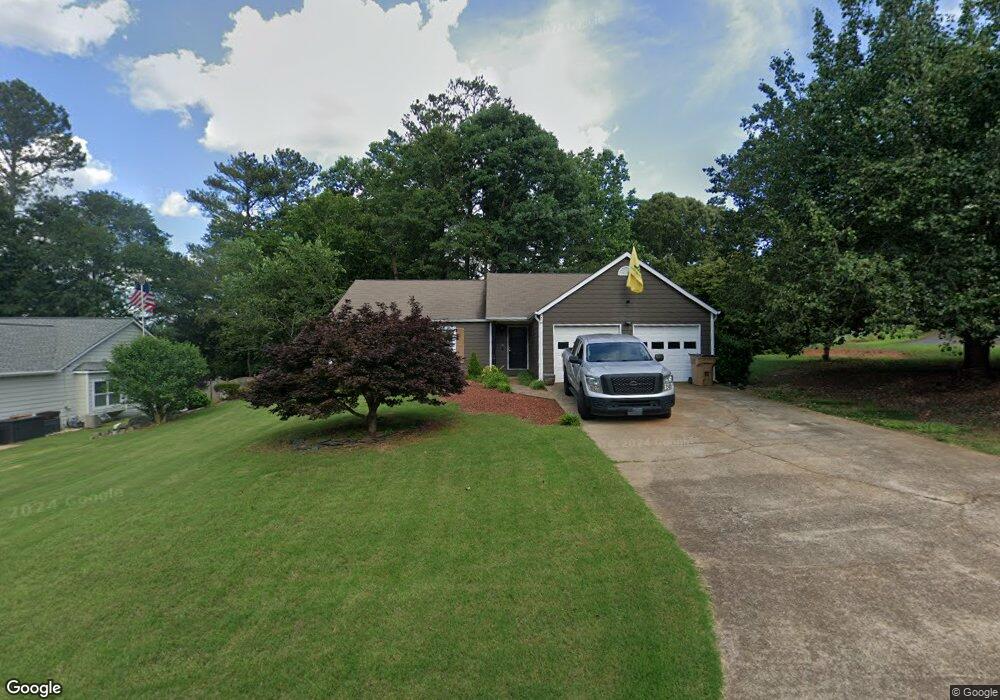
1906 Grant Ln Unit 2 Woodstock, GA 30188
Union Hill NeighborhoodEstimated Value: $352,410 - $359,000
3
Beds
2
Baths
1,396
Sq Ft
$255/Sq Ft
Est. Value
About This Home
This home is located at 1906 Grant Ln Unit 2, Woodstock, GA 30188 and is currently estimated at $355,705, approximately $254 per square foot. 1906 Grant Ln Unit 2 is a home located in Cherokee County with nearby schools including Arnold Mill Elementary School, Mill Creek Middle School, and River Ridge High School.
Ownership History
Date
Name
Owned For
Owner Type
Purchase Details
Closed on
Oct 8, 2004
Sold by
Chivers Martin
Bought by
Hill John B
Current Estimated Value
Home Financials for this Owner
Home Financials are based on the most recent Mortgage that was taken out on this home.
Original Mortgage
$25,000
Interest Rate
5.09%
Mortgage Type
Unknown
Purchase Details
Closed on
Jul 3, 2002
Sold by
Mercer Lorri B
Bought by
Chivers Martin
Home Financials for this Owner
Home Financials are based on the most recent Mortgage that was taken out on this home.
Original Mortgage
$106,000
Interest Rate
6.75%
Mortgage Type
New Conventional
Purchase Details
Closed on
Apr 24, 1996
Sold by
Davidson Laura
Bought by
Blair Lorri
Purchase Details
Closed on
May 19, 1993
Sold by
Mitchell Robert H and Mitchell Barbara J
Bought by
Davidson Laura S
Home Financials for this Owner
Home Financials are based on the most recent Mortgage that was taken out on this home.
Original Mortgage
$72,000
Interest Rate
7.57%
Create a Home Valuation Report for This Property
The Home Valuation Report is an in-depth analysis detailing your home's value as well as a comparison with similar homes in the area
Home Values in the Area
Average Home Value in this Area
Purchase History
| Date | Buyer | Sale Price | Title Company |
|---|---|---|---|
| Hill John B | $125,000 | -- | |
| Chivers Martin | $132,500 | -- | |
| Blair Lorri | $95,900 | -- | |
| Davidson Laura S | $72,000 | -- |
Source: Public Records
Mortgage History
| Date | Status | Borrower | Loan Amount |
|---|---|---|---|
| Closed | Hill John B | $25,000 | |
| Open | Hill John B | $100,000 | |
| Previous Owner | Chivers Martin | $106,000 | |
| Previous Owner | Davidson Laura S | $72,000 | |
| Closed | Blair Lorri | $0 |
Source: Public Records
Tax History Compared to Growth
Tax History
| Year | Tax Paid | Tax Assessment Tax Assessment Total Assessment is a certain percentage of the fair market value that is determined by local assessors to be the total taxable value of land and additions on the property. | Land | Improvement |
|---|---|---|---|---|
| 2025 | $2,716 | $120,616 | $32,000 | $88,616 |
| 2024 | $2,553 | $112,616 | $30,400 | $82,216 |
| 2023 | $2,085 | $111,056 | $28,800 | $82,256 |
| 2022 | $2,355 | $101,896 | $23,600 | $78,296 |
| 2021 | $2,016 | $78,696 | $18,000 | $60,696 |
| 2020 | $1,792 | $68,976 | $14,000 | $54,976 |
| 2019 | $1,690 | $64,560 | $14,000 | $50,560 |
| 2018 | $1,545 | $58,040 | $14,000 | $44,040 |
| 2017 | $1,498 | $138,800 | $14,000 | $41,520 |
| 2016 | $1,376 | $124,400 | $12,400 | $37,360 |
| 2015 | $1,331 | $118,900 | $12,400 | $35,160 |
| 2014 | $1,207 | $108,200 | $11,600 | $31,680 |
Source: Public Records
Map
Nearby Homes
- 624 Arnold Mill Rd
- 632 Arnold Mill Rd
- 636 Arnold Mill Rd
- 522 Watercress Dr
- 321 Burdock Trace
- 585 Arnold Mill Rd
- 236 Persimmon Dr
- 4006 N Arnold Mill Rd
- 124 Riverside Ln
- 4020 N Arnold Mill Rd
- 414 Spring View Dr
- 809 Araya Ct
- 202 Little River Way
- 114 Neetle Close Dr
- 116 Neetle Close Dr
- 154 Towey Trail
- 436 Silver Brook Dr
- 427 Silver Brook Dr
- 200 Dahlia Dr
- Dahlonega Elite Plan at Vista Ridge - The Meadows Collection
- 1908 Grant Ln
- 1507 River Rock Trace Unit 3
- 1506 River Rock Trace Unit 2
- 1905 Grant Ln Unit 2
- 1508 River Rock Trace
- 1005 Riverstone Ct
- 1910 Grant Ln
- 1910 Gantt Ln
- 1907 Grant Ln
- 1509 River Rock Trace Unit 3
- 1510 River Rock Trace
- 1903 Grant Ln Unit 2
- 1006 Riverstone Ct Unit 3
- 1902 Grant Ln
- 1003 Riverstone Ct
- 1909 Grant Ln
- 1511 River Rock Trace Unit 3
- 1501 River Rock Trace
- 1512 River Rock Trace
- 1912 Grant Ln