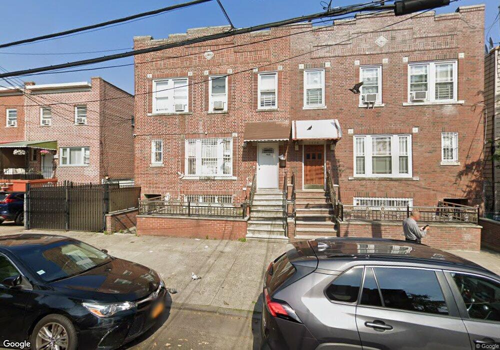
1906 Hunt Ave Bronx, NY 10462
Van Nest NeighborhoodEstimated Value: $1,022,000 - $1,345,000
--
Bed
--
Bath
3,228
Sq Ft
$354/Sq Ft
Est. Value
About This Home
This home is located at 1906 Hunt Ave, Bronx, NY 10462 and is currently estimated at $1,141,333, approximately $353 per square foot. 1906 Hunt Ave is a home located in Bronx County with nearby schools including P.S. 105 Senator Abraham Bernstein, Pelham Academy, and Bronx Green Middle School.
Ownership History
Date
Name
Owned For
Owner Type
Purchase Details
Closed on
Jun 27, 2023
Sold by
Muthana Foad S
Bought by
1906 Realty Llc
Current Estimated Value
Home Financials for this Owner
Home Financials are based on the most recent Mortgage that was taken out on this home.
Original Mortgage
$499,000
Outstanding Balance
$486,186
Interest Rate
6.39%
Mortgage Type
Purchase Money Mortgage
Estimated Equity
$655,147
Purchase Details
Closed on
Dec 4, 2014
Sold by
Capellupo Annette and Capellupo Robert
Bought by
Muthana Foad S
Home Financials for this Owner
Home Financials are based on the most recent Mortgage that was taken out on this home.
Original Mortgage
$423,750
Interest Rate
4.02%
Mortgage Type
New Conventional
Create a Home Valuation Report for This Property
The Home Valuation Report is an in-depth analysis detailing your home's value as well as a comparison with similar homes in the area
Home Values in the Area
Average Home Value in this Area
Purchase History
| Date | Buyer | Sale Price | Title Company |
|---|---|---|---|
| 1906 Realty Llc | -- | -- | |
| Muthana Foad S | $565,000 | -- |
Source: Public Records
Mortgage History
| Date | Status | Borrower | Loan Amount |
|---|---|---|---|
| Open | 1906 Realty Llc | $499,000 | |
| Previous Owner | Muthana Foad S | $423,750 |
Source: Public Records
Tax History Compared to Growth
Tax History
| Year | Tax Paid | Tax Assessment Tax Assessment Total Assessment is a certain percentage of the fair market value that is determined by local assessors to be the total taxable value of land and additions on the property. | Land | Improvement |
|---|---|---|---|---|
| 2025 | $15,297 | $132,144 | $52,457 | $79,687 |
| 2024 | $15,297 | $122,356 | $43,914 | $78,442 |
| 2023 | $15,009 | $122,356 | $42,743 | $79,613 |
| 2022 | $14,425 | $284,850 | $117,900 | $166,950 |
| 2021 | $0 | $227,700 | $117,900 | $109,800 |
| 2020 | $12,679 | $249,750 | $117,900 | $131,850 |
| 2019 | $11,870 | $260,550 | $117,900 | $142,650 |
| 2018 | $11,971 | $94,120 | $47,697 | $46,423 |
| 2017 | $11,535 | $90,693 | $49,919 | $40,774 |
| 2016 | $10,827 | $83,983 | $50,351 | $33,632 |
| 2015 | $7,014 | $78,192 | $54,485 | $23,707 |
| 2014 | $7,014 | $72,400 | $48,763 | $23,637 |
Source: Public Records
Map
Nearby Homes
- 1865 Hunt Ave
- 1914 Holland Ave
- 1858 Wallace Ave
- 1907 Barnes Ave
- 1961 Wallace Ave
- 1916 Barnes Ave
- 1852 Amethyst St
- 661 Sagamore St
- 1827 Amethyst St
- 1869 Muliner Ave
- 1731 White Plains Rd
- 1721 White Plains Rd
- 1904 Bronxdale Ave
- 1706 Holland Ave
- 762 Brady Ave Unit 221
- 762 Brady Ave Unit 621
- 848 Morris Park Ave
- 754 Brady Ave Unit 303
- 756 Brady Ave Unit 507
- 758 Brady Ave Unit 411
- 1904 Hunt Ave
- 1908 Hunt Ave
- 1902 Hunt Ave
- 1912 Hunt Ave
- 733 Rhinelander Ave
- 1900 Hunt Ave
- 731 Rhinelander Ave
- 735 Rhinelander Ave
- 1914 Hunt Ave
- 1916 Hunt Ave
- 1918 Hunt Ave
- 1907 Holland Ave
- 1909 Holland Ave
- 1920 Hunt Ave
- 1903 Holland Ave
- 1911 Holland Ave
- 1901 Holland Ave
- 1913 Holland Ave
- 1911 Hunt Ave
- 1905 Hunt Ave