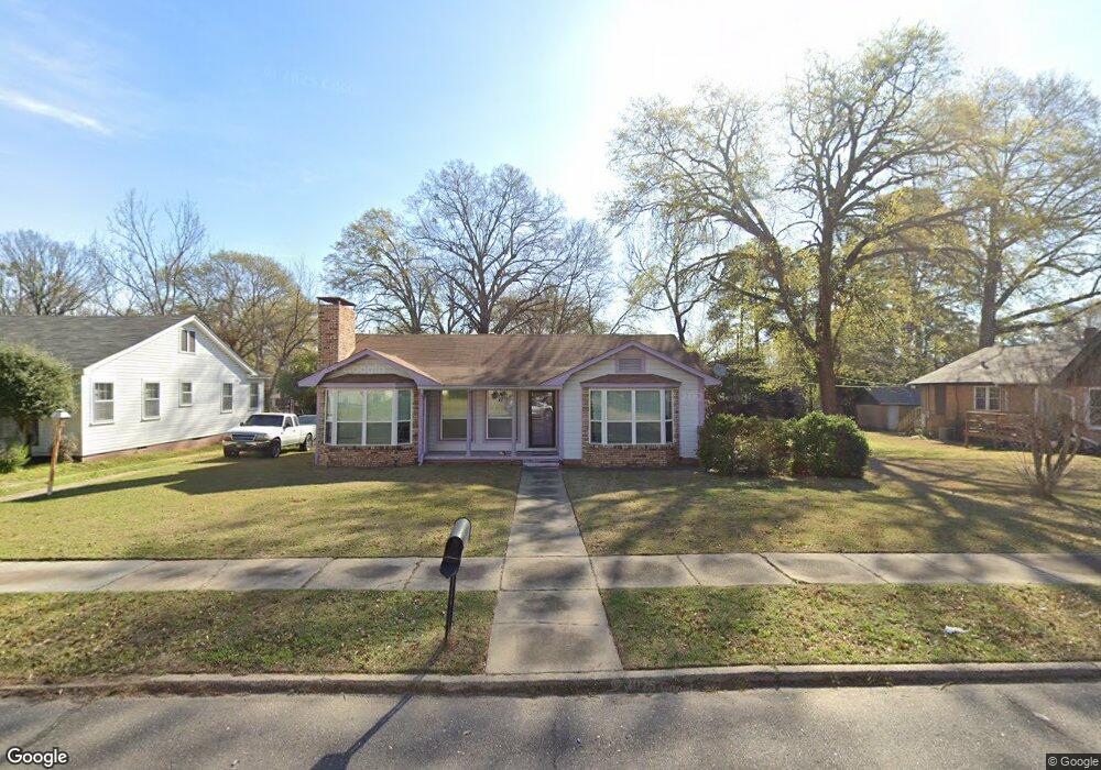
1906 Locust St Texarkana, AR 71854
Estimated Value: $85,993 - $118,000
--
Bed
1
Bath
1,262
Sq Ft
$83/Sq Ft
Est. Value
About This Home
This home is located at 1906 Locust St, Texarkana, AR 71854 and is currently estimated at $104,748, approximately $83 per square foot. 1906 Locust St is a home located in Miller County with nearby schools including Arkansas High School and Washington Academy.
Ownership History
Date
Name
Owned For
Owner Type
Purchase Details
Closed on
Sep 8, 2017
Sold by
Texar Federal Cu
Bought by
Gennings Michele
Current Estimated Value
Purchase Details
Closed on
May 15, 2017
Sold by
Scott Denice M
Bought by
Texar Fcu
Purchase Details
Closed on
Dec 6, 2010
Sold by
Talley Megan
Bought by
Scott Denice M
Home Financials for this Owner
Home Financials are based on the most recent Mortgage that was taken out on this home.
Original Mortgage
$79,800
Interest Rate
4.18%
Mortgage Type
New Conventional
Purchase Details
Closed on
Jan 1, 1989
Bought by
Buster Jack K
Purchase Details
Closed on
Sep 1, 1988
Bought by
Thomason Kandis Kaye
Purchase Details
Closed on
Jan 1, 1901
Bought by
Mcknight Kandis
Create a Home Valuation Report for This Property
The Home Valuation Report is an in-depth analysis detailing your home's value as well as a comparison with similar homes in the area
Home Values in the Area
Average Home Value in this Area
Purchase History
| Date | Buyer | Sale Price | Title Company |
|---|---|---|---|
| Gennings Michele | $66,500 | -- | |
| Texar Fcu | $51,419 | -- | |
| Scott Denice M | $84,000 | None Available | |
| Buster Jack K | $32,800 | -- | |
| Thomason Kandis Kaye | -- | -- | |
| Mcknight Kandis | -- | -- |
Source: Public Records
Mortgage History
| Date | Status | Borrower | Loan Amount |
|---|---|---|---|
| Previous Owner | Scott Denice M | $79,800 |
Source: Public Records
Tax History Compared to Growth
Tax History
| Year | Tax Paid | Tax Assessment Tax Assessment Total Assessment is a certain percentage of the fair market value that is determined by local assessors to be the total taxable value of land and additions on the property. | Land | Improvement |
|---|---|---|---|---|
| 2024 | $204 | $12,260 | $810 | $11,450 |
| 2023 | $248 | $12,260 | $810 | $11,450 |
| 2022 | $298 | $12,260 | $810 | $11,450 |
| 2021 | $298 | $12,260 | $810 | $11,450 |
| 2020 | $298 | $12,260 | $810 | $11,450 |
| 2019 | $390 | $13,940 | $1,980 | $11,960 |
| 2018 | $415 | $13,940 | $1,980 | $11,960 |
| 2017 | $415 | $13,940 | $1,980 | $11,960 |
| 2016 | $415 | $13,940 | $1,980 | $11,960 |
| 2015 | $415 | $13,940 | $1,980 | $11,960 |
| 2014 | $430 | $14,200 | $1,980 | $12,220 |
Source: Public Records
Map
Nearby Homes
- 2122 Garland Ave
- 1908 County Ave
- 2302 Locust St
- 2224 Pecan St
- 1520 Garland Ave Unit n/a
- 1701 Linden Ave
- 1500 Pecan St
- 1901 Ash St
- 2323 County Ave
- 1307 E 22nd St
- 1002 Senator St
- 2501 Senator St
- 1916 Laurel St
- 1302 Hickory St
- 2012 Laurel St
- 2615 Garland Ave
- 1324 Linden Ave
- 1401 Jefferson Ave
- 1319 E 22nd St
- 1200 Garland Ave
- 1906 Locust
- 1908 Locust St
- 1902 Locust St
- 1910 Locust St
- 1905 Garland Ave
- 1905 Locust St
- 1907 Garland Ave
- 1822 Locust St
- 1907 Locust St
- 1919 Locust St
- 1901 Garland Ave
- 1901 Locust St
- 1911 Garland Ave
- 1823 Locust St
- 1923 Locust St
- 1816 Locust St
- 1912 Locust St
- 1912 Locust St
- 1819 Locust St
- 1821 Garland Ave