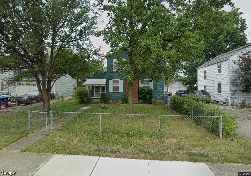
1906 Myrtle Ave Columbus, OH 43211
East Linden NeighborhoodEstimated Value: $173,000 - $219,000
4
Beds
2
Baths
1,152
Sq Ft
$162/Sq Ft
Est. Value
About This Home
This home is located at 1906 Myrtle Ave, Columbus, OH 43211 and is currently estimated at $187,144, approximately $162 per square foot. 1906 Myrtle Ave is a home located in Franklin County with nearby schools including Linden STEM Academy (K-6), Linden-Mckinley Stem School On Arcadia, and Focus Learning Academy of Central Columbus.
Ownership History
Date
Name
Owned For
Owner Type
Purchase Details
Closed on
Dec 9, 2009
Sold by
Patterson Nicole L and Malone Rodney
Bought by
Noll Properties Llc
Current Estimated Value
Purchase Details
Closed on
Feb 23, 2001
Sold by
George Wendal C and George Margaret L
Bought by
Patterson Nicole L
Home Financials for this Owner
Home Financials are based on the most recent Mortgage that was taken out on this home.
Original Mortgage
$71,299
Interest Rate
7.18%
Mortgage Type
FHA
Purchase Details
Closed on
Dec 27, 1965
Bought by
George Wendal C
Create a Home Valuation Report for This Property
The Home Valuation Report is an in-depth analysis detailing your home's value as well as a comparison with similar homes in the area
Home Values in the Area
Average Home Value in this Area
Purchase History
| Date | Buyer | Sale Price | Title Company |
|---|---|---|---|
| Noll Properties Llc | $15,000 | Real Living | |
| Patterson Nicole L | $71,900 | Landsel Title Agency | |
| George Wendal C | -- | -- |
Source: Public Records
Mortgage History
| Date | Status | Borrower | Loan Amount |
|---|---|---|---|
| Previous Owner | Patterson Nicole L | $71,299 |
Source: Public Records
Tax History Compared to Growth
Tax History
| Year | Tax Paid | Tax Assessment Tax Assessment Total Assessment is a certain percentage of the fair market value that is determined by local assessors to be the total taxable value of land and additions on the property. | Land | Improvement |
|---|---|---|---|---|
| 2024 | $2,482 | $54,150 | $7,740 | $46,410 |
| 2023 | $2,451 | $54,145 | $7,735 | $46,410 |
| 2022 | $963 | $18,130 | $2,030 | $16,100 |
| 2021 | $965 | $18,130 | $2,030 | $16,100 |
| 2020 | $967 | $18,130 | $2,030 | $16,100 |
| 2019 | $938 | $15,090 | $1,750 | $13,340 |
| 2018 | $871 | $15,090 | $1,750 | $13,340 |
| 2017 | $912 | $15,090 | $1,750 | $13,340 |
| 2016 | $885 | $13,030 | $2,630 | $10,400 |
| 2015 | $806 | $13,030 | $2,630 | $10,400 |
| 2014 | $808 | $13,030 | $2,630 | $10,400 |
| 2013 | $623 | $20,370 | $3,080 | $17,290 |
Source: Public Records
Map
Nearby Homes
- 1938 Myrtle Ave
- 1995 Minnesota Ave
- 2444 Bancroft St
- 2055 Earl Ave
- 1799 Harold Place
- 2480 Parkwood Ave
- 1985 Aberdeen Ave
- 1864 E Hudson St
- 00 Minnesota Ave
- 01 Minnesota Ave
- 1326 Minnesota Ave
- 2096 Minnesota Ave
- 2040 Loretta Ave
- 0 Parkwood Ave
- 1967 Denune Ave
- 1975 Mock Rd
- 1614 Republic Ave
- 2585 Perdue Ave
- 1609 Arlington Ave
- 1615 Minnesota Ave
- 1914 Myrtle Ave
- 2418 Delbert Rd
- 1896 Myrtle Ave
- 2424 Delbert Rd
- 1922 Myrtle Ave
- 2411 Bretton Place
- 1903 Myrtle Ave
- 2417 Bretton Place
- 1893 Myrtle Ave
- 2430 Delbert Rd
- 1911 Myrtle Ave
- 2423 Bretton Place
- 1917 Myrtle Ave
- 2436 Delbert Rd
- 2384 Delbert Rd
- 1878 Myrtle Ave
- 1923 Myrtle Ave
- 2429 Bretton Place
- 2419 Delbert Rd
- 1875 Myrtle Ave