1906 Polaris Dr Glendale, CA 91208
Verdugo Woodlands NeighborhoodEstimated Value: $1,492,000 - $2,300,908
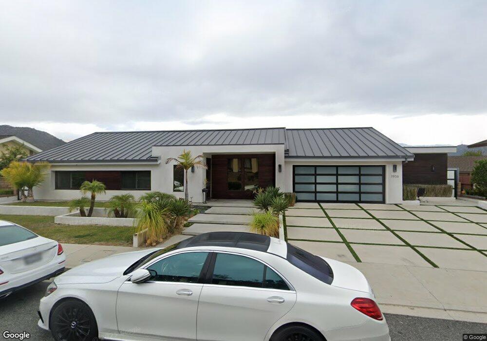
About This Home
This home is located at 1906 Polaris Dr, Glendale, CA 91208 and is currently estimated at $1,904,227, approximately $1,042 per square foot. 1906 Polaris Dr is a home located in Los Angeles County with nearby schools including Verdugo Woodlands Elementary School, Woodrow Wilson Middle School, and Glendale High School.
Ownership History
We collect this data history from publicly available records. To have your information removed, we recommend requesting removal directly through your county’s website.
Purchase Details
Purchase Details
Purchase Details
Purchase Details
Home Financials for this Owner
Home Financials are based on the most recent Mortgage that was taken out on this home.Purchase Details
Home Values in the Area
Average Home Value in this Area
Purchase History
We collect this data history from publicly available records. To have your information removed, we recommend requesting removal directly through your county’s website.
| Date | Buyer | Sale Price | Title Company |
|---|---|---|---|
| $530,000 | Priority Title | ||
| -- | North American Title Company | ||
| $500,000 | North American Title Company | ||
| $900,000 | Alliance Title Company | ||
| -- | -- | ||
| -- | -- |
Mortgage History
We collect this data history from publicly available records. To have your information removed, we recommend requesting removal directly through your county’s website.
| Date | Status | Borrower | Loan Amount |
|---|---|---|---|
| Previous Owner | $720,000 |
Tax History
We collect this data history from publicly available records. To have your information removed, we recommend requesting removal directly through your county’s website.
| Year | Tax Paid | Tax Assessment Tax Assessment Total Assessment is a certain percentage of the fair market value that is determined by local assessors to be the total taxable value of land and additions on the property. | Land | Improvement |
|---|---|---|---|---|
| 2025 | $13,561 | $1,211,706 | $624,958 | $586,748 |
| 2024 | $13,264 | $1,187,948 | $612,704 | $575,244 |
| 2023 | $12,963 | $1,164,656 | $600,691 | $563,965 |
| 2022 | $12,739 | $1,141,820 | $588,913 | $552,907 |
| 2021 | $12,520 | $1,119,432 | $577,366 | $542,066 |
| 2019 | $12,043 | $1,086,231 | $560,242 | $525,989 |
| 2018 | $11,730 | $1,064,933 | $549,257 | $515,676 |
| 2016 | $9,432 | $862,962 | $609,150 | $253,812 |
| 2015 | $9,238 | $850,000 | $600,000 | $250,000 |
| 2014 | $5,753 | $512,315 | $409,852 | $102,463 |
Map
- 1474 Hillside Dr
- 1340 Hillside Dr
- 1021 Wolverton Dr
- 1910 Las Flores Dr
- 2321 Via Saldivar St
- 0 Arvin Dr Unit SR26065904
- 0 Arvin Dr Unit SR26065915
- 1310 Imperial Dr
- 900 Chudleigh Ln
- 1734 N Verdugo Rd Unit 23
- 1816 Rosita Dr
- 1823 Hillside Dr
- 1636 N Verdugo Rd
- 1742 El Rito Ave
- 1321 Greenbriar Rd
- 1900 Sherer Ln
- 1864 Arvin Dr
- 1 Pasa Glen Dr
- 1334 Carmen Dr
- 1331 Carmen Dr
- 1900 Polaris Dr
- 1914 Polaris Dr
- 1909 Polaris Dr
- 1409 Sunshine Dr
- 1901 Polaris Dr
- 1915 Polaris Dr
- 1924 Polaris Dr
- 1921 Polaris Dr
- 1415 Sunshine Dr
- 1934 Polaris Dr
- 1410 Sunshine Dr
- 1927 Polaris Dr
- 1400 Sunshine Dr
- 1421 Sunshine Dr
- 1935 Polaris Dr
- 1444 Hillside Dr
- 1425 Sunshine Dr
- 1454 Hillside Dr
- 1426 Sunshine Dr
- 1456 Hillside Dr
Ask me questions while you tour the home.