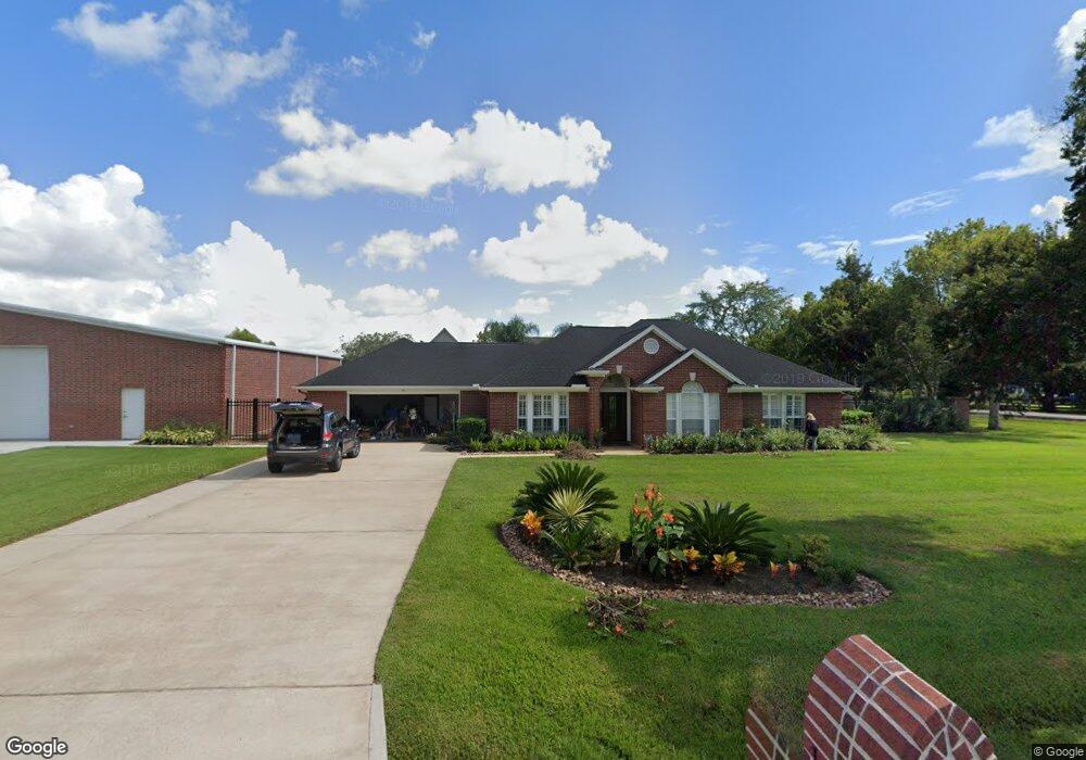
1906 Quinn Rd Pearland, TX 77581
West Friendswood NeighborhoodEstimated Value: $578,188 - $700,000
4
Beds
4
Baths
2,836
Sq Ft
$225/Sq Ft
Est. Value
About This Home
This home is located at 1906 Quinn Rd, Pearland, TX 77581 and is currently estimated at $638,797, approximately $225 per square foot. 1906 Quinn Rd is a home located in Brazoria County with nearby schools including Rustic Oak Elementary School, Alexander Middle School, and Pearland Junior High School East.
Ownership History
Date
Name
Owned For
Owner Type
Purchase Details
Closed on
Sep 22, 2011
Sold by
Davidson Rhonda Stodghill and Davidson Christopher
Bought by
Jordan Clark and Jordan Heather A
Current Estimated Value
Home Financials for this Owner
Home Financials are based on the most recent Mortgage that was taken out on this home.
Original Mortgage
$243,662
Outstanding Balance
$20,512
Interest Rate
3.5%
Mortgage Type
FHA
Estimated Equity
$618,285
Create a Home Valuation Report for This Property
The Home Valuation Report is an in-depth analysis detailing your home's value as well as a comparison with similar homes in the area
Home Values in the Area
Average Home Value in this Area
Purchase History
| Date | Buyer | Sale Price | Title Company |
|---|---|---|---|
| Jordan Clark | -- | None Available |
Source: Public Records
Mortgage History
| Date | Status | Borrower | Loan Amount |
|---|---|---|---|
| Open | Jordan Clark | $243,662 |
Source: Public Records
Tax History Compared to Growth
Tax History
| Year | Tax Paid | Tax Assessment Tax Assessment Total Assessment is a certain percentage of the fair market value that is determined by local assessors to be the total taxable value of land and additions on the property. | Land | Improvement |
|---|---|---|---|---|
| 2025 | $8,000 | $599,560 | $102,880 | $496,680 |
| 2023 | $8,000 | $529,569 | $92,800 | $544,230 |
| 2022 | $9,060 | $481,426 | $92,800 | $449,340 |
| 2021 | $8,563 | $437,660 | $80,420 | $357,240 |
| 2020 | $8,186 | $418,340 | $74,240 | $344,100 |
| 2019 | $8,109 | $407,610 | $74,240 | $333,370 |
| 2018 | $7,984 | $398,840 | $80,420 | $318,420 |
| 2017 | $7,553 | $374,500 | $86,610 | $287,890 |
| 2016 | $6,866 | $348,160 | $57,740 | $290,420 |
| 2015 | $5,236 | $322,990 | $41,240 | $281,750 |
| 2014 | $5,236 | $295,360 | $41,240 | $254,120 |
Source: Public Records
Map
Nearby Homes
- 1914 Quinn Rd
- 18120 County Road 127
- 2243 County Road 130
- 0 County Road 130
- 18118 County Road 125
- 205 Del Monte Dr
- 153 Mooney Rd
- 158 Mooney Rd
- 17903 County Road 125
- 17810 County Road 125
- 1208 Cowards Creek Dr
- 1204 Cowards Creek Dr
- 101 Westfield Ln
- 0 Cr 124 Unit 13541782
- 310 Rustic Ln
- 1004 Tall Pines Dr
- 805 W Edgewood Dr
- 607 Fernwood Dr
- 801 Meadow Lark Ave
- 1404 Blueberry Ln
- 1910 Quinn Rd
- 18223 County Road 132
- 18223 County Road 132 Unit 3
- 18223 County Road 132 Unit 2
- 18223 County Road 132 Unit A
- 18236 County Road 132
- 18226 County Road 132
- 18230 County Road 132
- 1914 County Road 252
- 18203 County Road 132
- 1915 Quinn Rd
- None Cr 132
- 18411 County Road 132
- 1920 Quinn Rd
- 18125 County Road 132
- 18109 County Road 132
- 1925 Quinn Rd
- 1928 Quinn Rd Unit 252
- 18405 County Road 132
- 1932 Quinn Rd