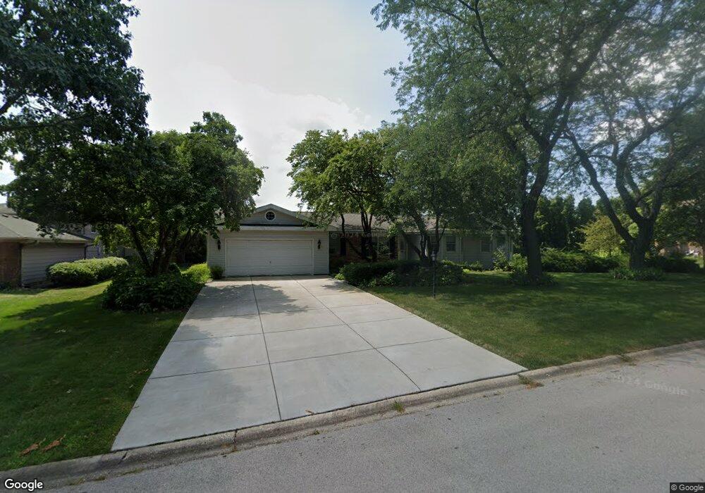
1906 Tomahawk Ridge Unit 1 New Lenox, IL 60451
Estimated Value: $422,000 - $438,000
--
Bed
--
Bath
--
Sq Ft
0.46
Acres
About This Home
This home is located at 1906 Tomahawk Ridge Unit 1, New Lenox, IL 60451 and is currently estimated at $431,876. 1906 Tomahawk Ridge Unit 1 is a home located in Will County with nearby schools including Spencer Trail, Spencer Pointe, and Spencer Crossing Intermediate School.
Ownership History
Date
Name
Owned For
Owner Type
Purchase Details
Closed on
Mar 12, 2003
Sold by
Anderson Thomas E and Tharp Marnie E
Bought by
Anderson Thomas E
Current Estimated Value
Home Financials for this Owner
Home Financials are based on the most recent Mortgage that was taken out on this home.
Original Mortgage
$192,500
Outstanding Balance
$83,178
Interest Rate
5.95%
Mortgage Type
Purchase Money Mortgage
Estimated Equity
$348,698
Purchase Details
Closed on
Mar 26, 2001
Sold by
Cole Taylor Bank
Bought by
Anderson Thomas E and Tharp Marnie E
Home Financials for this Owner
Home Financials are based on the most recent Mortgage that was taken out on this home.
Original Mortgage
$191,750
Interest Rate
7.13%
Create a Home Valuation Report for This Property
The Home Valuation Report is an in-depth analysis detailing your home's value as well as a comparison with similar homes in the area
Home Values in the Area
Average Home Value in this Area
Purchase History
| Date | Buyer | Sale Price | Title Company |
|---|---|---|---|
| Anderson Thomas E | -- | Greater Illinois Title Compa | |
| Anderson Thomas E | $217,500 | -- |
Source: Public Records
Mortgage History
| Date | Status | Borrower | Loan Amount |
|---|---|---|---|
| Open | Anderson Thomas E | $192,500 | |
| Closed | Anderson Thomas E | $191,750 |
Source: Public Records
Tax History Compared to Growth
Tax History
| Year | Tax Paid | Tax Assessment Tax Assessment Total Assessment is a certain percentage of the fair market value that is determined by local assessors to be the total taxable value of land and additions on the property. | Land | Improvement |
|---|---|---|---|---|
| 2024 | $9,523 | $129,706 | $33,360 | $96,346 |
| 2023 | $9,523 | $118,237 | $30,410 | $87,827 |
| 2022 | $8,585 | $108,924 | $28,015 | $80,909 |
| 2021 | $8,150 | $102,439 | $26,347 | $76,092 |
| 2020 | $7,915 | $98,784 | $25,407 | $73,377 |
| 2019 | $7,570 | $95,721 | $24,619 | $71,102 |
| 2018 | $7,392 | $92,421 | $23,770 | $68,651 |
| 2017 | $7,015 | $89,764 | $23,087 | $66,677 |
| 2016 | $6,808 | $87,361 | $22,469 | $64,892 |
| 2015 | $6,545 | $84,611 | $21,762 | $62,849 |
| 2014 | $6,545 | $83,566 | $21,493 | $62,073 |
| 2013 | $6,545 | $84,693 | $21,783 | $62,910 |
Source: Public Records
Map
Nearby Homes
- 2165 High View Rd
- 2124 Sky Harbor Dr
- 22559 S Country Ln
- 2125 Sky Harbor Dr
- 2164 Sky Harbor Dr
- 2166 Sky Harbor Dr
- 2980 Oak Rail Dr
- 500 E Laraway Rd
- 550 E Laraway Rd
- 1401 Ottawa Dr
- 2019 Royalglen Dr
- 911 Canongate Ln
- 2185 Bristol Park Rd
- 1501 Glenbrooke Ln
- 1515 Glenbrooke Ln
- Avalon Plan at Leigh Creek - Townhome
- Hampton Plan at Leigh Creek - Townhome
- 1781 Orchard Ln
- 1738 Orchard Ln
- 1595 Glenbrooke Ln
- 1910 Tomahawk Ridge
- 1902 Tomahawk Ridge
- 1905 Tomahawk Ridge
- 1909 Tomahawk Ridge
- 1901 Pheasant Ln
- 1810 Tomahawk Ridge Unit 1
- 1901 Tomahawk Ridge
- 1921 Pheasant Ln
- 1941 Pheasant Ln
- 1906 Illini Dr
- 1809 Tomahawk Ridge
- 1861 Pheasant Ln
- 1910 Illini Dr
- 1902 Illini Dr
- 1806 Tomahawk Ridge
- 1810 Illini Dr
- 1841 Pheasant Ln
- 1805 Tomahawk Ridge
- 1808 Illini Dr
- 1804 Tomahawk Ridge