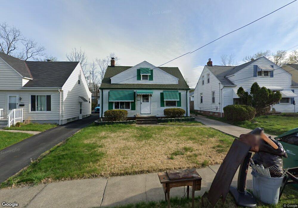
19061 Raymond St Maple Heights, OH 44137
Estimated Value: $107,105 - $141,000
3
Beds
1
Bath
910
Sq Ft
$136/Sq Ft
Est. Value
About This Home
This home is located at 19061 Raymond St, Maple Heights, OH 44137 and is currently estimated at $123,526, approximately $135 per square foot. 19061 Raymond St is a home located in Cuyahoga County with nearby schools including Abraham Lincoln Elementary School, Rockside/ J.F. Kennedy School, and Italy High School.
Ownership History
Date
Name
Owned For
Owner Type
Purchase Details
Closed on
Sep 24, 1987
Sold by
Roberto Constance M
Bought by
Brown Cameron A
Current Estimated Value
Purchase Details
Closed on
Jun 15, 1977
Sold by
Roberto Jos P and Roberto Constance M
Bought by
Roberto Constance M
Purchase Details
Closed on
Jan 1, 1975
Bought by
Roberto Jos P and Roberto Constance M
Create a Home Valuation Report for This Property
The Home Valuation Report is an in-depth analysis detailing your home's value as well as a comparison with similar homes in the area
Home Values in the Area
Average Home Value in this Area
Purchase History
| Date | Buyer | Sale Price | Title Company |
|---|---|---|---|
| Brown Cameron A | $52,000 | -- | |
| Roberto Constance M | -- | -- | |
| Roberto Jos P | -- | -- |
Source: Public Records
Tax History Compared to Growth
Tax History
| Year | Tax Paid | Tax Assessment Tax Assessment Total Assessment is a certain percentage of the fair market value that is determined by local assessors to be the total taxable value of land and additions on the property. | Land | Improvement |
|---|---|---|---|---|
| 2024 | $2,971 | $32,585 | $6,370 | $26,215 |
| 2023 | $1,947 | $17,510 | $3,890 | $13,620 |
| 2022 | $1,941 | $17,500 | $3,890 | $13,620 |
| 2021 | $2,064 | $17,500 | $3,890 | $13,620 |
| 2020 | $1,775 | $13,270 | $2,940 | $10,330 |
| 2019 | $1,764 | $37,900 | $8,400 | $29,500 |
| 2018 | $1,658 | $13,270 | $2,940 | $10,330 |
| 2017 | $1,694 | $12,430 | $2,700 | $9,730 |
| 2016 | $1,639 | $12,430 | $2,700 | $9,730 |
| 2015 | $1,628 | $12,430 | $2,700 | $9,730 |
| 2014 | $1,628 | $13,660 | $2,980 | $10,680 |
Source: Public Records
Map
Nearby Homes
- 19309 Nitra Ave
- 5165 Camden Rd
- 19520 Maple Heights Blvd
- 5265 Bellview St
- 19807 Gardenview Dr
- 5234 Erwin St
- 20120 Mccracken Rd
- 19806 Mountville Dr
- 5199 Arch St
- 19221 Stafford Ave
- 5031 Cato St
- 18909 Maple Heights Blvd
- 5239 Arch St
- 19289 Stafford Ave
- 5357 Beechwood Ave
- 19812 Stockton Ave
- 20107 Libby Rd
- 5409 Hollywood Ave
- 5061 Philip Ave
- 5082 Philip Ave
- 19081 Raymond St
- 19041 Raymond St
- 19101 Raymond St
- 19021 Raymond St
- 19001 Raymond St
- 19018 Longview Ave
- 19121 Raymond St
- 19102 Longview Ave
- 19014 Longview Ave
- 19106 Longview Ave
- 18981 Raymond St
- 19141 Raymond St
- 19060 Raymond St
- 19010 Longview Ave
- 19080 Raymond St
- 19040 Raymond St
- 19110 Longview Ave
- 19100 Raymond St
- 19020 Raymond St
- 18961 Raymond St