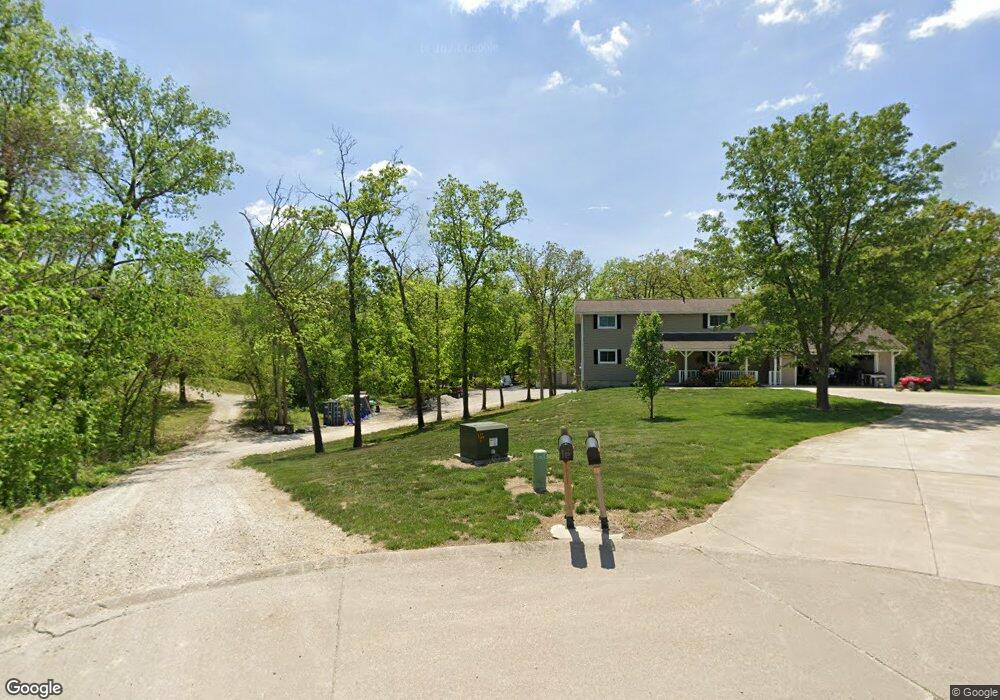
1907 Darwood Cir Moberly, MO 65270
Estimated Value: $266,000 - $293,000
3
Beds
2
Baths
2,400
Sq Ft
$118/Sq Ft
Est. Value
About This Home
This home is located at 1907 Darwood Cir, Moberly, MO 65270 and is currently estimated at $283,925, approximately $118 per square foot. 1907 Darwood Cir is a home located in Randolph County with nearby schools including Moberly Senior High School, Maranatha Seventh-day Adventist School, and Terrill Road Christian Academy.
Ownership History
Date
Name
Owned For
Owner Type
Purchase Details
Closed on
Aug 23, 2024
Sold by
Birdsong Benn and Birdsong Andrea
Bought by
Benn Ryan and Benn Andrea
Current Estimated Value
Home Financials for this Owner
Home Financials are based on the most recent Mortgage that was taken out on this home.
Original Mortgage
$738,480
Interest Rate
6.89%
Mortgage Type
Construction
Purchase Details
Closed on
Feb 15, 2008
Sold by
Hils Jess
Bought by
Benn Ryan and Birdsong Andrea
Home Financials for this Owner
Home Financials are based on the most recent Mortgage that was taken out on this home.
Original Mortgage
$115,000
Interest Rate
5.68%
Mortgage Type
Purchase Money Mortgage
Create a Home Valuation Report for This Property
The Home Valuation Report is an in-depth analysis detailing your home's value as well as a comparison with similar homes in the area
Home Values in the Area
Average Home Value in this Area
Purchase History
| Date | Buyer | Sale Price | Title Company |
|---|---|---|---|
| Benn Ryan | -- | Town & Country Abstract | |
| Benn Ryan | -- | -- |
Source: Public Records
Mortgage History
| Date | Status | Borrower | Loan Amount |
|---|---|---|---|
| Closed | Benn Ryan | $738,480 | |
| Previous Owner | Benn Ryan | $115,000 |
Source: Public Records
Tax History Compared to Growth
Tax History
| Year | Tax Paid | Tax Assessment Tax Assessment Total Assessment is a certain percentage of the fair market value that is determined by local assessors to be the total taxable value of land and additions on the property. | Land | Improvement |
|---|---|---|---|---|
| 2025 | $2,715 | $39,930 | $3,270 | $36,660 |
| 2024 | $2,715 | $37,280 | $2,850 | $34,430 |
| 2023 | $2,756 | $37,280 | $2,850 | $34,430 |
| 2022 | $2,613 | $36,290 | $2,850 | $33,440 |
| 2021 | $2,000 | $36,290 | $2,850 | $33,440 |
| 2020 | $2,000 | $27,801 | $2,850 | $24,951 |
| 2019 | $2,005 | $27,920 | $2,850 | $25,070 |
| 2018 | $1,999 | $27,920 | $2,850 | $25,070 |
| 2017 | $1,966 | $27,520 | $0 | $0 |
| 2016 | $1,874 | $26,380 | $0 | $0 |
| 2014 | -- | $24,450 | $0 | $0 |
| 2013 | -- | $24,450 | $0 | $0 |
| 2012 | -- | $23,660 | $0 | $0 |
Source: Public Records
Map
Nearby Homes
- LOT 38 Cedar Slopes
- 0 10 Acres Cedar Ridge Unit 417498
- 2108 Vinny Ave
- 2109 Vinny Ave
- 2122 Vinny Ave
- 2105 Vinny Ave
- 900 Destinee Dr
- 913 Destinee Dr
- 0 S Ridge Subdivision Unit 413910
- 0 S Ridge Subdivision Unit 413909
- 0 S Ridge Subdivision Unit 413908
- 0 S Ridge Subdivision Unit 413906
- 0 S Ridge Subdivision Unit 18-418
- 0 S Ridge Subdivision Unit 18-417
- 0 S Ridge Subdivision Unit 18-416
- 0 S Ridge Subdivision Unit 22-6
- 2010 Sterling Dr
- 501 Terrill Rd
- 1825 S Morley St
- 1826 S Morley St
- 1600 E Urbandale Dr
- 1906 Darwood Cir
- 1530 E Urbandale Dr
- 1920 Southridge Ct
- 1603 E Urbandale Dr
- 0 Lot 14 Southridge Ct Unit 22-250
- 0 Lot 14 Southridge Ct Unit 408283
- 1521 Ridgeline Dr
- 1450 E Urbandale Dr
- 1916 Southridge Ct
- 1503 E Urbandale Dr
- 1911 Southridge Ct
- 1424 E Urbandale Dr
- Lot 14 Southridge Ct
- 1526 Ridgeline Dr
- 1400 Cedar Ridge Dr
- 1909 Southridge Ct
- 1445 E Urbandale Dr
- 1520 Ridgeline Dr
- 0 Cedar Ridge Ln