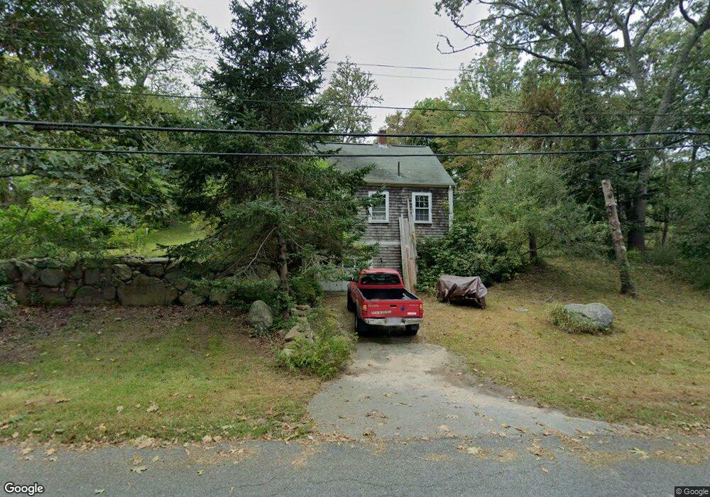
1907 Drift Rd Westport Point, MA 02791
Westport Point NeighborhoodEstimated Value: $524,000 - $2,194,000
2
Beds
--
Bath
864
Sq Ft
$1,197/Sq Ft
Est. Value
About This Home
This home is located at 1907 Drift Rd, Westport Point, MA 02791 and is currently estimated at $1,034,376, approximately $1,197 per square foot. 1907 Drift Rd is a home with nearby schools including Alice A. Macomber Primary School, Westport Elementary School, and Westport Middle-High School.
Ownership History
Date
Name
Owned For
Owner Type
Purchase Details
Closed on
Jan 28, 1999
Sold by
Nancy F Greenlees Rt
Bought by
Nowell John T and Nowell Sheila C
Current Estimated Value
Home Financials for this Owner
Home Financials are based on the most recent Mortgage that was taken out on this home.
Original Mortgage
$120,000
Outstanding Balance
$28,233
Interest Rate
6.67%
Mortgage Type
Purchase Money Mortgage
Estimated Equity
$1,006,143
Purchase Details
Closed on
May 3, 1993
Sold by
Hilsee Lissa G
Bought by
Greenlees J Rogers J and Greenlees Nancy F
Home Financials for this Owner
Home Financials are based on the most recent Mortgage that was taken out on this home.
Original Mortgage
$106,400
Interest Rate
7.51%
Mortgage Type
Purchase Money Mortgage
Create a Home Valuation Report for This Property
The Home Valuation Report is an in-depth analysis detailing your home's value as well as a comparison with similar homes in the area
Home Values in the Area
Average Home Value in this Area
Purchase History
| Date | Buyer | Sale Price | Title Company |
|---|---|---|---|
| Nowell John T | $155,000 | -- | |
| Nowell John T | $155,000 | -- | |
| Greenlees J Rogers J | $139,000 | -- | |
| Greenlees J Rogers J | $139,000 | -- |
Source: Public Records
Mortgage History
| Date | Status | Borrower | Loan Amount |
|---|---|---|---|
| Open | Greenlees J Rogers J | $120,000 | |
| Closed | Greenlees J Rogers J | $120,000 | |
| Previous Owner | Greenlees J Rogers J | $106,400 |
Source: Public Records
Tax History Compared to Growth
Tax History
| Year | Tax Paid | Tax Assessment Tax Assessment Total Assessment is a certain percentage of the fair market value that is determined by local assessors to be the total taxable value of land and additions on the property. | Land | Improvement |
|---|---|---|---|---|
| 2025 | $4,083 | $548,100 | $453,900 | $94,200 |
| 2024 | $3,963 | $512,700 | $420,500 | $92,200 |
| 2023 | $3,732 | $457,300 | $368,700 | $88,600 |
| 2022 | $3,239 | $431,300 | $356,000 | $75,300 |
| 2021 | $2,697 | $375,800 | $300,500 | $75,300 |
| 2020 | $3,067 | $363,800 | $288,500 | $75,300 |
| 2019 | $2,993 | $361,900 | $288,500 | $73,400 |
| 2018 | $1,880 | $230,100 | $170,400 | $59,700 |
| 2017 | $2,405 | $231,200 | $170,400 | $60,800 |
| 2016 | $1,829 | $231,200 | $170,400 | $60,800 |
| 2015 | $1,814 | $228,800 | $170,400 | $58,400 |
Source: Public Records
Map
Nearby Homes
- 1881 Main Rd
- 1749 Main Rd
- 1702J Drift Rd
- 1702 Drift Rd
- 1580 Main Rd
- 1346 Main Rd Unit B
- 99 Sylvia Ln
- 19 Seabury Ln
- 189 Brayton Point Rd
- 238-242 E Beach Rd
- 304 Brayton Point Rd
- 255 John Dyer Rd
- 225 Hixbridge Rd
- Lot 2 Horseneck Rd
- 920 Drift Rd
- 245 John Dyer Rd
- 17 Quail Trail
- 101 Adamsville Rd
- 837 Main Rd
- Lot 2E Horseneck Rd
- 1901 Drift Rd
- 1946 Drift Rd Unit 1
- 1913 Drift Rd
- 1868 Main Rd
- 1919 Drift Rd
- 1919 Drift Rd
- 1878 Drift Rd Unit H
- 1878 Drift Rd Unit G
- 1878 Drift Rd Unit F
- 1878 Drift Rd Unit E
- 1878 Drift Rd Unit D
- 1878 Drift Rd Unit C
- 1878 Drift Rd Unit B
- 1878 Drift Rd
- 1874 Main Rd
- 1871 Main Rd
- 1923 Drift Rd
- 1856 Main Rd
- 1871 Main Rd
- 1865 Main Rd