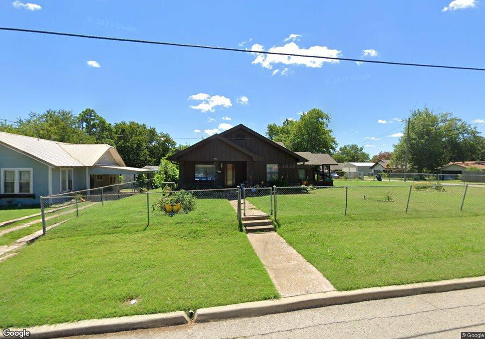
1907 E 10th St Shawnee, OK 74801
Estimated Value: $135,000 - $164,000
3
Beds
2
Baths
1,590
Sq Ft
$93/Sq Ft
Est. Value
About This Home
This home is located at 1907 E 10th St, Shawnee, OK 74801 and is currently estimated at $148,407, approximately $93 per square foot. 1907 E 10th St is a home located in Pottawatomie County with nearby schools including Horace Mann Elementary School, Shawnee Middle School, and Shawnee High School.
Ownership History
Date
Name
Owned For
Owner Type
Purchase Details
Closed on
Nov 18, 2011
Sold by
Richardson Michael L and Richardson Cheryl
Bought by
Harris Ebony
Current Estimated Value
Home Financials for this Owner
Home Financials are based on the most recent Mortgage that was taken out on this home.
Original Mortgage
$81,428
Outstanding Balance
$55,414
Interest Rate
4.13%
Mortgage Type
New Conventional
Estimated Equity
$92,993
Purchase Details
Closed on
Jan 18, 2011
Sold by
Richardson Michael L
Bought by
Richardson Michael L and Courtney Linda D
Purchase Details
Closed on
Aug 1, 2008
Sold by
Richardson Minnie L and Richardson Minnie Lois
Bought by
The Minnie Lois Richardson Revocable Liv
Create a Home Valuation Report for This Property
The Home Valuation Report is an in-depth analysis detailing your home's value as well as a comparison with similar homes in the area
Purchase History
| Date | Buyer | Sale Price | Title Company |
|---|---|---|---|
| Harris Ebony | $79,800 | Choice Title Insurance | |
| Richardson Michael L | -- | None Available | |
| The Minnie Lois Richardson Revocable Liv | -- | None Available |
Source: Public Records
Mortgage History
| Date | Status | Borrower | Loan Amount |
|---|---|---|---|
| Open | Harris Ebony | $81,428 |
Source: Public Records
Tax History Compared to Growth
Tax History
| Year | Tax Paid | Tax Assessment Tax Assessment Total Assessment is a certain percentage of the fair market value that is determined by local assessors to be the total taxable value of land and additions on the property. | Land | Improvement |
|---|---|---|---|---|
| 2025 | $1,051 | $11,535 | $706 | $10,829 |
| 2024 | $1,031 | $11,199 | $706 | $10,493 |
| 2023 | $1,031 | $10,872 | $1,260 | $9,612 |
| 2022 | $1,013 | $10,872 | $1,260 | $9,612 |
| 2021 | $995 | $10,872 | $1,260 | $9,612 |
| 2020 | $1,017 | $11,067 | $1,260 | $9,807 |
| 2019 | $1,092 | $11,458 | $1,260 | $10,198 |
| 2018 | $1,037 | $11,130 | $1,231 | $9,899 |
| 2017 | $990 | $10,806 | $1,156 | $9,650 |
| 2016 | $968 | $10,490 | $1,116 | $9,374 |
| 2015 | $919 | $10,185 | $1,068 | $9,117 |
| 2014 | $889 | $9,888 | $975 | $8,913 |
Source: Public Records
Map
Nearby Homes
- 309 N Tenbrook Ave
- 302 N Kimberly Ave
- 507 N Roosevelt Ave
- 1416 E 9th St
- 1330 E Main St
- 301 Clubhouse Dr
- 703 N Roosevelt Ave
- 1328 E 10th St
- 1330 E Whittaker St
- 711 N Cleveland Ave
- 648 N Cleveland Ave
- 1 Country Club Rd
- 1327 E Fay St
- 1600 E Farrall
- 1322 E Margaret St
- 1314 E Margaret St
- 1824 E Remington St
- 1119 E 11th St
- 601 Pool Ln
- 0 E Fay St
- 1911 E 10th St
- 1913 E 10th St
- 1915 E 10th St
- 1902 E 10th St
- 1825 E 10th St
- 208 N Tenbrook Ave
- 205 N Tenbrook Ave
- 212 N Tenbrook Ave
- 302 N Mead Ave
- 310 N Mead Ave
- 312 N Tenbrook Ave
- 314 N Tenbrook Ave
- 202 N Tenbrook Ave
- 1824 E 10th St
- 318 N Tenbrook Ave
- 318 N Mead Ave
- 320 N Mead Ave
- 306 N Mead Ave
- 319 N Mead Ave
- 317 N Mead Ave