Estimated Value: $247,000 - $348,000
2
Beds
2
Baths
1,675
Sq Ft
$172/Sq Ft
Est. Value
About This Home
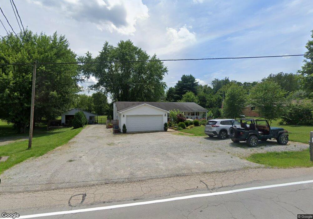
This home is located at 1907 Lower Bellbrook Rd, Xenia, OH 45385 and is currently estimated at $287,752, approximately $171 per square foot. 1907 Lower Bellbrook Rd is a home located in Greene County with nearby schools including Xenia High School and Summit Academy Community School for Alternative Learners - Xenia.
Ownership History
Date
Name
Owned For
Owner Type
Purchase Details
Closed on
Mar 12, 2018
Sold by
Fannie Mae
Bought by
Davis Michael
Current Estimated Value
Home Financials for this Owner
Home Financials are based on the most recent Mortgage that was taken out on this home.
Original Mortgage
$91,000
Outstanding Balance
$77,980
Interest Rate
4.38%
Mortgage Type
New Conventional
Estimated Equity
$209,772
Purchase Details
Closed on
Dec 14, 2017
Sold by
Greene County Sheriff
Bought by
Federal National Mortgage Association
Purchase Details
Closed on
Oct 8, 1999
Sold by
Farley Billie L and Farley Virginia L
Bought by
Farley Billie L and Farley Virginia L
Purchase Details
Closed on
Mar 19, 1993
Bought by
Farley Billie L and Farley Farley
Create a Home Valuation Report for This Property
The Home Valuation Report is an in-depth analysis detailing your home's value as well as a comparison with similar homes in the area
Home Values in the Area
Average Home Value in this Area
Purchase History
| Date | Buyer | Sale Price | Title Company |
|---|---|---|---|
| Davis Michael | -- | -- | |
| Federal National Mortgage Association | -- | -- | |
| Farley Billie L | -- | -- | |
| Farley Billie L | $71,500 | -- |
Source: Public Records
Mortgage History
| Date | Status | Borrower | Loan Amount |
|---|---|---|---|
| Open | Davis Michael | $91,000 |
Source: Public Records
Tax History Compared to Growth
Tax History
| Year | Tax Paid | Tax Assessment Tax Assessment Total Assessment is a certain percentage of the fair market value that is determined by local assessors to be the total taxable value of land and additions on the property. | Land | Improvement |
|---|---|---|---|---|
| 2024 | $3,870 | $77,600 | $10,180 | $67,420 |
| 2023 | $3,870 | $77,600 | $10,180 | $67,420 |
| 2022 | $3,396 | $58,810 | $9,160 | $49,650 |
| 2021 | $3,437 | $54,850 | $9,160 | $45,690 |
| 2020 | $2,932 | $54,850 | $9,160 | $45,690 |
| 2019 | $2,689 | $47,140 | $8,910 | $38,230 |
| 2018 | $2,719 | $47,140 | $8,910 | $38,230 |
| 2017 | $2,020 | $47,140 | $8,910 | $38,230 |
| 2016 | $2,020 | $45,450 | $8,910 | $36,540 |
| 2015 | $2,025 | $45,450 | $8,910 | $36,540 |
| 2014 | $1,943 | $45,450 | $8,910 | $36,540 |
Source: Public Records
Map
Nearby Homes
- 1839 Simison Rd
- 1681 Valley Heights Rd
- 2336 Washington Mill Rd
- 1753 Cedar Ridge Dr
- 196 Mound St
- 1711 Mcclellan Rd
- 1474 Hawkshead St
- Chatham Plan at Edenbridge
- Bellamy Plan at Edenbridge
- Holcombe Plan at Edenbridge
- Henley Plan at Edenbridge
- Newcastle Plan at Edenbridge
- 1292 Baybury Ave
- 1272 Baybury Ave
- 1293 Baybury Ave
- 1256 Baybury Ave
- 1282 Baybury Ave
- 1298 Baybury Ave
- 1304 Baybury Ave
- 1358 Shannon Ln
- 1899 Lower Bellbrook Rd
- 1929 Lower Bellbrook Rd
- 1920 Lower Bellbrook Rd
- 1941 Lower Bellbrook Rd
- 1955 Lower Bellbrook Rd
- 1810 Sunnymeade Rd
- 1969 Lower Bellbrook Rd
- 1960 Lower Bellbrook Rd
- 1860 Simison Rd
- 1806 Simison Rd
- 1818 Simison Rd
- 1828 Simison Rd
- 1840 Simison Rd
- 1987 Lower Bellbrook Rd
- 1829 Simison Rd
- 1817 Simison Rd
- 1861 Simison Rd
- 1781 Sunnymeade Rd
- 1750 Sunnymeade Rd
- 1803 Simison Rd