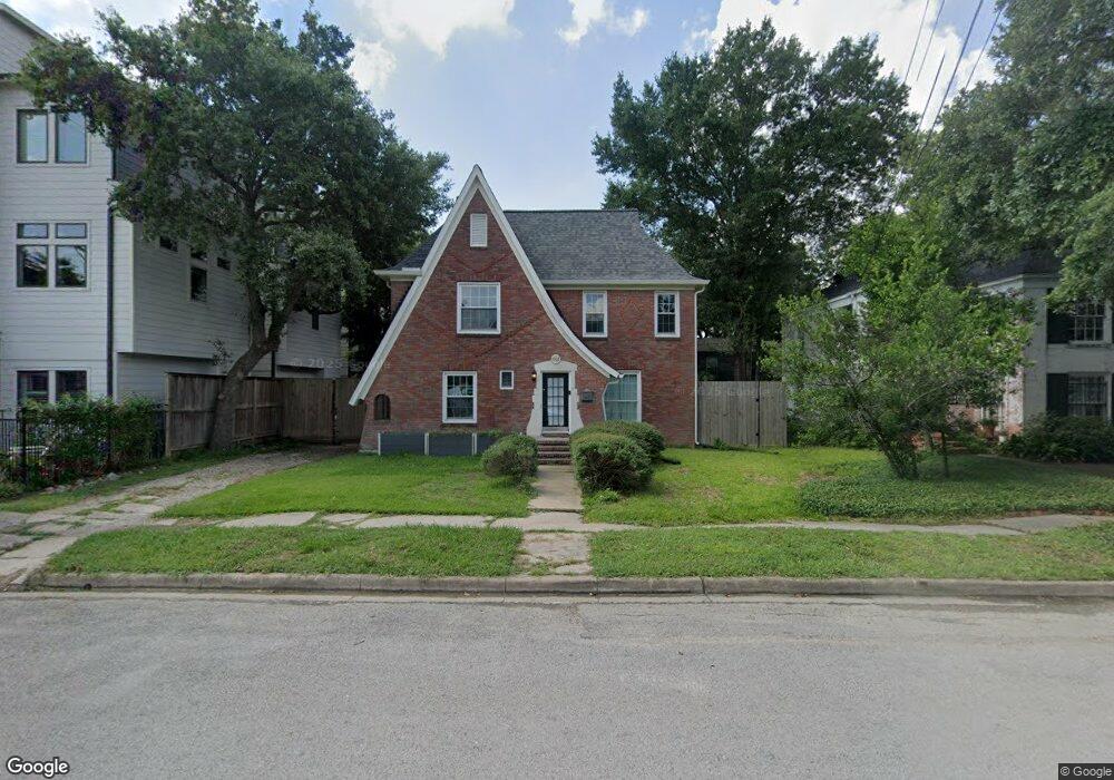
1907 Sul Ross St Unit A Houston, TX 77098
Montrose NeighborhoodEstimated Value: $1,111,000 - $1,362,000
3
Beds
2
Baths
3,636
Sq Ft
$342/Sq Ft
Est. Value
About This Home
This home is located at 1907 Sul Ross St Unit A, Houston, TX 77098 and is currently estimated at $1,242,485, approximately $341 per square foot. 1907 Sul Ross St Unit A is a home located in Harris County with nearby schools including Poe Elementary School, Lanier Middle School, and Lamar High School.
Ownership History
Date
Name
Owned For
Owner Type
Purchase Details
Closed on
Aug 27, 2019
Sold by
Ford Michael A and Ford Candace C
Bought by
Karfunkle Benjamin and Schnieder Nicole
Current Estimated Value
Home Financials for this Owner
Home Financials are based on the most recent Mortgage that was taken out on this home.
Original Mortgage
$629,840
Outstanding Balance
$553,934
Interest Rate
3.8%
Mortgage Type
New Conventional
Estimated Equity
$688,551
Purchase Details
Closed on
Oct 9, 2002
Sold by
Herolz Trudy Hutchings
Bought by
Ford Michael A and Ford Candace B
Home Financials for this Owner
Home Financials are based on the most recent Mortgage that was taken out on this home.
Original Mortgage
$239,200
Interest Rate
6.2%
Mortgage Type
Purchase Money Mortgage
Purchase Details
Closed on
Oct 23, 1995
Sold by
Bratton Leona
Bought by
Herolz Trudy Hutchings
Home Financials for this Owner
Home Financials are based on the most recent Mortgage that was taken out on this home.
Original Mortgage
$84,500
Interest Rate
7.6%
Mortgage Type
Purchase Money Mortgage
Create a Home Valuation Report for This Property
The Home Valuation Report is an in-depth analysis detailing your home's value as well as a comparison with similar homes in the area
Home Values in the Area
Average Home Value in this Area
Purchase History
| Date | Buyer | Sale Price | Title Company |
|---|---|---|---|
| Karfunkle Benjamin | -- | None Available | |
| Ford Michael A | -- | -- | |
| Herolz Trudy Hutchings | -- | -- |
Source: Public Records
Mortgage History
| Date | Status | Borrower | Loan Amount |
|---|---|---|---|
| Open | Karfunkle Benjamin | $629,840 | |
| Previous Owner | Ford Michael A | $239,200 | |
| Previous Owner | Herolz Trudy Hutchings | $84,500 |
Source: Public Records
Tax History Compared to Growth
Tax History
| Year | Tax Paid | Tax Assessment Tax Assessment Total Assessment is a certain percentage of the fair market value that is determined by local assessors to be the total taxable value of land and additions on the property. | Land | Improvement |
|---|---|---|---|---|
| 2025 | $18,353 | $1,287,100 | $937,560 | $349,540 |
| 2024 | $18,353 | $1,146,333 | $859,430 | $286,903 |
| 2023 | $18,353 | $1,146,389 | $859,430 | $286,959 |
| 2022 | $24,132 | $1,139,301 | $625,040 | $514,261 |
| 2021 | $23,221 | $996,315 | $625,040 | $371,275 |
| 2020 | $17,951 | $741,295 | $562,520 | $178,775 |
| 2019 | $15,666 | $619,098 | $562,520 | $56,578 |
| 2018 | $15,964 | $630,859 | $527,363 | $103,496 |
| 2017 | $16,740 | $630,859 | $527,363 | $103,496 |
| 2016 | $15,404 | $580,521 | $457,048 | $123,473 |
| 2015 | $8,325 | $547,855 | $421,890 | $125,965 |
| 2014 | $8,325 | $484,931 | $386,733 | $98,198 |
Source: Public Records
Map
Nearby Homes
- 2027 Branard St
- 3902 Hazard St
- 2044 Branard St
- 1849 W Main St Unit 15
- 2034 Colquitt St Unit A
- 1844 Colquitt St
- 2025 W Alabama St
- 1829 W Main St Unit C
- 1819 Branard St
- 2108 Branard St
- 2107 W Main St
- 1844 W Alabama St
- 1842 W Alabama St
- 1818 Colquitt St
- 1849 Marshall St Unit 9
- 1849 Marshall St Unit 19
- 2120 Branard St
- 1841 Marshall St Unit 4
- 1826 Portsmouth St
- 1849 Portsmouth St
- 1907 Sul Ross St
- 1911 Sul Ross St
- 3906 Hazard St
- 3908 Hazard St
- 1901 Sul Ross St
- 3912 Hazard St
- 3914 Hazard St
- 3914 Hazard St
- 1915 Sul Ross St
- 1912 Branard St
- 1912 Branard St Unit 1
- 1912 Branard St Unit 2
- 3916 Hazard St
- 3916 Hazard St
- 1914 Branard St
- 3911 Mcduffie St
- 1902 Sul Ross St
- 1916 1/2 Branard St
- 1916 Branard St
- 1904 Branard St