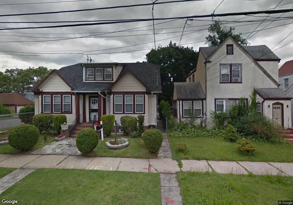
19070 111th Rd Saint Albans, NY 11412
Hollis NeighborhoodEstimated Value: $584,566 - $737,000
--
Bed
--
Bath
1,176
Sq Ft
$548/Sq Ft
Est. Value
About This Home
This home is located at 19070 111th Rd, Saint Albans, NY 11412 and is currently estimated at $644,642, approximately $548 per square foot. 19070 111th Rd is a home located in Queens County with nearby schools including P.S. 118 Lorraine Hansberry, I.S. 192 The Linden, and True Deliverance Christian School.
Ownership History
Date
Name
Owned For
Owner Type
Purchase Details
Closed on
Dec 11, 2024
Sold by
Jack Joycelyn
Bought by
Joycelyn Jack Irrevocable Trust Of New Y and Stewart As Trustee Kern
Current Estimated Value
Purchase Details
Closed on
Nov 3, 2000
Sold by
Linden Properties Corp
Bought by
Jack Joycelyn
Home Financials for this Owner
Home Financials are based on the most recent Mortgage that was taken out on this home.
Original Mortgage
$213,750
Interest Rate
7.78%
Purchase Details
Closed on
Sep 1, 2000
Sold by
Jones Lawrence
Bought by
Linden Properties Inc
Create a Home Valuation Report for This Property
The Home Valuation Report is an in-depth analysis detailing your home's value as well as a comparison with similar homes in the area
Home Values in the Area
Average Home Value in this Area
Purchase History
| Date | Buyer | Sale Price | Title Company |
|---|---|---|---|
| Joycelyn Jack Irrevocable Trust Of New Y | -- | -- | |
| Jack Joycelyn | $225,000 | -- | |
| Jack Joycelyn | $225,000 | -- | |
| Linden Properties Inc | $155,000 | -- | |
| Linden Properties Inc | $155,000 | -- |
Source: Public Records
Mortgage History
| Date | Status | Borrower | Loan Amount |
|---|---|---|---|
| Previous Owner | Jack Joycelyn | $213,750 |
Source: Public Records
Tax History Compared to Growth
Tax History
| Year | Tax Paid | Tax Assessment Tax Assessment Total Assessment is a certain percentage of the fair market value that is determined by local assessors to be the total taxable value of land and additions on the property. | Land | Improvement |
|---|---|---|---|---|
| 2025 | $5,332 | $27,946 | $8,015 | $19,931 |
| 2024 | $4,300 | $27,946 | $7,528 | $20,418 |
| 2023 | $5,143 | $27,004 | $7,326 | $19,678 |
| 2022 | $4,799 | $38,820 | $11,460 | $27,360 |
| 2021 | $4,899 | $32,640 | $11,460 | $21,180 |
| 2020 | $4,633 | $28,080 | $11,460 | $16,620 |
| 2019 | $4,579 | $30,840 | $11,460 | $19,380 |
| 2018 | $4,290 | $22,503 | $9,263 | $13,240 |
| 2017 | $4,028 | $21,232 | $9,964 | $11,268 |
| 2016 | $3,802 | $21,232 | $9,964 | $11,268 |
| 2015 | $2,196 | $19,407 | $11,622 | $7,785 |
| 2014 | $2,196 | $19,407 | $9,962 | $9,445 |
Source: Public Records
Map
Nearby Homes
- 190-59 112th Ave
- 190-63 112th Ave
- 194- 24 111th Rd
- 194-16 112th Ave
- 194-29 112th Ave
- 19022 111th Rd
- 191-40 112th Rd
- 194-04 110th Rd
- 111-06 Farmers Blvd
- 19432 113th Rd
- 19427 Murdock Ave
- 18833 Keeseville Ave
- 193-21 109th Rd
- 19445 Murdock Ave
- 187-44 Jordan Ave
- 188-25 Mangin Ave
- 194-42 Murdock Ave
- 18823 Mangin Ave
- 194-56 Murdock Ave
- 19027 109th Rd
- 19066 111th Rd
- 19074 111th Rd
- 19062 111th Rd
- 19059 112th Ave
- 19063 112th Ave
- 19057 112th Ave
- 190-74 111th Rd
- 19065 112th Ave
- 19055 112th Ave
- 19058 111th Rd
- 19058 111th Rd
- 19051 112th Ave
- 19051 112th Ave
- 19404 111th Rd
- 19049 112th Ave
- 19067 111th Rd
- 19054 111th Rd
- 19065 111th Rd
- 19071 111th Rd
- 19401 112th Ave