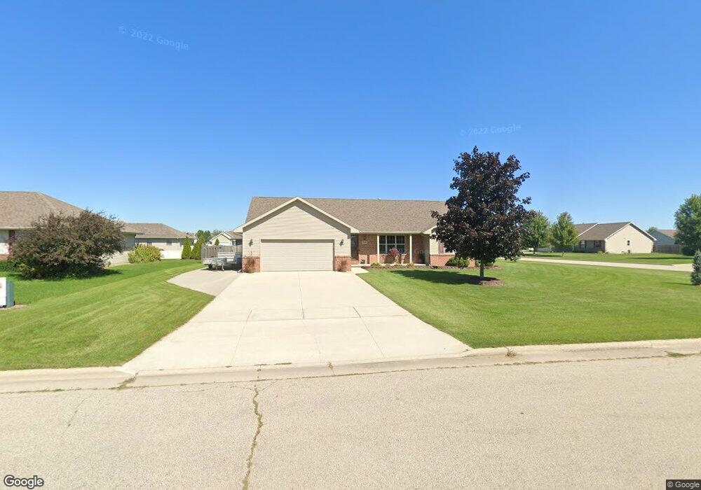
1908 Bonfire Way de Pere, WI 54115
Estimated Value: $396,000 - $436,000
3
Beds
2
Baths
1,563
Sq Ft
$265/Sq Ft
Est. Value
About This Home
This home is located at 1908 Bonfire Way, de Pere, WI 54115 and is currently estimated at $414,583, approximately $265 per square foot. 1908 Bonfire Way is a home located in Brown County with nearby schools including Hemlock Creek Elementary School, West De Pere Middle School, and West De Pere High School.
Ownership History
Date
Name
Owned For
Owner Type
Purchase Details
Closed on
Jun 25, 2021
Sold by
Manthe Kerry L
Bought by
Kerry L Manthe Revocable Trust
Current Estimated Value
Purchase Details
Closed on
Sep 18, 2007
Sold by
Lexington Homes Inc
Bought by
Manthe Michael M and Manthe Kerry L
Home Financials for this Owner
Home Financials are based on the most recent Mortgage that was taken out on this home.
Original Mortgage
$152,950
Outstanding Balance
$95,044
Interest Rate
6.66%
Mortgage Type
Purchase Money Mortgage
Estimated Equity
$319,539
Purchase Details
Closed on
Sep 29, 2004
Sold by
Garot Keith E
Bought by
Lexington Homes Inc
Home Financials for this Owner
Home Financials are based on the most recent Mortgage that was taken out on this home.
Original Mortgage
$3,080,000
Interest Rate
5.93%
Mortgage Type
Purchase Money Mortgage
Create a Home Valuation Report for This Property
The Home Valuation Report is an in-depth analysis detailing your home's value as well as a comparison with similar homes in the area
Home Values in the Area
Average Home Value in this Area
Purchase History
| Date | Buyer | Sale Price | Title Company |
|---|---|---|---|
| Kerry L Manthe Revocable Trust | -- | None Available | |
| Manthe Michael M | $170,000 | Evans Title | |
| Lexington Homes Inc | $3,080,000 | Bay Title & Abstract Inc |
Source: Public Records
Mortgage History
| Date | Status | Borrower | Loan Amount |
|---|---|---|---|
| Open | Manthe Michael M | $152,950 | |
| Previous Owner | Lexington Homes Inc | $3,080,000 |
Source: Public Records
Tax History
| Year | Tax Paid | Tax Assessment Tax Assessment Total Assessment is a certain percentage of the fair market value that is determined by local assessors to be the total taxable value of land and additions on the property. | Land | Improvement |
|---|---|---|---|---|
| 2025 | $4,035 | $263,200 | $57,100 | $206,100 |
| 2024 | $3,827 | $263,200 | $57,100 | $206,100 |
| 2023 | $3,515 | $263,200 | $57,100 | $206,100 |
| 2022 | $3,523 | $263,200 | $57,100 | $206,100 |
| 2021 | $3,530 | $263,200 | $57,100 | $206,100 |
| 2020 | $3,531 | $187,700 | $38,200 | $149,500 |
| 2019 | $3,477 | $187,700 | $38,200 | $149,500 |
| 2018 | $3,326 | $187,700 | $38,200 | $149,500 |
| 2017 | $3,390 | $187,700 | $38,200 | $149,500 |
| 2016 | $3,424 | $187,700 | $38,200 | $149,500 |
| 2015 | $3,495 | $187,700 | $38,200 | $149,500 |
| 2014 | $3,629 | $187,700 | $38,200 | $149,500 |
| 2013 | $3,629 | $187,700 | $38,200 | $149,500 |
Source: Public Records
Map
Nearby Homes
- 1843 Sandy Springs Rd
- 1319 Pond View Cir Unit 59
- 1242 Pond View Cir Unit 18
- 1267 Pond View Cir Unit 42
- 1924 Andraya Ln
- 3740 Edwina Dr
- 1972 Sinclair Dr
- 1653 Crimson Ct
- 3706 Edwina Dr
- 2017 Morning Dew Ln
- 3763 Edwina Dr
- 3705 Edwina Dr
- 1338 Highland Ridge Dr
- 3644 E Hank Ave
- 3578 W Hank Ave
- 3629 W Hank Ave
- 1330 Fernando Dr
- 1127 Princess Dove Cir Unit 16
- 1372 Lear Ln
- 1350 Copilot Way
- 1914 Bonfire Way
- 1905 Sandy Springs Rd
- 1911 Sandy Springs Rd
- 1909 Bonfire Way
- 1922 Bonfire Way
- 1525 Morning Mist Way
- 1517 Morning Mist Way
- 1533 Morning Mist Way
- 1917 Bonfire Way
- 1919 Sandy Springs Rd
- 1541 Morning Mist Way
- 1549 Morning Mist Way
- 1925 Bonfire Way
- 1892 Sandy Springs Rd Unit 2
- 1560 Morning Mist Way
- 1881 Sandy Springs Rd
- 1902 Sandy Springs Rd Unit 1904
- 1908 Sandy Springs Rd Unit 1910
- 1925 Sandy Springs Rd
- 1896 Sandy Springs Rd Unit 1898
Your Personal Tour Guide
Ask me questions while you tour the home.