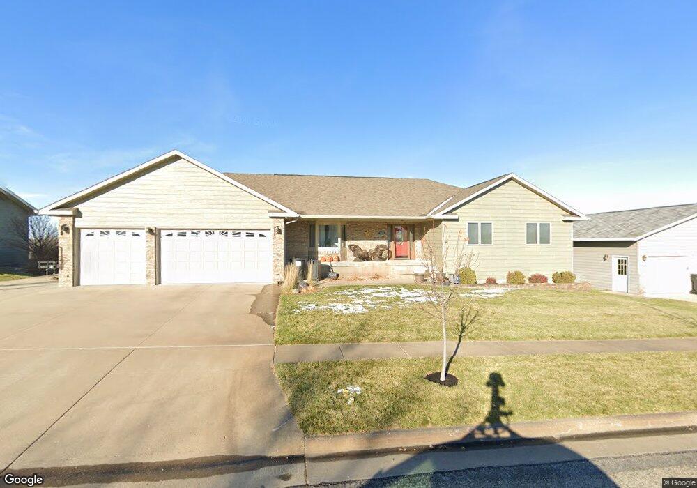
1908 Flag Mountain Dr Pierre, SD 57501
Estimated Value: $475,000 - $515,000
--
Bed
3
Baths
1,906
Sq Ft
$260/Sq Ft
Est. Value
About This Home
This home is located at 1908 Flag Mountain Dr, Pierre, SD 57501 and is currently estimated at $495,339, approximately $259 per square foot. 1908 Flag Mountain Dr is a home with nearby schools including T.F. Riggs High School and Pierre SDA School.
Ownership History
Date
Name
Owned For
Owner Type
Purchase Details
Closed on
Mar 1, 2011
Sold by
Kanwal Inderpal S and Kanwal Inderpal
Bought by
Weisgram Sam A and Weisgram Amanda J
Current Estimated Value
Home Financials for this Owner
Home Financials are based on the most recent Mortgage that was taken out on this home.
Original Mortgage
$183,000
Outstanding Balance
$127,210
Interest Rate
5.04%
Estimated Equity
$368,129
Purchase Details
Closed on
May 29, 2008
Sold by
Clelland Dale W and Clelland Mary L
Bought by
Kanwal Inderpal S and Singh Rest
Purchase Details
Closed on
Sep 12, 2005
Sold by
Sommer Tom and Sommer Carmin
Bought by
Clelland Dale W and Clelland Mary L
Home Financials for this Owner
Home Financials are based on the most recent Mortgage that was taken out on this home.
Original Mortgage
$200,000
Interest Rate
5.93%
Create a Home Valuation Report for This Property
The Home Valuation Report is an in-depth analysis detailing your home's value as well as a comparison with similar homes in the area
Home Values in the Area
Average Home Value in this Area
Purchase History
| Date | Buyer | Sale Price | Title Company |
|---|---|---|---|
| Weisgram Sam A | $294,000 | -- | |
| Kanwal Inderpal S | $300,000 | -- | |
| Clelland Dale W | $285,000 | -- |
Source: Public Records
Mortgage History
| Date | Status | Borrower | Loan Amount |
|---|---|---|---|
| Open | Weisgram Sam A | $183,000 | |
| Previous Owner | Clelland Dale W | $200,000 |
Source: Public Records
Tax History
| Year | Tax Paid | Tax Assessment Tax Assessment Total Assessment is a certain percentage of the fair market value that is determined by local assessors to be the total taxable value of land and additions on the property. | Land | Improvement |
|---|---|---|---|---|
| 2025 | $5,435 | $465,968 | $50,833 | $415,135 |
| 2024 | $5,430 | $446,200 | $50,833 | $395,367 |
| 2023 | $4,961 | $434,368 | $48,644 | $385,724 |
| 2022 | $4,668 | $367,765 | $46,328 | $321,437 |
| 2021 | $4,572 | $328,361 | $41,364 | $286,997 |
| 2020 | $4,681 | $318,797 | $40,159 | $278,638 |
| 2019 | $4,672 | $318,797 | $40,159 | $278,638 |
| 2018 | $4,474 | $309,511 | $38,989 | $270,522 |
| 2017 | -- | $294,772 | $37,132 | $257,640 |
| 2016 | $4,683 | $294,772 | $37,132 | $257,640 |
| 2015 | -- | $286,186 | $36,050 | $250,136 |
| 2014 | -- | $277,850 | $35,000 | $242,850 |
| 2013 | -- | $277,850 | $35,000 | $242,850 |
| 2011 | -- | $308,882 | $33,135 | $275,747 |
Source: Public Records
Map
Nearby Homes
- 109 Baja Dr
- 2106 Antelope St
- 404 Yucca Dr
- 2004 Buffalo St
- 313 N Taylor Ave
- TBD Lilac Dr
- 129 Norbeck Dr
- 0 Woodview Dr
- 620 N Harrison Ave
- 2400 E Capitol Ave
- 131 Hampton Dr
- 203 N Tyler Ave
- Lot 13R N Garfield Ave
- 1602 E Cabot St
- 1621 Abbey Rd
- 1217 Hilgers Dr
- 115 S Tyler Ave
- 2416 E Franklin St
- 1515 E Capitol Ave
- 1511 E Capitol Ave
- 1912 Flag Mountain Dr
- 1904 Flag Mountain Dr
- 1916 Riggs Dr
- 1912 Riggs Dr
- 1920 Riggs Dr
- 1917 Flag Mountain Dr
- 1913 Flag Mountain Dr
- 2000 Flag Mountain Dr
- 1921 Flag Mountain Dr
- 1909 Flag Mountain Dr
- 1908 Riggs Dr
- 1824 Flag Mountain Dr
- 1924 Riggs Dr
- 1923 Riggs Dr
- 1917 Riggs Dr
- 2001 Flag Mountain Dr
- 2008 Flag Mountain Dr
- 1905 Flag Mountain Dr
- 2009 Flag Mountain Dr
- 1900 Flag Mountain Dr
Your Personal Tour Guide
Ask me questions while you tour the home.