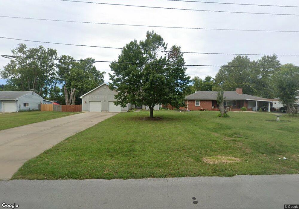
1908 James Downey Rd Independence, MO 64057
Bridger NeighborhoodEstimated Value: $321,000 - $403,000
3
Beds
2
Baths
2,337
Sq Ft
$161/Sq Ft
Est. Value
About This Home
This home is located at 1908 James Downey Rd, Independence, MO 64057 and is currently estimated at $376,388, approximately $161 per square foot. 1908 James Downey Rd is a home located in Jackson County with nearby schools including Blackburn Elementary School, Bridger Middle School, and Bingham Middle School.
Ownership History
Date
Name
Owned For
Owner Type
Purchase Details
Closed on
Aug 8, 2005
Sold by
Bungart Mark A and Bungart Connie W
Bought by
Bungart Mark A and Williams Bungart Connie
Current Estimated Value
Home Financials for this Owner
Home Financials are based on the most recent Mortgage that was taken out on this home.
Original Mortgage
$120,000
Interest Rate
5.51%
Mortgage Type
Stand Alone Refi Refinance Of Original Loan
Purchase Details
Closed on
Sep 26, 2001
Sold by
Homestead Mtg Corp
Bought by
Bungart Mark A and Bungart Connie W
Purchase Details
Closed on
Sep 11, 2001
Sold by
Harris John J and Harris Tamra D
Bought by
Truex John Lee
Purchase Details
Closed on
Mar 1, 2000
Sold by
Skouse Donald G and Skouse Harriet D
Bought by
Homestead Mtg Corp
Create a Home Valuation Report for This Property
The Home Valuation Report is an in-depth analysis detailing your home's value as well as a comparison with similar homes in the area
Home Values in the Area
Average Home Value in this Area
Purchase History
| Date | Buyer | Sale Price | Title Company |
|---|---|---|---|
| Bungart Mark A | -- | Parkway Title Inc | |
| Bungart Mark A | -- | Heart Of America Title Inc | |
| Truex John Lee | -- | First American Title Ins | |
| Homestead Mtg Corp | -- | Heart Of America Title Inc |
Source: Public Records
Mortgage History
| Date | Status | Borrower | Loan Amount |
|---|---|---|---|
| Closed | Bungart Mark A | $120,000 |
Source: Public Records
Tax History
| Year | Tax Paid | Tax Assessment Tax Assessment Total Assessment is a certain percentage of the fair market value that is determined by local assessors to be the total taxable value of land and additions on the property. | Land | Improvement |
|---|---|---|---|---|
| 2025 | $4,657 | $69,100 | $9,620 | $59,480 |
| 2024 | $4,657 | $67,218 | $10,923 | $56,295 |
| 2023 | $4,551 | $67,218 | $6,825 | $60,393 |
| 2022 | $3,860 | $52,250 | $12,007 | $40,243 |
| 2021 | $3,858 | $52,250 | $12,007 | $40,243 |
| 2020 | $3,894 | $51,241 | $12,007 | $39,234 |
| 2019 | $3,831 | $51,241 | $12,007 | $39,234 |
| 2018 | $3,493 | $44,596 | $10,450 | $34,146 |
| 2017 | $3,444 | $44,596 | $10,450 | $34,146 |
| 2016 | $3,444 | $43,543 | $5,088 | $38,455 |
| 2014 | $3,271 | $42,275 | $4,940 | $37,335 |
Source: Public Records
Map
Nearby Homes
- 16805 Sunset Dr
- 1800 S M 291 Hwy
- 1721 S Ellison Way
- 1704 Highland Dr
- 2018 James Downey Rd
- 2100 James Downey Rd
- 1909 S Ellison Way
- 1611 S Queen Ridge Way
- 1602 S Queen Ridge Way
- 16208 E Sea Ave
- 5218 Indiana Ave
- 1225 Berry Rd
- 1215 Berry Rd
- 2417 S Ellison Way
- 2527 Queen Ridge Dr
- 1820 E Morgan Rd
- 1749 Sinnott Cir
- 2608 Baker Rd
- 1109 S Woodbury St
- 17504 E R D Mize Rd
- 1900 James Downey Rd
- 1910 James Downey Rd
- 1822 James Downey Rd
- 16801 Sunset Dr
- 16809 Sunset Dr
- 16807 Sunset Dr
- 1916 James Downey Rd
- 16811 Sunset Dr
- 1903 James Downey Rd
- 1901 James Downey Rd
- 1905 James Downey Rd
- 1917 James Downey Rd
- 1819 James Downey Rd
- 16808 Sunset Dr
- 1922 James Downey Rd
- 1815 James Downey Rd
- 16804 Sunset Dr
- 1814 James Downey Rd
- 1929 James Downey Rd
- 1931 James Downey Rd
Your Personal Tour Guide
Ask me questions while you tour the home.