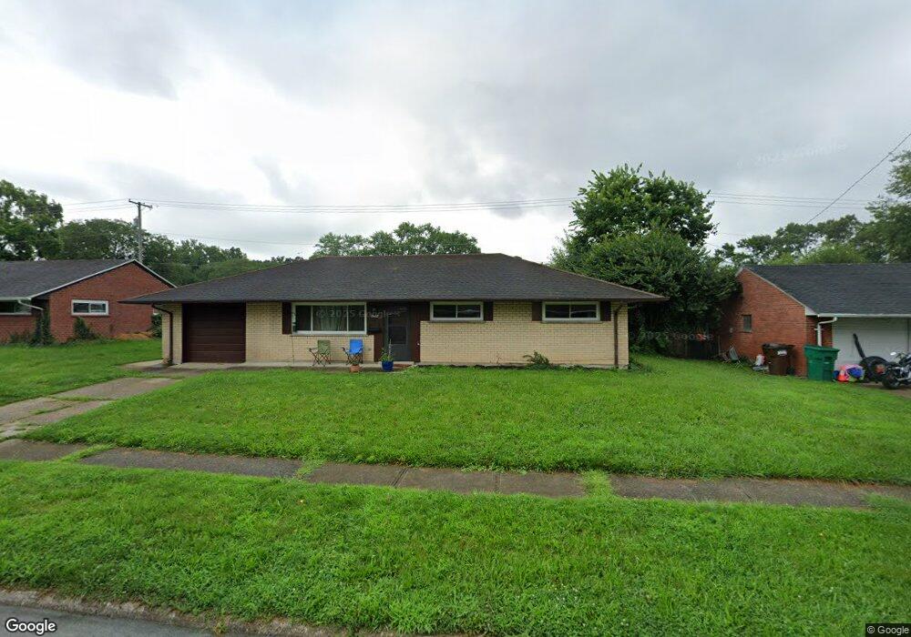
1908 Mattis Dr Dayton, OH 45439
Woodbourne-Hyde Park NeighborhoodEstimated Value: $160,201 - $191,000
3
Beds
1
Bath
1,080
Sq Ft
$163/Sq Ft
Est. Value
About This Home
This home is located at 1908 Mattis Dr, Dayton, OH 45439 and is currently estimated at $175,550, approximately $162 per square foot. 1908 Mattis Dr is a home located in Montgomery County with nearby schools including West Carrollton High School, Miami Valley Academies, and St. Albert the Great Catholic School.
Ownership History
Date
Name
Owned For
Owner Type
Purchase Details
Closed on
Nov 17, 1999
Sold by
Kelly Patrick J
Bought by
Maximum Investment Group Inc
Current Estimated Value
Home Financials for this Owner
Home Financials are based on the most recent Mortgage that was taken out on this home.
Original Mortgage
$30,275
Interest Rate
7.88%
Create a Home Valuation Report for This Property
The Home Valuation Report is an in-depth analysis detailing your home's value as well as a comparison with similar homes in the area
Home Values in the Area
Average Home Value in this Area
Purchase History
| Date | Buyer | Sale Price | Title Company |
|---|---|---|---|
| Maximum Investment Group Inc | -- | Midwest Abstract Company |
Source: Public Records
Mortgage History
| Date | Status | Borrower | Loan Amount |
|---|---|---|---|
| Closed | Maximum Investment Group Inc | $30,275 |
Source: Public Records
Tax History Compared to Growth
Tax History
| Year | Tax Paid | Tax Assessment Tax Assessment Total Assessment is a certain percentage of the fair market value that is determined by local assessors to be the total taxable value of land and additions on the property. | Land | Improvement |
|---|---|---|---|---|
| 2024 | $67 | $31,040 | $7,820 | $23,220 |
| 2023 | $67 | $31,040 | $7,820 | $23,220 |
| 2022 | $1,965 | $20,830 | $5,250 | $15,580 |
| 2021 | $1,798 | $20,830 | $5,250 | $15,580 |
| 2020 | $2,487 | $28,860 | $5,250 | $23,610 |
| 2019 | $2,035 | $20,550 | $5,250 | $15,300 |
| 2018 | $1,907 | $20,550 | $5,250 | $15,300 |
| 2017 | $1,897 | $20,550 | $5,250 | $15,300 |
| 2016 | $1,960 | $20,550 | $5,250 | $15,300 |
| 2015 | $1,828 | $20,550 | $5,250 | $15,300 |
| 2014 | $1,828 | $20,550 | $5,250 | $15,300 |
| 2012 | -- | $27,140 | $7,000 | $20,140 |
Source: Public Records
Map
Nearby Homes
- 1673 W Stroop Rd
- 4301 Tait Rd
- 2090 Mattis Dr
- 1905 Tait Circle Rd
- 3720 Ridgeleigh Rd Unit D
- 1952 Tait Circle Rd
- 3519 Waterbury Dr
- 1349 Tamerlane Rd
- 2050 William Ln
- 4519 Harbison St
- 4207 S Dixie Dr
- 4629 Richwood Dr
- 4661 Richwood Dr
- 4400 Royal Ridge Way
- 1314 Ridgeview Ave
- 4447 Royal Ridge Way
- 1301 Ridgeview Ave
- 3225 Southdale Dr Unit 1
- 1955 Kresswood Cir
- 4792 Loxley Dr
- 1896 Mattis Dr
- 1922 Mattis Dr
- 1921 Owendale Dr
- 1909 Owendale Dr
- 1935 Owendale Dr
- 1880 Mattis Dr
- 1934 Mattis Dr
- 1909 Mattis Dr
- 1897 Mattis Dr
- 1895 Owendale Dr
- 1923 Mattis Dr
- 1951 Owendale Dr
- 1946 Mattis Dr
- 1868 Mattis Dr
- 1935 Mattis Dr
- 1881 Owendale Dr
- 1920 Owendale Dr
- 1886 W Stroop Rd
- 1869 Mattis Dr
- 1936 Owendale Dr