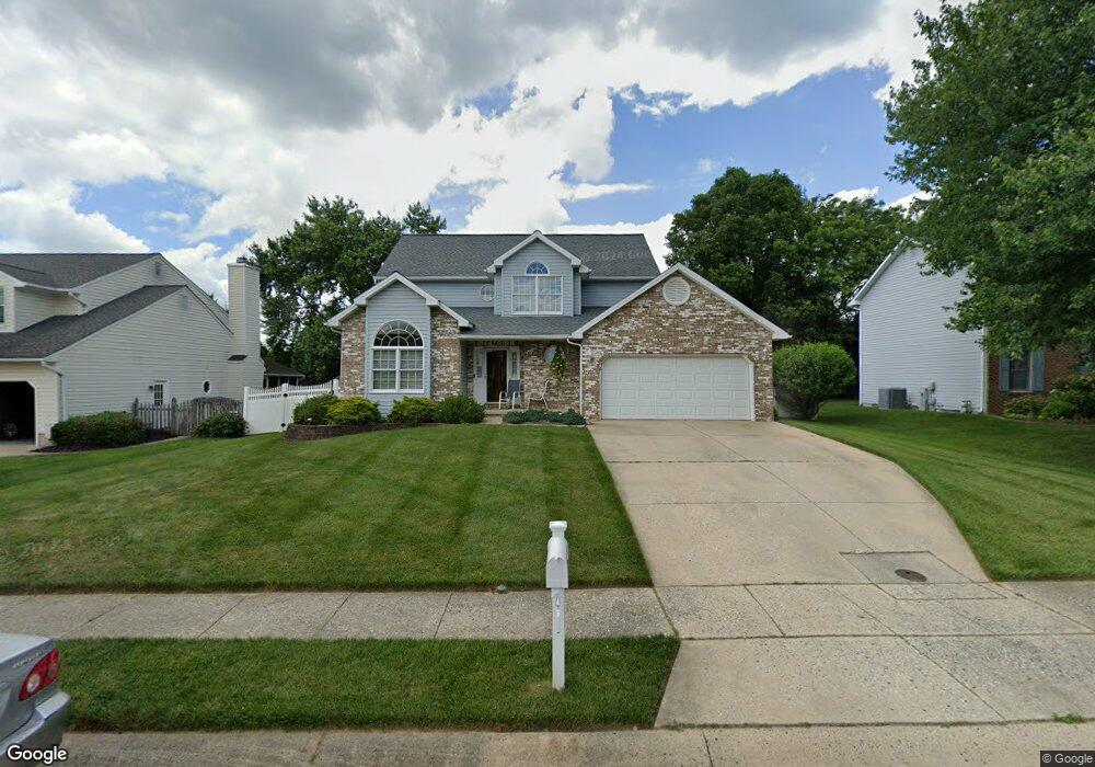
1908 Munsey Dr Forest Hill, MD 21050
Estimated Value: $479,601 - $614,000
Studio
3
Baths
1,994
Sq Ft
$289/Sq Ft
Est. Value
About This Home
This home is located at 1908 Munsey Dr, Forest Hill, MD 21050 and is currently estimated at $575,900, approximately $288 per square foot. 1908 Munsey Dr is a home located in Harford County with nearby schools including Forest Lakes Elementary School, Bel Air Middle School, and Bel Air High School.
Ownership History
Date
Name
Owned For
Owner Type
Purchase Details
Closed on
Mar 27, 1992
Sold by
Lin Mar Development Corporation
Bought by
Kline Ray P and Kline Maureen J
Current Estimated Value
Home Financials for this Owner
Home Financials are based on the most recent Mortgage that was taken out on this home.
Original Mortgage
$75,000
Interest Rate
8.98%
Purchase Details
Closed on
Jan 4, 1989
Sold by
Osborne Winton B
Bought by
Lin Mar Development Corporation
Create a Home Valuation Report for This Property
The Home Valuation Report is an in-depth analysis detailing your home's value as well as a comparison with similar homes in the area
Home Values in the Area
Average Home Value in this Area
Purchase History
| Date | Buyer | Sale Price | Title Company |
|---|---|---|---|
| Kline Ray P | $142,400 | -- | |
| Lin Mar Development Corporation | $36,000 | -- |
Source: Public Records
Mortgage History
| Date | Status | Borrower | Loan Amount |
|---|---|---|---|
| Closed | Kline Ray P | $75,000 |
Source: Public Records
Tax History
| Year | Tax Paid | Tax Assessment Tax Assessment Total Assessment is a certain percentage of the fair market value that is determined by local assessors to be the total taxable value of land and additions on the property. | Land | Improvement |
|---|---|---|---|---|
| 2025 | $4,003 | $380,500 | $116,100 | $264,400 |
| 2024 | $4,003 | $367,267 | $0 | $0 |
| 2023 | $3,859 | $354,033 | $0 | $0 |
| 2022 | $3,714 | $340,800 | $116,100 | $224,700 |
| 2021 | $3,877 | $338,367 | $0 | $0 |
| 2020 | $3,877 | $335,933 | $0 | $0 |
| 2019 | $3,849 | $333,500 | $119,300 | $214,200 |
| 2018 | $3,679 | $321,700 | $0 | $0 |
| 2017 | $3,544 | $333,500 | $0 | $0 |
| 2016 | $140 | $298,100 | $0 | $0 |
| 2015 | $3,476 | $295,967 | $0 | $0 |
| 2014 | $3,476 | $293,833 | $0 | $0 |
Source: Public Records
Map
Nearby Homes
- 904 Delray Dr
- 2003 Hialeah Ct
- 434 Dellcrest Dr
- 2027 Brandy Dr
- 1809 Beth Bridge Cir
- 112 Gwen Dr Unit 1K
- 111 Sunshine Ct Unit A
- 1127 Darlene Rd
- 138 Paden Ct
- 203 Reba Ct
- 107 J Sunshine Ct
- 1615 Samantha Dr
- 1605 Samantha Dr
- 1721 Chrisemmett Ct Unit 3A
- 1814 Ridgecroft Dr
- 1524 Swearingen Dr
- 16 Wagner Way
- 206 Kimary Ct Unit 1B
- 202 Kimary Ct Unit 1A
- 137 Spencer Cir
Your Personal Tour Guide
Ask me questions while you tour the home.