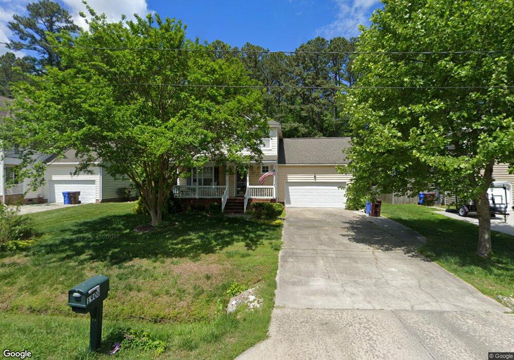
1908 Orangewood Rd Chesapeake, VA 23323
Deep Creek-Portsmouth NeighborhoodEstimated Value: $578,591 - $613,000
4
Beds
4
Baths
2,724
Sq Ft
$220/Sq Ft
Est. Value
About This Home
This home is located at 1908 Orangewood Rd, Chesapeake, VA 23323 and is currently estimated at $598,148, approximately $219 per square foot. 1908 Orangewood Rd is a home located in Chesapeake City with nearby schools including Grassfield Elementary School, Hugo a Owens Middle, and Grassfield High School.
Ownership History
Date
Name
Owned For
Owner Type
Purchase Details
Closed on
Dec 14, 2007
Sold by
Majestic Home Inv
Bought by
Bauer Richard G
Current Estimated Value
Home Financials for this Owner
Home Financials are based on the most recent Mortgage that was taken out on this home.
Original Mortgage
$268,720
Outstanding Balance
$169,825
Interest Rate
6.27%
Mortgage Type
New Conventional
Estimated Equity
$428,323
Create a Home Valuation Report for This Property
The Home Valuation Report is an in-depth analysis detailing your home's value as well as a comparison with similar homes in the area
Home Values in the Area
Average Home Value in this Area
Purchase History
| Date | Buyer | Sale Price | Title Company |
|---|---|---|---|
| Bauer Richard G | $335,900 | -- |
Source: Public Records
Mortgage History
| Date | Status | Borrower | Loan Amount |
|---|---|---|---|
| Open | Bauer Richard G | $268,720 |
Source: Public Records
Tax History Compared to Growth
Tax History
| Year | Tax Paid | Tax Assessment Tax Assessment Total Assessment is a certain percentage of the fair market value that is determined by local assessors to be the total taxable value of land and additions on the property. | Land | Improvement |
|---|---|---|---|---|
| 2025 | $4,959 | $521,300 | $190,000 | $331,300 |
| 2024 | $4,959 | $491,000 | $175,000 | $316,000 |
| 2023 | $4,782 | $473,500 | $145,000 | $328,500 |
| 2022 | $4,306 | $426,300 | $135,000 | $291,300 |
| 2021 | $3,948 | $376,000 | $110,000 | $266,000 |
| 2020 | $3,830 | $364,800 | $105,000 | $259,800 |
| 2019 | $3,735 | $355,700 | $105,000 | $250,700 |
| 2018 | $3,685 | $349,200 | $90,000 | $259,200 |
| 2017 | $3,898 | $371,200 | $105,000 | $266,200 |
| 2016 | $3,845 | $366,200 | $100,000 | $266,200 |
| 2015 | $3,793 | $361,200 | $95,000 | $266,200 |
| 2014 | $3,667 | $349,200 | $90,000 | $259,200 |
Source: Public Records
Map
Nearby Homes
- 1949 Rockwood Dr
- 1949 Lemonwood Rd
- 2057 Burson Dr
- 1960 Reefwood Rd
- 2029 Shipyard Rd
- 2014 Millville Rd
- .181AC Shipyard Rd
- 1860 Millville Rd
- 1820 Rockwood Dr
- 1758 Watershed Ct
- 1908 Mccoy Rd
- 1916 Mccoy Rd
- 1918 Mccoy Rd
- 1917 Mccoy Rd
- 1857 Shipyard Rd
- 1653 Shipyard Rd
- 2084 Millville Rd
- 2219 Angler Ln
- 1808 Aft Way
- 2000 Kelsey Bay Ct
- 1900 Orangewood Rd
- 1912 Orangewood Rd
- 1916 Orangewood Rd
- 1913 Orangewood Rd
- 1901 Orangewood Rd
- 1917 Orangewood Rd
- 1920 Orangewood Rd
- 1944 Rockwood Dr
- 1944 Rockwood Dr Unit Dr
- 1953 Rockwood Dr
- 1957 Rockwood Dr
- 1921 Orangewood Rd
- 1945 Rockwood Dr
- 1968 Rockwood Dr
- 1961 Rockwood Dr
- 1940 Rockwood Dr
- 1941 Rockwood Dr
- 1924 Orangewood Rd
- 1972 Rockwood Dr
- 1969 Rockwood Dr