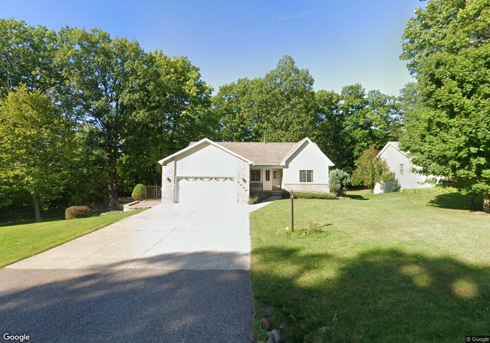
1908 Robindale Dr Houghton, MI 49931
Estimated Value: $400,875 - $532,000
5
Beds
2
Baths
3,136
Sq Ft
$151/Sq Ft
Est. Value
About This Home
This home is located at 1908 Robindale Dr, Houghton, MI 49931 and is currently estimated at $474,469, approximately $151 per square foot. 1908 Robindale Dr is a home located in Houghton County with nearby schools including South Range Elementary School and Jeffers High School.
Ownership History
Date
Name
Owned For
Owner Type
Purchase Details
Closed on
Jul 28, 2021
Sold by
Thomas Oommen
Bought by
Rawashdeh Nathir
Current Estimated Value
Home Financials for this Owner
Home Financials are based on the most recent Mortgage that was taken out on this home.
Original Mortgage
$332,500
Outstanding Balance
$302,209
Interest Rate
2.87%
Mortgage Type
Construction
Estimated Equity
$172,260
Purchase Details
Closed on
Jun 14, 2001
Sold by
Aper Ryan and Aper Rebecca
Bought by
Oommen Thomas and Philip Selin
Create a Home Valuation Report for This Property
The Home Valuation Report is an in-depth analysis detailing your home's value as well as a comparison with similar homes in the area
Home Values in the Area
Average Home Value in this Area
Purchase History
| Date | Buyer | Sale Price | Title Company |
|---|---|---|---|
| Rawashdeh Nathir | $350,000 | M&M Title | |
| Oommen Thomas | $160,000 | -- |
Source: Public Records
Mortgage History
| Date | Status | Borrower | Loan Amount |
|---|---|---|---|
| Open | Rawashdeh Nathir | $332,500 |
Source: Public Records
Tax History
| Year | Tax Paid | Tax Assessment Tax Assessment Total Assessment is a certain percentage of the fair market value that is determined by local assessors to be the total taxable value of land and additions on the property. | Land | Improvement |
|---|---|---|---|---|
| 2025 | $5,593 | $189,507 | $0 | $0 |
| 2024 | $54 | $182,139 | $0 | $0 |
| 2023 | $5,166 | $160,102 | $0 | $0 |
| 2022 | $6,391 | $139,211 | $0 | $0 |
| 2021 | $5,797 | $128,779 | $0 | $0 |
| 2020 | $5,716 | $125,891 | $0 | $0 |
| 2019 | $5,613 | $122,551 | $0 | $0 |
| 2018 | $5,469 | $124,715 | $0 | $0 |
| 2017 | $5,198 | $117,452 | $0 | $0 |
| 2016 | -- | $114,677 | $0 | $0 |
| 2015 | -- | $118,694 | $0 | $0 |
| 2014 | -- | $115,377 | $0 | $0 |
Source: Public Records
Map
Nearby Homes
- TBD-undeveloped Oak Ridge Ln
- 1906 White Oak Ln
- 1506 Sugar Maple Ln
- 1504 Sugar Maple Ln
- 47302 Janovosky Rd
- 52275 N Superior Rd
- TBD A B C Navy Stream
- TBD Razorback Dr Unit Part of Lot 22, Enti
- 19336 W Edwards Ave
- 515 Emma Ave
- 707 W Douglass Ave
- 607 W Edwards Ave
- Unit 4 Greenway Dr Unit 4
- Unit 6 Greenway Dr
- TBD W Sharon Ave
- TBD Off Cedar St
- TBD Green Acres Rd
- 701 W Memorial Dr
- 503 W Baraga Ave
- 900 3rd St
- 1906 Robindale Dr
- 1910 Robindale Dr
- 1907 Robindale Dr
- 1904 Robindale Dr
- 1909 Middle Pointe Ln
- 1907 Middle Pointe Ln
- 1909 Robindale Dr
- 1905 Middle Pointe Ln
- 1905 Robindale Dr
- 1911 Middle Pointe Ln
- 1912 Robindale Dr
- 1902 Robindale Dr
- 1911 Robindale Dr
- 1903 Middle Pointe Ln
- 2000 Spruce Ln
- 1913 Middle Pointe Ln
- 1900 Spruce Ln
- 1903 Robindale Dr
- 2001 Spruce Ln
- 1914 Robindale Dr
Your Personal Tour Guide
Ask me questions while you tour the home.