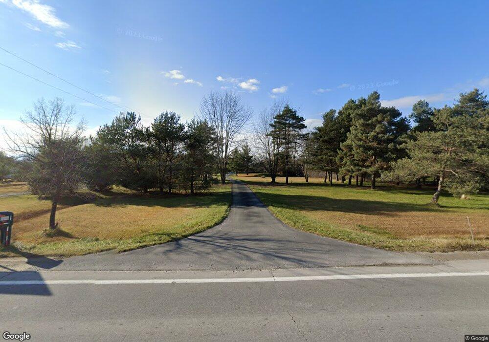
1908 S Range Rd Saint Clair, MI 48079
Estimated Value: $374,000 - $503,000
Studio
--
Bath
2,024
Sq Ft
$216/Sq Ft
Est. Value
About This Home
This home is located at 1908 S Range Rd, Saint Clair, MI 48079 and is currently estimated at $438,112, approximately $216 per square foot. 1908 S Range Rd is a home located in St. Clair County with nearby schools including Gearing Elementary School, St. Clair Middle School, and St. Clair High School.
Ownership History
Date
Name
Owned For
Owner Type
Purchase Details
Closed on
Jul 3, 2024
Sold by
Fraley Floyd Francis and Fraley Kathleen Theresa
Bought by
Fraley Floyd Francis and Fraley Kathleen Theresa
Current Estimated Value
Purchase Details
Closed on
Sep 16, 2019
Sold by
Gee Sandra D
Bought by
Fraley Floyd and Fraley Kathleen
Purchase Details
Closed on
Apr 13, 2016
Sold by
Sandra Gee
Bought by
Yachcik Michael and Yachcik Amy
Home Financials for this Owner
Home Financials are based on the most recent Mortgage that was taken out on this home.
Original Mortgage
$196,000
Interest Rate
3.59%
Create a Home Valuation Report for This Property
The Home Valuation Report is an in-depth analysis detailing your home's value as well as a comparison with similar homes in the area
Home Values in the Area
Average Home Value in this Area
Purchase History
| Date | Buyer | Sale Price | Title Company |
|---|---|---|---|
| Fraley Floyd Francis | -- | None Listed On Document | |
| Fraley Floyd | $65,000 | Cislo Title | |
| Yachcik Michael | -- | -- |
Source: Public Records
Mortgage History
| Date | Status | Borrower | Loan Amount |
|---|---|---|---|
| Previous Owner | Yachcik Michael | $196,000 | |
| Previous Owner | Yachcik Michael | -- |
Source: Public Records
Tax History
| Year | Tax Paid | Tax Assessment Tax Assessment Total Assessment is a certain percentage of the fair market value that is determined by local assessors to be the total taxable value of land and additions on the property. | Land | Improvement |
|---|---|---|---|---|
| 2025 | $3,370 | $240,600 | $0 | $0 |
| 2024 | $3,268 | $250,700 | $0 | $0 |
| 2023 | $3,003 | $192,300 | $0 | $0 |
| 2022 | $3,121 | $177,800 | $0 | $0 |
| 2020 | $108 | $19,500 | $19,500 | $0 |
| 2019 | $43 | $15,700 | $0 | $0 |
| 2018 | $0 | $15,700 | $0 | $0 |
| 2017 | $140 | $15,700 | $0 | $0 |
| 2016 | $107 | $15,700 | $0 | $0 |
| 2015 | -- | $16,300 | $16,300 | $0 |
| 2014 | -- | $16,700 | $16,700 | $0 |
| 2013 | -- | $14,700 | $0 | $0 |
Source: Public Records
Map
Nearby Homes
- 1931 Pug Rd
- 9 Golfside Dr
- 3179 Regatta Ln
- 50 Golfside Dr
- 0 Braeburn Dr Unit 6
- 740 Highland Dr
- 4455 Irene Dr
- 3071 Regatta Ln
- 4147 River Pointe Dr
- 3059 Regatta Ln
- 3072 Regatta Ln
- 4085 Blue River Dr
- 4170 Neuman Rd
- 1581 Golden Gate Ct
- 2118 N River Rd
- 1715 River Rd 39 Rd Unit 39
- 1715 River Rd Unit 22
- 1715 River Rd Unit 77
- 1715 River Rd Unit 41
- 1991 Karen Ave
- 1908 S Range Rd
- 1908 S Range Rd
- 1908 S Range Rd Rd S
- 1920 S Range Rd
- 1884 S Range Rd
- 1880 S Range Rd
- 1850 S Range Rd
- 1950 S Range Rd
- 1844 S Range Rd
- 4600 Yankee Rd
- 4570 Yankee Rd
- 0 Vacant Land - Range and Yankee Unit 219091433
- 4580 Yankee Rd
- 1790 S Range Rd Unit 1780
- 4626 Yankee Rd
- 4545 Yankee Rd
- 1770 S Range Rd
- 4623 Yankee Rd
- 4627 Yankee Rd
- 4660 Yankee Rd
