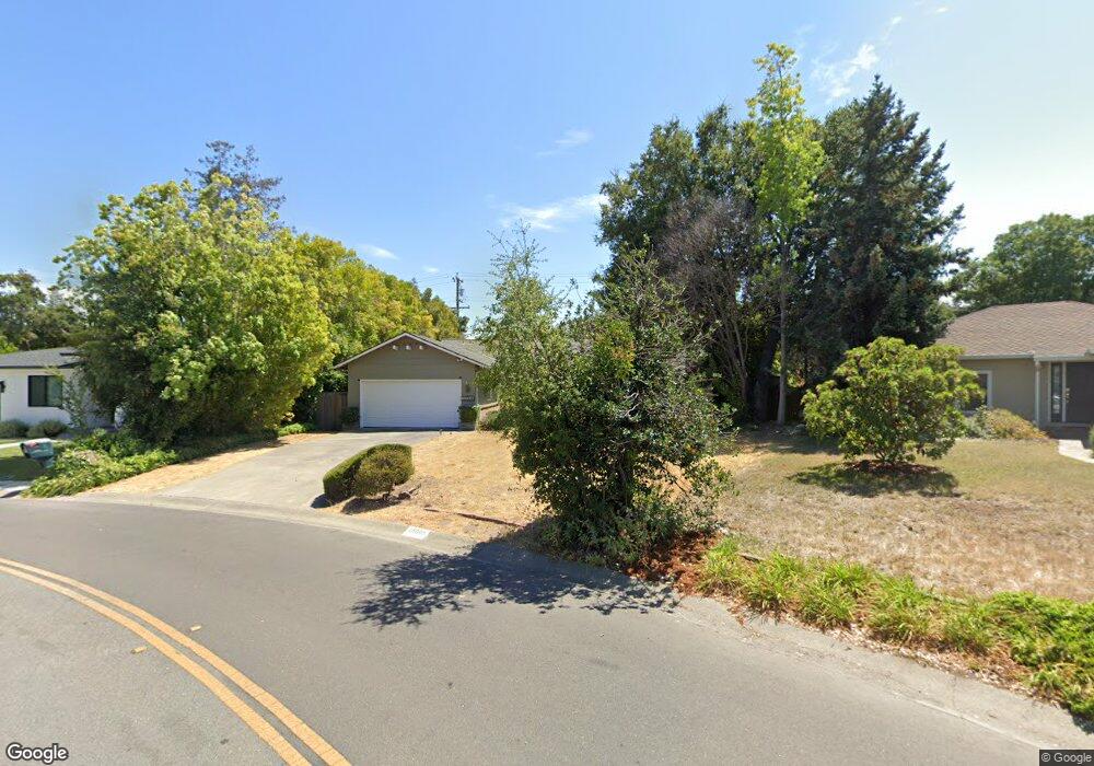
19080 Brook Ln Saratoga, CA 95070
West San Jose NeighborhoodEstimated Value: $3,101,110 - $3,603,000
3
Beds
2
Baths
1,395
Sq Ft
$2,426/Sq Ft
Est. Value
About This Home
This home is located at 19080 Brook Ln, Saratoga, CA 95070 and is currently estimated at $3,384,528, approximately $2,426 per square foot. 19080 Brook Ln is a home located in Santa Clara County with nearby schools including Country Lane Elementary School, Moreland Middle School, and Prospect High School.
Ownership History
Date
Name
Owned For
Owner Type
Purchase Details
Closed on
May 23, 2020
Sold by
Brunngraber Lee
Bought by
Brunngraber Lee and Lee Brunngraber Revocable
Current Estimated Value
Purchase Details
Closed on
Jun 26, 2008
Sold by
Brunngraber Rodric F
Bought by
Brunngraber Lee
Home Financials for this Owner
Home Financials are based on the most recent Mortgage that was taken out on this home.
Original Mortgage
$306,000
Interest Rate
5.37%
Mortgage Type
New Conventional
Create a Home Valuation Report for This Property
The Home Valuation Report is an in-depth analysis detailing your home's value as well as a comparison with similar homes in the area
Home Values in the Area
Average Home Value in this Area
Purchase History
| Date | Buyer | Sale Price | Title Company |
|---|---|---|---|
| Brunngraber Lee | -- | None Available | |
| Brunngraber Lee | -- | Ticor Title Of Nevada Inc |
Source: Public Records
Mortgage History
| Date | Status | Borrower | Loan Amount |
|---|---|---|---|
| Closed | Brunngraber Lee | $306,000 |
Source: Public Records
Tax History
| Year | Tax Paid | Tax Assessment Tax Assessment Total Assessment is a certain percentage of the fair market value that is determined by local assessors to be the total taxable value of land and additions on the property. | Land | Improvement |
|---|---|---|---|---|
| 2025 | $6,436 | $438,078 | $199,125 | $238,953 |
| 2024 | $6,312 | $429,489 | $195,221 | $234,268 |
| 2023 | $6,254 | $421,069 | $191,394 | $229,675 |
| 2022 | $6,169 | $412,814 | $187,642 | $225,172 |
| 2021 | $6,059 | $404,720 | $183,963 | $220,757 |
| 2020 | $5,953 | $400,571 | $182,077 | $218,494 |
| 2019 | $5,721 | $392,717 | $178,507 | $214,210 |
| 2018 | $5,596 | $385,017 | $175,007 | $210,010 |
| 2017 | $5,504 | $377,469 | $171,576 | $205,893 |
| 2016 | $5,164 | $370,068 | $168,212 | $201,856 |
| 2015 | $5,087 | $364,510 | $165,686 | $198,824 |
| 2014 | $4,947 | $357,371 | $162,441 | $194,930 |
Source: Public Records
Map
Nearby Homes
- 12095 Brookglen Dr
- 19150 Brookhaven Dr
- 11891 Brookglen Dr
- 1582 Petal Way
- 5948 Royal Ann Dr
- 12304 Saratoga Creek Dr
- 12534 Brookglen Dr
- 18813 Westview Dr
- 6128 Rainbow Dr
- 1439 Miller Ave
- 1527 Fields Dr
- 1487 Larkin Ave
- 1396 Cordelia Ave
- 1596 Bonnie Joy Ave
- 5492 Castle Glen Ave
- 12619 Saratoga Ave
- 1529 Cameo Dr
- 18932 Sara Park Cir Unit 72
- 1547 Crespi Dr
- 12536 Paseo Flores
- 19100 Brook Ln
- 19060 Brook Ln
- 19040 Brook Ln
- 1560 Johnson Ave
- 1554 Johnson Ave
- 19101 Brook Ln
- 19120 Brook Ln
- 12011 Brookridge Dr
- 12111 Woodside Dr
- 12101 Woodside Dr
- 1552 Johnson Ave
- 19020 Brook Ln
- 19150 Prospect Rd
- 19136 Prospect Rd
- 12024 Brookridge Dr
- 11991 Brookridge Dr
- 12008 Brookridge Dr
- 12090 Mellowood Dr
- 19125 Brook Ln
- 12090 Country Squire Ln
Your Personal Tour Guide
Ask me questions while you tour the home.