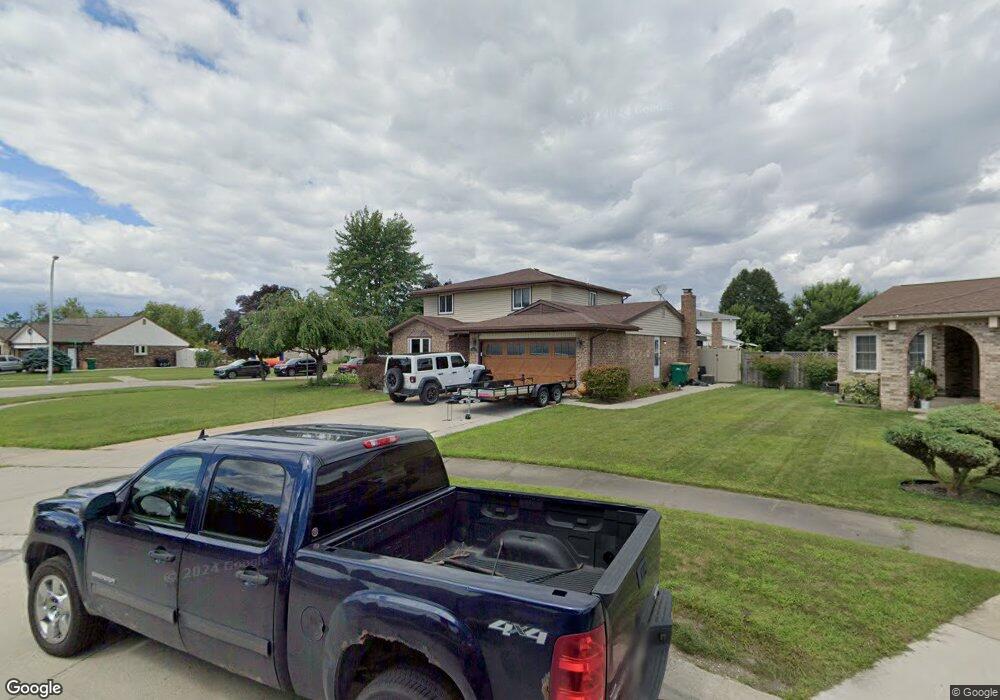
19087 Cascade Dr Brownstown, MI 48193
Estimated Value: $331,950 - $360,000
4
Beds
3
Baths
2,036
Sq Ft
$168/Sq Ft
Est. Value
About This Home
This home is located at 19087 Cascade Dr, Brownstown, MI 48193 and is currently estimated at $341,988, approximately $167 per square foot. 19087 Cascade Dr is a home located in Wayne County with nearby schools including Yake Elementary School, Patrick Henry Middle School, and Brownstown Middle School.
Ownership History
Date
Name
Owned For
Owner Type
Purchase Details
Closed on
Feb 19, 2010
Sold by
Mortgage Electronic Registration Systems
Bought by
Federal National Mortgage Association
Current Estimated Value
Purchase Details
Closed on
Feb 18, 2010
Sold by
Anderson Paul and Anderson Luwanna
Bought by
Mortgage Electronic Registration Systems
Purchase Details
Closed on
May 12, 2005
Sold by
Nasr Naim and Nasr Joaida
Bought by
Anderson Paul R
Purchase Details
Closed on
Jan 23, 2003
Sold by
Nasr Naim
Bought by
Nasr Naim
Create a Home Valuation Report for This Property
The Home Valuation Report is an in-depth analysis detailing your home's value as well as a comparison with similar homes in the area
Home Values in the Area
Average Home Value in this Area
Purchase History
| Date | Buyer | Sale Price | Title Company |
|---|---|---|---|
| Federal National Mortgage Association | -- | None Available | |
| Mortgage Electronic Registration Systems | $197,949 | None Available | |
| Anderson Paul R | $227,000 | Able Title Agency Llc | |
| Nasr Naim | -- | -- |
Source: Public Records
Tax History
| Year | Tax Paid | Tax Assessment Tax Assessment Total Assessment is a certain percentage of the fair market value that is determined by local assessors to be the total taxable value of land and additions on the property. | Land | Improvement |
|---|---|---|---|---|
| 2025 | $2,564 | $156,900 | $0 | $0 |
| 2024 | $2,493 | $147,800 | $0 | $0 |
| 2023 | $2,378 | $137,400 | $0 | $0 |
| 2022 | $4,309 | $130,500 | $0 | $0 |
| 2021 | $3,996 | $121,400 | $0 | $0 |
| 2020 | $3,929 | $117,000 | $0 | $0 |
| 2019 | $3,899 | $109,300 | $0 | $0 |
| 2018 | $2,078 | $98,100 | $0 | $0 |
| 2017 | $3,499 | $103,500 | $0 | $0 |
| 2016 | $3,747 | $91,600 | $0 | $0 |
| 2015 | $7,928 | $89,700 | $0 | $0 |
| 2013 | $7,680 | $87,400 | $0 | $0 |
| 2012 | -- | $77,800 | $17,600 | $60,200 |
Source: Public Records
Map
Nearby Homes
- 19170 Dawnshire Dr
- 18689 Hilltop Blvd
- 18641 Hilltop Ln
- 18890 Church Hill Dr
- 19345 Allen Rd
- 0000 Allen Rd
- 14851 Williamsburg Dr
- 14749 Williamsburg Dr
- 000 King Rd
- 16959 Anderson Dr
- 1799 Grange Rd
- 17486 Poplar St
- 1905 Newman St
- 13842 Heritage St
- 2501 King Rd
- 3804 S Longmeadow Rd
- 20698 Coachwood Rd
- 0000 Fort St
- 16392 Weddel St
- 16117 Jackson St
- 17657 Cascade Dr
- 19103 Cascade Dr
- 19069 Seaton Dr
- 16900 Woodridge Dr
- 19121 Cascade Dr
- 19051 Seaton Dr
- 19120 Cascade Dr
- 19137 Cascade Dr
- 16901 Woodridge Dr
- 19136 Cascade Dr
- 17100 Woodridge Dr
- 19050 Seaton Dr
- 19035 Seaton Dr
- 17101 Woodridge Dr
- 19153 Cascade Dr
- 19170 Cascade Dr
- 19034 Seaton Dr
- 17300 Woodridge Dr
- 19017 Seaton Dr
- 17301 Woodridge Dr
Your Personal Tour Guide
Ask me questions while you tour the home.