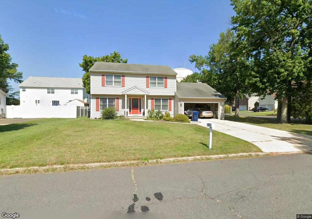
1909 6th St North Brunswick, NJ 08902
Estimated Value: $635,978 - $713,000
--
Bed
--
Bath
2,016
Sq Ft
$328/Sq Ft
Est. Value
About This Home
This home is located at 1909 6th St, North Brunswick, NJ 08902 and is currently estimated at $660,495, approximately $327 per square foot. 1909 6th St is a home located in Middlesex County with nearby schools including Arthur M. Judd Elementary School, Linwood Middle School, and North Brunswick Twp High School.
Ownership History
Date
Name
Owned For
Owner Type
Purchase Details
Closed on
Feb 15, 1996
Sold by
N Brunswick Const Matls
Bought by
Hart Thomas and Hart Robin
Current Estimated Value
Home Financials for this Owner
Home Financials are based on the most recent Mortgage that was taken out on this home.
Original Mortgage
$175,000
Outstanding Balance
$5,715
Interest Rate
6.99%
Estimated Equity
$654,780
Create a Home Valuation Report for This Property
The Home Valuation Report is an in-depth analysis detailing your home's value as well as a comparison with similar homes in the area
Home Values in the Area
Average Home Value in this Area
Purchase History
| Date | Buyer | Sale Price | Title Company |
|---|---|---|---|
| Hart Thomas | $195,126 | -- |
Source: Public Records
Mortgage History
| Date | Status | Borrower | Loan Amount |
|---|---|---|---|
| Open | Hart Thomas | $175,000 |
Source: Public Records
Tax History Compared to Growth
Tax History
| Year | Tax Paid | Tax Assessment Tax Assessment Total Assessment is a certain percentage of the fair market value that is determined by local assessors to be the total taxable value of land and additions on the property. | Land | Improvement |
|---|---|---|---|---|
| 2025 | $11,354 | $179,200 | $45,000 | $134,200 |
| 2024 | $11,150 | $179,200 | $45,000 | $134,200 |
| 2023 | $11,150 | $179,200 | $45,000 | $134,200 |
| 2022 | $10,770 | $179,200 | $45,000 | $134,200 |
| 2021 | $7,846 | $179,200 | $45,000 | $134,200 |
| 2020 | $10,369 | $179,200 | $45,000 | $134,200 |
| 2019 | $10,157 | $179,200 | $45,000 | $134,200 |
| 2018 | $9,949 | $179,200 | $45,000 | $134,200 |
| 2017 | $9,774 | $179,200 | $45,000 | $134,200 |
| 2016 | $9,569 | $179,200 | $45,000 | $134,200 |
| 2015 | $9,406 | $179,200 | $45,000 | $134,200 |
| 2014 | $9,300 | $179,200 | $45,000 | $134,200 |
Source: Public Records
Map
Nearby Homes
- 17 David Dr
- 1827 Oak Rd
- 4201 Birchwood Ct
- 4417 Birchwood Ct
- 3910 Birchwood Ct
- 3807 Birchwood Ct
- 1508 Plymouth Rd
- 132 Jared Dr
- 430 Wood Ave
- 122 Salem Rd
- 1584 Holly Rd
- 1 Michael Ct
- 7 Timber Ridge Rd
- 346 Wood Ave
- 457 Barrymore Place
- 38 Brighton Way Unit H2
- 5 Peppermint Hill Rd
- 34 Princess Dr
- 1660 Us Highway 130
- 18 Sheffield Ct