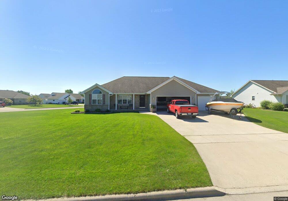
1909 Bonfire Way de Pere, WI 54115
Estimated Value: $405,000 - $433,000
3
Beds
2
Baths
1,612
Sq Ft
$258/Sq Ft
Est. Value
About This Home
This home is located at 1909 Bonfire Way, de Pere, WI 54115 and is currently estimated at $415,985, approximately $258 per square foot. 1909 Bonfire Way is a home located in Brown County with nearby schools including Hemlock Creek Elementary School, West De Pere Middle School, and West De Pere High School.
Ownership History
Date
Name
Owned For
Owner Type
Purchase Details
Closed on
Feb 9, 2018
Sold by
Mckinney Margaret M
Bought by
Mckinney Matthew J
Current Estimated Value
Home Financials for this Owner
Home Financials are based on the most recent Mortgage that was taken out on this home.
Original Mortgage
$239,449
Outstanding Balance
$205,327
Interest Rate
4.5%
Mortgage Type
VA
Estimated Equity
$210,658
Purchase Details
Closed on
Jul 13, 2006
Sold by
Lexington Homes Inc
Bought by
Mckinney Matthew J and Mckinney Margaret M
Home Financials for this Owner
Home Financials are based on the most recent Mortgage that was taken out on this home.
Original Mortgage
$235,575
Interest Rate
6.73%
Mortgage Type
VA
Create a Home Valuation Report for This Property
The Home Valuation Report is an in-depth analysis detailing your home's value as well as a comparison with similar homes in the area
Home Values in the Area
Average Home Value in this Area
Purchase History
| Date | Buyer | Sale Price | Title Company |
|---|---|---|---|
| Mckinney Matthew J | -- | None Available | |
| Mckinney Matthew J | $228,100 | Evans Title |
Source: Public Records
Mortgage History
| Date | Status | Borrower | Loan Amount |
|---|---|---|---|
| Open | Mckinney Matthew J | $239,449 | |
| Closed | Mckinney Matthew J | $235,575 |
Source: Public Records
Tax History Compared to Growth
Tax History
| Year | Tax Paid | Tax Assessment Tax Assessment Total Assessment is a certain percentage of the fair market value that is determined by local assessors to be the total taxable value of land and additions on the property. | Land | Improvement |
|---|---|---|---|---|
| 2024 | $3,897 | $268,300 | $60,800 | $207,500 |
| 2023 | $3,580 | $268,300 | $60,800 | $207,500 |
| 2022 | $3,589 | $268,300 | $60,800 | $207,500 |
| 2021 | $3,598 | $268,300 | $60,800 | $207,500 |
| 2020 | $3,614 | $192,200 | $41,400 | $150,800 |
| 2019 | $3,559 | $192,200 | $41,400 | $150,800 |
| 2018 | $3,403 | $192,200 | $41,400 | $150,800 |
| 2017 | $3,467 | $192,200 | $41,400 | $150,800 |
| 2016 | $3,502 | $192,200 | $41,400 | $150,800 |
| 2015 | $3,572 | $192,200 | $41,400 | $150,800 |
| 2014 | $3,717 | $192,200 | $41,400 | $150,800 |
| 2013 | $3,717 | $192,200 | $41,400 | $150,800 |
Source: Public Records
Map
Nearby Homes
- 1595 Talus Cir
- 1108 Hoks Ridge Ln
- 1359 Shelby Ln
- 0 Scheuring Rd
- 1454 Navigator Way
- 1338 Highland Ridge Dr
- 3644 E Hank Ave
- 3578 W Hank Ave
- 3629 W Hank Ave
- 3581 W Hank Ave
- 3608 E Hank Ave
- 1068 Misty Meadow Cir Unit 2
- 3566 W Hank Ave
- 1408 Crossroads Dr
- 1396 Crossroads Dr
- 3571 Sand Acres Dr
- 1432 Crossroads Dr
- 3683 Ponds Edge Ct
- 1378 Crossroads Dr
- 1372 Crossroads Dr
- 1917 Bonfire Way
- 1560 Morning Mist Way
- 1549 Morning Mist Way
- 1908 Bonfire Way
- 1914 Bonfire Way
- 1925 Bonfire Way
- 1557 Morning Mist Way
- 1541 Morning Mist Way
- 1570 Morning Mist Way
- 1922 Bonfire Way
- 1533 Morning Mist Way
- 1565 Morning Mist Way
- 814 Mystic Ct
- 1933 Bonfire Way
- 1905 Sandy Springs Rd
- 1911 Sandy Springs Rd
- 1525 Morning Mist Way
- 1556 Shadow Ridge Way
- 1548 Shadow Ridge Way
- 1564 Shadow Ridge Way