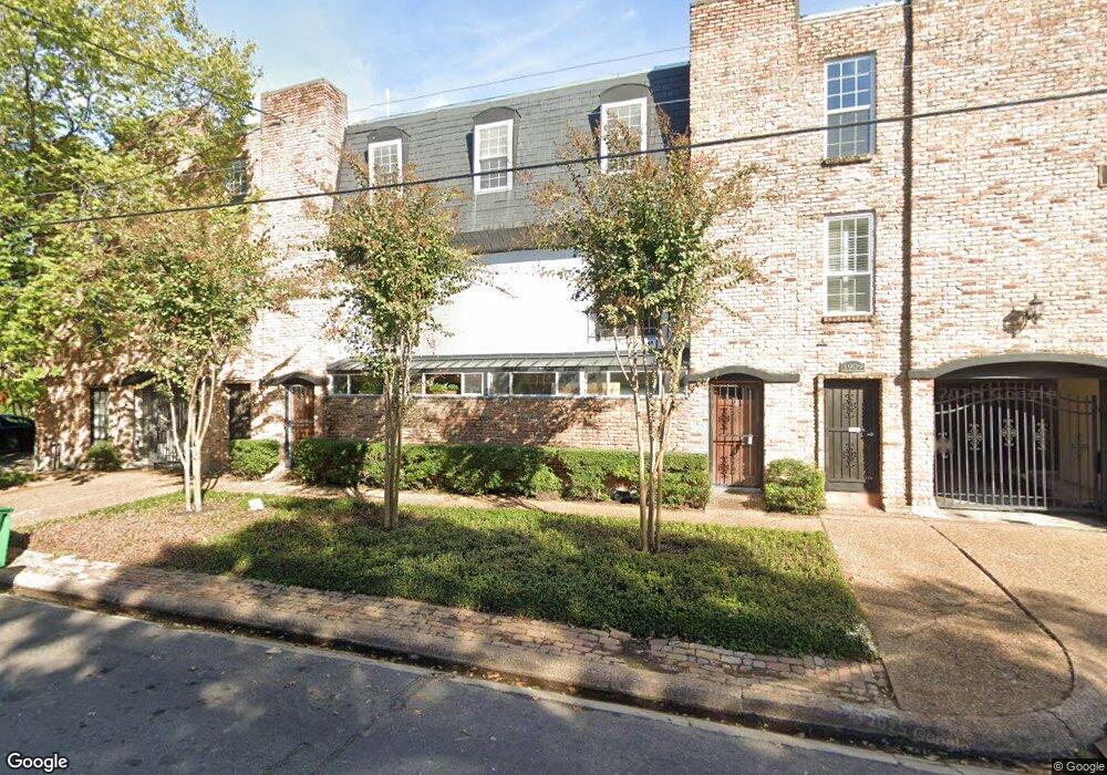
1909 Brun St Unit 14 Houston, TX 77019
Montrose NeighborhoodEstimated Value: $214,624 - $258,000
2
Beds
2
Baths
909
Sq Ft
$259/Sq Ft
Est. Value
About This Home
This home is located at 1909 Brun St Unit 14, Houston, TX 77019 and is currently estimated at $235,656, approximately $259 per square foot. 1909 Brun St Unit 14 is a home located in Harris County with nearby schools including Baker Montessori, Lanier Middle School, and Lamar High School.
Ownership History
Date
Name
Owned For
Owner Type
Purchase Details
Closed on
Apr 27, 2017
Sold by
Blanks Rowacs
Bought by
Blanks Ronalds
Current Estimated Value
Purchase Details
Closed on
Oct 4, 2016
Sold by
Westbrook William M
Bought by
Investmens Lands
Purchase Details
Closed on
Jun 8, 2012
Sold by
Chang Albert M and Chang Katherine Ting - Ting
Bought by
Wetbrook William Michael
Purchase Details
Closed on
Jun 29, 2005
Sold by
Gautreaux Wesley A and Gautreaux Jennifer
Bought by
Wong Alden Y
Create a Home Valuation Report for This Property
The Home Valuation Report is an in-depth analysis detailing your home's value as well as a comparison with similar homes in the area
Home Values in the Area
Average Home Value in this Area
Purchase History
| Date | Buyer | Sale Price | Title Company |
|---|---|---|---|
| Blanks Ronalds | -- | None Available | |
| Investmens Lands | $150,000 | None Available | |
| Wetbrook William Michael | -- | None Available | |
| Wong Alden Y | -- | -- |
Source: Public Records
Tax History Compared to Growth
Tax History
| Year | Tax Paid | Tax Assessment Tax Assessment Total Assessment is a certain percentage of the fair market value that is determined by local assessors to be the total taxable value of land and additions on the property. | Land | Improvement |
|---|---|---|---|---|
| 2025 | $4,156 | $208,963 | $39,703 | $169,260 |
| 2024 | $4,156 | $225,602 | $42,864 | $182,738 |
| 2023 | $4,156 | $212,762 | $40,425 | $172,337 |
| 2022 | $4,163 | $187,500 | $35,625 | $151,875 |
| 2021 | $3,869 | $166,000 | $31,540 | $134,460 |
| 2020 | $4,020 | $166,000 | $31,540 | $134,460 |
| 2019 | $4,201 | $166,000 | $31,540 | $134,460 |
| 2018 | $0 | $166,000 | $31,540 | $134,460 |
| 2017 | $4,405 | $192,201 | $36,518 | $155,683 |
| 2016 | $5,037 | $189,814 | $36,065 | $153,749 |
| 2015 | $3,193 | $189,814 | $36,065 | $153,749 |
| 2014 | $3,193 | $124,216 | $23,601 | $100,615 |
Source: Public Records
Map
Nearby Homes
- 1909 Brun St Unit 17
- 2026 Welch St
- 1904 Hazard St
- 1810 Hazard St Unit A
- 1910 Huldy St Unit A
- 2027 Huldy St
- 1711 Huldy St Unit A
- 1812 Driscoll St
- 2112 Mcduffie St
- 2103 Hazard St
- 2113 Huldy St
- 2115 Huldy St
- 2100 Welch St Unit C113
- 2100 Welch St Unit C212
- 2100 Welch St Unit C101
- 2119 Huldy St
- 2026 Morse St
- 1606 Hazard St
- 2111 Welch St Unit A107
- 2111 Welch St Unit B220
- 1909 Brun St
- 1909 Brun St Unit 10
- 1909 Brun St Unit 2
- 1909 Brun St Unit 3
- 1909 Brun St Unit 4
- 1909 Brun St Unit 9
- 1909 Brun St Unit 5
- 1909 Brun St Unit 8
- 1909 Brun St Unit 16
- 1909 Brun St Unit 15
- 1909 Brun St Unit 13
- 1909 Brun St Unit 12
- 1909 Brun St Unit 11
- 1909 Brun St Unit 7
- 1909 Brun St Unit 6
- 1909 Brun St Unit 1
- 1917 Brun St
- 1919 Brun St
- 2009 Vermont St
- 1912 Mcduffie St