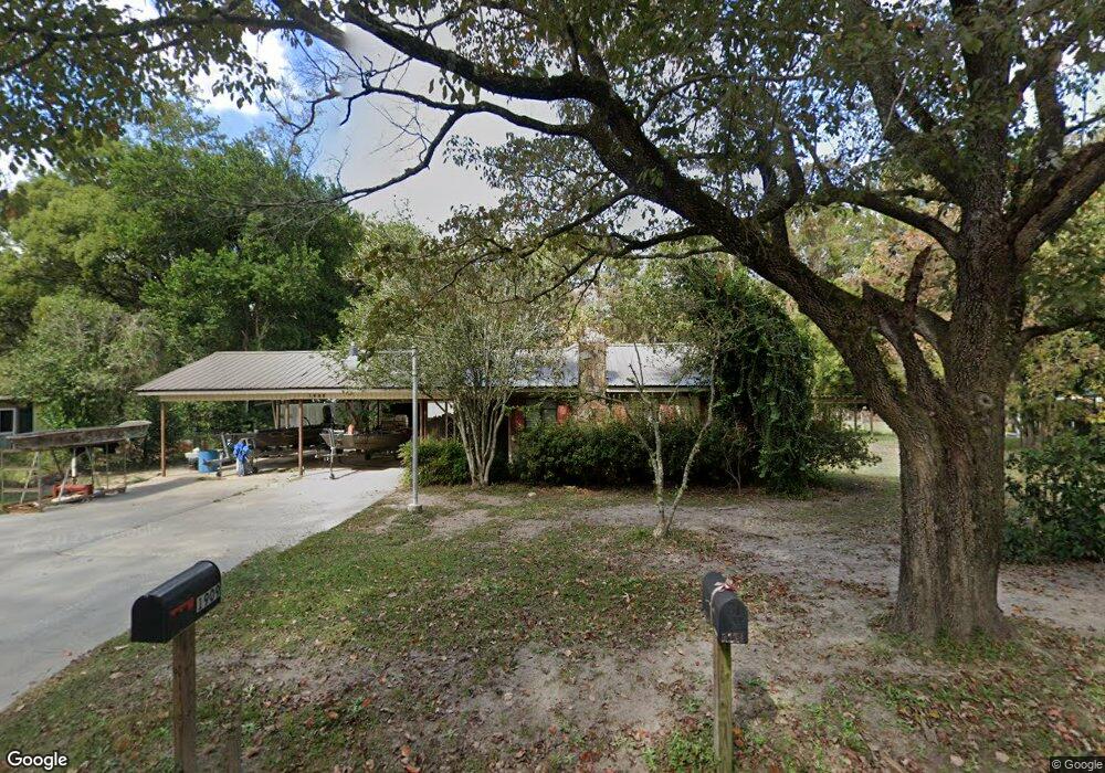
1909 Mount Pleasant Rd Waycross, GA 31503
Estimated Value: $105,000 - $258,000
2
Beds
1
Bath
984
Sq Ft
$197/Sq Ft
Est. Value
About This Home
This home is located at 1909 Mount Pleasant Rd, Waycross, GA 31503 and is currently estimated at $194,333, approximately $197 per square foot. 1909 Mount Pleasant Rd is a home located in Ware County with nearby schools including Williams Heights Elementary School, Waycross Middle School, and Ware County High School.
Ownership History
Date
Name
Owned For
Owner Type
Purchase Details
Closed on
Jul 7, 2016
Sold by
Barton Barbara Ann H
Bought by
Lee Kristie
Current Estimated Value
Home Financials for this Owner
Home Financials are based on the most recent Mortgage that was taken out on this home.
Original Mortgage
$20,000
Interest Rate
3.6%
Mortgage Type
New Conventional
Purchase Details
Closed on
Jun 30, 2016
Sold by
Hickson Mark L
Bought by
Barton Barbara Ann H
Home Financials for this Owner
Home Financials are based on the most recent Mortgage that was taken out on this home.
Original Mortgage
$20,000
Interest Rate
3.6%
Mortgage Type
New Conventional
Create a Home Valuation Report for This Property
The Home Valuation Report is an in-depth analysis detailing your home's value as well as a comparison with similar homes in the area
Home Values in the Area
Average Home Value in this Area
Purchase History
| Date | Buyer | Sale Price | Title Company |
|---|---|---|---|
| Lee Kristie | $20,000 | -- | |
| Barton Barbara Ann H | -- | -- |
Source: Public Records
Mortgage History
| Date | Status | Borrower | Loan Amount |
|---|---|---|---|
| Closed | Lee Kristie | $20,000 |
Source: Public Records
Tax History Compared to Growth
Tax History
| Year | Tax Paid | Tax Assessment Tax Assessment Total Assessment is a certain percentage of the fair market value that is determined by local assessors to be the total taxable value of land and additions on the property. | Land | Improvement |
|---|---|---|---|---|
| 2024 | $1,154 | $45,736 | $4,469 | $41,267 |
| 2023 | $1,177 | $25,864 | $2,183 | $23,681 |
| 2022 | $740 | $25,626 | $2,183 | $23,443 |
| 2021 | $571 | $18,218 | $2,183 | $16,035 |
| 2020 | $559 | $17,637 | $2,183 | $15,454 |
| 2019 | $542 | $16,753 | $2,183 | $14,570 |
| 2018 | $527 | $16,159 | $2,183 | $13,976 |
| 2017 | $531 | $16,159 | $2,183 | $13,976 |
| 2016 | $531 | $16,159 | $2,183 | $13,976 |
| 2015 | -- | $16,159 | $2,183 | $13,976 |
| 2014 | -- | $16,159 | $2,183 | $13,976 |
| 2013 | -- | $16,159 | $2,183 | $13,976 |
Source: Public Records
Map
Nearby Homes
- 807 City Blvd
- 7438 Central Ave
- 1312 Atlantic Ave
- 914 Barkley St
- 1204 Richmond Ave
- 1100 Atlantic Ave
- 1205 Dean Dr
- 955 Lynn Dr
- 0 Brunswick Hwy Unit 1648370
- 1100 Euclid Ave
- 713 Magnolia Dr
- 723 St Bernard Trail
- 1009 Euclid Ave
- 1502 Seminole Trail
- 907 Euclid Ave
- 1049 Riverdale Dr
- 0 Goodwin St
- 00 Seminole Trail
- 808 Satilla Blvd
- 1001 Coral Rd
- 1943 Mount Pleasant Rd
- 1815 Mount Pleasant Rd
- 1883 Mount Pleasant Rd
- 1934 Mount Pleasant Rd
- 1946 Mount Pleasant Rd
- 1961 Mount Pleasant Rd
- 1871 Mount Pleasant Rd
- 1964 Mount Pleasant Rd
- 1966 Mount Pleasant Rd
- 1865 Mount Pleasant Rd
- 1862 Mount Pleasant Rd
- 700 Mount Pleasant Rd
- 1894 Mount Pleasant Rd
- 2004 Central Ave
- 748 Mount Pleasant Rd
- 1836 Mount Pleasant Rd
- 1833 Mount Pleasant Rd
- 851 Mount Pleasant Rd
- 1819 Mt Pleasant Rd
- 603 City Blvd