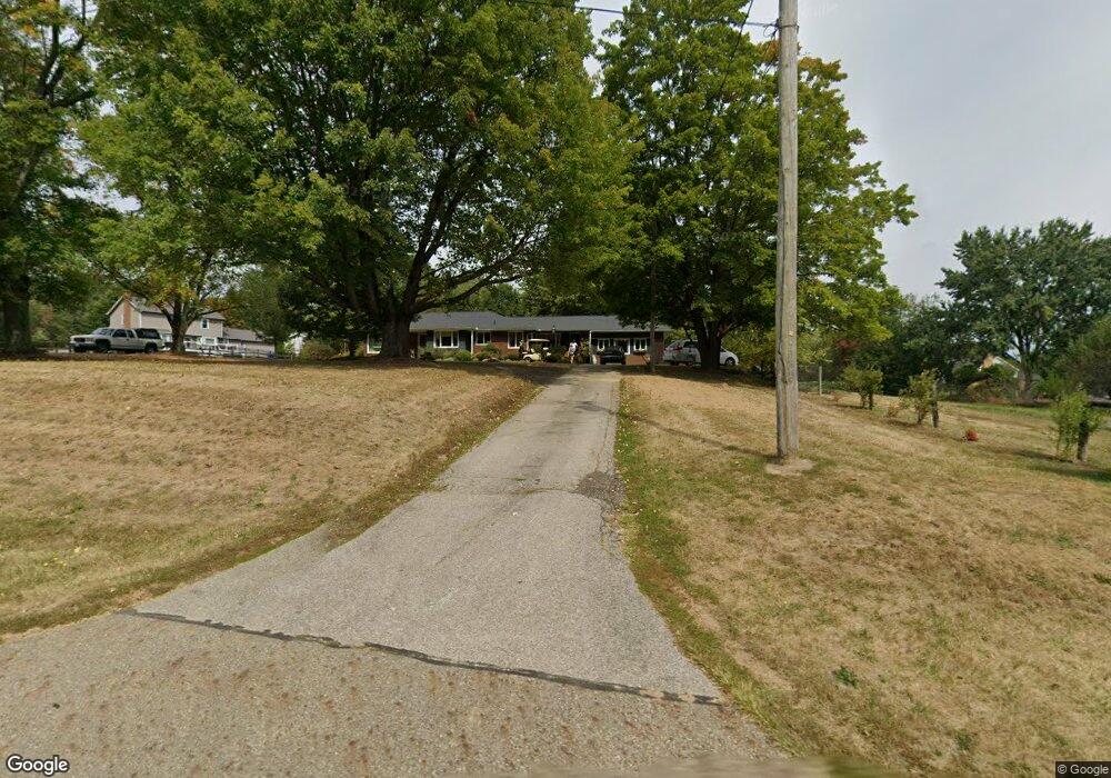
1909 Raber Rd Uniontown, OH 44685
Estimated Value: $243,000 - $285,357
3
Beds
2
Baths
1,669
Sq Ft
$159/Sq Ft
Est. Value
About This Home
This home is located at 1909 Raber Rd, Uniontown, OH 44685 and is currently estimated at $266,089, approximately $159 per square foot. 1909 Raber Rd is a home located in Summit County with nearby schools including Greenwood Elementary School, Green Primary School, and Green Intermediate Elementary School.
Ownership History
Date
Name
Owned For
Owner Type
Purchase Details
Closed on
Sep 8, 2006
Sold by
Caldren Peggy J
Bought by
Hosey Kurt S and Hosey Aisley E
Current Estimated Value
Home Financials for this Owner
Home Financials are based on the most recent Mortgage that was taken out on this home.
Original Mortgage
$139,500
Interest Rate
10.35%
Mortgage Type
Purchase Money Mortgage
Create a Home Valuation Report for This Property
The Home Valuation Report is an in-depth analysis detailing your home's value as well as a comparison with similar homes in the area
Home Values in the Area
Average Home Value in this Area
Purchase History
| Date | Buyer | Sale Price | Title Company |
|---|---|---|---|
| Hosey Kurt S | $155,000 | Multiple |
Source: Public Records
Mortgage History
| Date | Status | Borrower | Loan Amount |
|---|---|---|---|
| Closed | Hosey Kurt S | $139,500 |
Source: Public Records
Tax History Compared to Growth
Tax History
| Year | Tax Paid | Tax Assessment Tax Assessment Total Assessment is a certain percentage of the fair market value that is determined by local assessors to be the total taxable value of land and additions on the property. | Land | Improvement |
|---|---|---|---|---|
| 2025 | $3,802 | $77,365 | $16,398 | $60,967 |
| 2024 | $3,802 | $77,365 | $16,398 | $60,967 |
| 2023 | $3,802 | $77,365 | $16,398 | $60,967 |
| 2022 | $3,396 | $61,719 | $13,013 | $48,706 |
| 2021 | $3,194 | $61,719 | $13,013 | $48,706 |
| 2020 | $3,135 | $61,720 | $13,010 | $48,710 |
| 2019 | $2,731 | $49,860 | $31,030 | $18,830 |
| 2018 | $2,788 | $49,860 | $31,030 | $18,830 |
| 2017 | $2,854 | $49,860 | $31,030 | $18,830 |
| 2016 | $2,840 | $47,990 | $31,030 | $16,960 |
| 2015 | $2,854 | $47,990 | $31,030 | $16,960 |
| 2014 | $2,836 | $47,990 | $31,030 | $16,960 |
| 2013 | $2,854 | $47,990 | $31,030 | $16,960 |
Source: Public Records
Map
Nearby Homes
- 3523 Parfoure Blvd
- 1959 Fairway Dr
- 4009 Troon Dr
- 0 Raber Terrace
- 3544 Raber Terrace
- 2189 E Park Dr
- 3598 Elmhurst Cir
- 2245 Glenross Dr
- 3609 Glenshire Cir Unit 55B
- 3541 Elmhurst Cir
- 2154 Prestwick Dr
- 2518 Glenshire Cir Unit 36A
- 3083 Massillon Rd
- 3117 Imrek Dr
- 2511 Royal County Down
- 3534 Chanticleer Ct
- 2535 Royal County Down Unit B
- 2500 Marlborough Dr
- 1457 5th Ave
- 1352 Sassafras Place
- 3575 Saddleboro Dr
- 3586 Parfoure Blvd
- 3572 Parfoure Blvd
- 1914 Raber Rd
- 3563 Saddleboro Dr
- 3585 Saddleboro Dr
- 3560 Parfoure Blvd
- 1900 Players Cir
- 3553 Saddleboro Dr
- 3525 Avanti Ln
- 3581 Parfoure Blvd
- 3578 Saddleboro Dr
- 3567 Parfoure Blvd
- 1941 Birkdale Dr
- 1904 Players Cir
- 3568 Saddleboro Dr
- 3541 Saddleboro Dr
- 3536 Parfoure Blvd
- 3553 Parfoure Blvd
- 3548 Saddleboro Dr