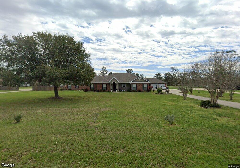
19096 Highway 40 Loranger, LA 70446
Estimated Value: $264,000 - $478,000
6
Beds
5
Baths
3,120
Sq Ft
$111/Sq Ft
Est. Value
About This Home
This home is located at 19096 Highway 40, Loranger, LA 70446 and is currently estimated at $344,842, approximately $110 per square foot. 19096 Highway 40 is a home located in Tangipahoa Parish with nearby schools including Loranger Elementary School, Loranger Middle School, and Loranger High School.
Ownership History
Date
Name
Owned For
Owner Type
Purchase Details
Closed on
Aug 10, 2006
Sold by
Ogima Nicholas
Bought by
Wright Elijah and Wright Helen Perry
Current Estimated Value
Home Financials for this Owner
Home Financials are based on the most recent Mortgage that was taken out on this home.
Original Mortgage
$372,500
Outstanding Balance
$223,522
Interest Rate
6.75%
Mortgage Type
New Conventional
Estimated Equity
$121,320
Create a Home Valuation Report for This Property
The Home Valuation Report is an in-depth analysis detailing your home's value as well as a comparison with similar homes in the area
Home Values in the Area
Average Home Value in this Area
Purchase History
| Date | Buyer | Sale Price | Title Company |
|---|---|---|---|
| Wright Elijah | $372,500 | Gulf Coast Title Inc |
Source: Public Records
Mortgage History
| Date | Status | Borrower | Loan Amount |
|---|---|---|---|
| Open | Wright Elijah | $372,500 |
Source: Public Records
Tax History Compared to Growth
Tax History
| Year | Tax Paid | Tax Assessment Tax Assessment Total Assessment is a certain percentage of the fair market value that is determined by local assessors to be the total taxable value of land and additions on the property. | Land | Improvement |
|---|---|---|---|---|
| 2024 | $1,112 | $15,511 | $2,550 | $12,961 |
| 2023 | $1,119 | $15,511 | $2,550 | $12,961 |
| 2022 | $1,119 | $15,511 | $2,550 | $12,961 |
| 2021 | $584 | $15,511 | $2,550 | $12,961 |
| 2020 | $1,119 | $15,511 | $2,550 | $12,961 |
| 2019 | $1,119 | $15,511 | $2,550 | $12,961 |
| 2018 | $1,119 | $15,511 | $2,550 | $12,961 |
| 2017 | $1,119 | $15,511 | $2,550 | $12,961 |
| 2016 | $1,119 | $15,511 | $2,550 | $12,961 |
| 2015 | $579 | $15,511 | $2,550 | $12,961 |
| 2014 | $578 | $15,511 | $2,550 | $12,961 |
Source: Public Records
Map
Nearby Homes
- TBD Loranger Trace
- 53361 Caitlyn`s Way None
- 53361 Caitlyns Way
- 53511 Harvest Ln
- 54120 Passman Rd
- 54225 Passman Rd
- Hwy 40 E Unit LotWP001
- 53384 N Highway 40 Hwy
- La 40 Unit LotWP001
- 18178 Grey Wolf Trail
- 18190 Wolf Track Way
- 55029 Coyote Den Way
- 55021 Coyote Den Way
- 18188 Red Wolf Trail
- 18171 Grey Wolf Trail
- 55021 Coyote Trail None
- 55154 Coyote Den Way
- 19321 Deerfield Loop
- 55029 Coyote Trail None
- 18181 Red Wolf Trail
- 19096 Louisiana 40
- 19080 Highway 40
- 19112 Highway 40
- 19080 Louisiana 40
- 19112 Louisiana 40
- 19064 Hwy 40 Other
- 19064 Louisiana 40
- 19064 Highway 40
- 53523 Harvest Ln
- 19154 Highway 40
- 19154 Highway 40
- 19154 Highway 40
- 19052 Highway 40
- 19147 Highway 40
- 19147 Louisiana 40
- 0 Harvest Ln
- 19166 Highway 40
- 19166 Louisiana 40
- 19163 Highway 40
- 53514 Cook Rd